One of many
trip reports under the
SilGro home page for Alan Silverstein and Cathie
Grow.
Email me at
ajs@frii.com.
Last update: February 18, 2025
(Previous trip report: 2003_0630-0705_HawaiiHoneymoon.htm)
(A
Fourteener
trip report.)
Related webpages:
Contents:
In mid-2003 I had the rare honor and pleasure of participating in a "catered family campout" for the family and friends of the Space Shuttle Columbia crew, six months after its re-entry accident. I helped install a bronze plaque on the summit of the newly named Columbia Point (13980'+, 37.97844 -105.59685) and arranged for transportation for the group up and down one of the worst roads in Colorado. This involved two trips up the mountain during July 18-19 and August 6-9, 2003.
Columbia Point was located in the Sangre de Cristo Range of Colorado near South Colony Lake, Great Sand Dunes NP and the town of Westcliffe. It was officially named in June, 2003 for the space shuttle that burned up on re-entry February 1, following a naming proposal by astronaut Scott Parazynski (NASA bio page).
July 18-19, 2003: I, Scott, and four others (including astronaut John Herrington ( NASA bio), Dwight Sunwall, and Steve Hunter), did a scouting and preparatory trip to the summit. I gave Scott and John a ride up the horrible South Colony Lakes road in my cramped little 1994 Toyota truck, as described below. The others met us later that evening at camp.
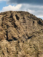
We had crummy weather, and had to rush off the summit, although by then
we were out of battery juice for the hammer drill, and out of sharp
drill bits too. Here's Steve Hunter operating the drill (click to
enlarge), and a photo someone took later from the Kit Carson - Columbia
Point saddle looking back at us working on the summit.

August 7-9, 2003:
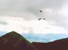
We returned with many Columbia family members for a camping trip,
dedication service, plaque installation, and F16 missing-man flyby
(click to enlarge) out of Buckley AB that Scott somehow arranged. The
entire event was not publicized or covered in any media.
The August trip included 15 4WD vehicles and 21 volunteers, mostly from northern Colorado -- amateur radio operators from the NCARC and members of the Larimer Mountaineers 4WD club -- who helped transport 34 NASA and NOLS people, including 14 family members and 10 astronauts, about five miles up and down the terrible South Colony Lakes Road. I was responsible for finding and coordinating these volunteers, and also for leading the placement of the plaque on the summit.
Unfortunately we had lousy weather during the August trip too. Only
three of us made it back up to
Columbia Point,
but in less than three hours we were able to finish installing the
plaque, while most of the NASA folks visited the Humboldt saddle.
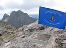
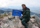
Here's me with the freshly installed plaque, and
Mike Smith
from the US Forest Service, whose assistance was invaluable!
I got involved with this effort due in part to my leading the expedition that placed the Challenger Point plaque in 1987; see the other trip report listed earlier.
The rest of this report is a somewhat haphazard collection of excerpts from emails I sent to various people that year. The following includes only emails I sent to others, and none that I received and saved from others. Also I left out some specifics to protect the privacy of people whose permission I did not obtain to name or to quote them.
From:  Alan Silverstein <ajs@frii.com>
Date:  4 Feb 2003 17:41:38 -0700
Subject:  Columbia memorial on Colorado mountain peak?
To:  (person at NASA JSC)
Greetings. I write to offer my condolences, and also discover your possible interest in an unusual memorial to the Columbia.
In 1987 I led an expedition to place the bronze memorial plaque (that still remains) on the newly-named Challenger Point, Colorado (14081', 375849N 1053622W). I have always been a fan, advocate, and supporter of NASA and the space program. Also being an engineer and a mountain climber, it was natural for me to create this memorial.
There's already a Mount Columbia in Colorado (14073', 385414N 1061749W). While this peak was named long ago for the university, along with numerous other Collegiate Peaks such as Mounts Princeton, Harvard, Oxford, and Yale, it occurred to me that a suitably worded plaque placed on Mount Columbia could also be a fitting tribute and memorial to the lost crew of the Orbiter.
I don't expect any direct support from NASA, but I would appreciate a reply with your thoughts on the matter, and/or the forwarding of this email as appropriate. In the long run, if this memorial is created, I would like the astronauts' families to know of its existence, much as I sent photographs and a report to Dr. Scobee in 1987.
Thank you for your time, and also for NASA's open and professional handling of the news related to this tragedy. ...
The preceding email led to me being in contact with astronaut Scott Parazynski, who'd climbed Challenger Point a few years before, and to my involvement in the rest of the project.
June 16, from http://www.doi.gov/news/030610a.htm:
Department Of Interior
OFFICE OF THE SECRETARY
Contact:
Joan Moody
For Immediate Release: June 10, 2003202-208-6416
Secretary Norton and Nasa Administrator O'Keefe Announce "Columbia Point" In Honor of Space Shuttle Columbia
(WASHINGTON) - Interior Secretary Gale A. Norton and NASA Administrator Sean O'Keefe today announced the naming of Columbia Point, a 13,980-foot mountain peak in Colorado's Sangre de Cristo Mountains, in honor of the Space Shuttle Columbia's final voyage. Relatives of the astronauts, who were lost upon re-entry to the Earth's atmosphere on February 1, 2003, joined the ceremony at the U.S. Department of the Interior.
...
Background Information on Columbia Point
Columbia Point: summit, elevation 4,262 m (13,980 ft); located in the Sangre de Cristo Mountains, on the east side of Kit Carson Mountain, 0.8 km (0.5 mi) east-southeast of Challenger Point; named in memory of the Space Shuttle Columbia, lost in an accident on February 1, 2003, and for the scientific exploration, technical excellence, and the dream of spaceflight for which the mission stood; Saguache County, Colorado; 37 58'42"N, 105 35'46"W.
From:  Alan Silverstein <ajs@frii.com>
Date:  13 Jul 2003 23:53:02 -0600
Subject:  Columbia Point news -- transportation, mostly
To:  (long list)
...First, some news on transportation. I spoke with (astronaut) on the phone this weekend. We agreed to divide up some tasks as follows. (Of course this is subject to approval by Scott or (NASA person) -- we are trying to be helpful, but we don't intend to muddle hierarchical coordination and leadership either.)
In reality, transportation by collected 4WD vehicles might actually begin at the motel in Westcliffe; we'll see. [Yes, it did.] It depends on how the group gets to Westcliffe, whether that transportation is still around the next morning, and if it makes sense to use it from the motel to the end of the 2WD road, or just pile into jeeps. Note, many of the 4WD vehicles will be ham-radio capable.
As I mailed to at least some of you earlier, I started a spreadsheet to gather and track 4WD volunteer info. (So far, five vehicles and six passenger seats.) (Astronaut)'s outfitter friend talked in turn with (head of Custer County S&R). ...
Furthermore, I've been invited to speak to the monthly meeting of the Larimer County Mountaineers (northern Colorado) 4WD club this coming Wednesday night in Fort Collins. There are 70 members, and about 35 show up at meetings. I expect to gain a lot of volunteers this way. [Yes, I did.] I'll add them to the same master list.
Meanwhile, I called and spoke with someone at the Custer County Sheriff's Office on Saturday. They have no concerns about the Columbia Point event, but hadn't heard much of it either. The sheriff is available Tue-Sat, but was out of the office that day for a special event. I will call him back later this week just to make nice. Probably it will suffice for him that we are in touch with his S&R volunteers.
As time permits, I intend to pursue other contacts, such as Larimer County S&R, another local ham radio club, and perhaps the Mile Hi Jeep Club in Denver -- whose nice webpage is actually not very functional for contacts. Meanwhile a few of the people already contacted are seeking additional volunteers in turn.
I'm optimistic that we'll obtain 35+ passenger seats. The 35 derives from Scott's participants list, and I assume other people not on his list are all 4WD volunteers "bringing their own seats". The plus sign means about 10% overhead for attrition, say 39-40 total seats. If by some miracle more than 40 seats materialize, I'll ask volunteers for their enthusiasm level, and ask some if they mind being on a backup waiting list. ...
From:  Alan Silverstein <ajs@frii.com>
Date: 21 Jul 2003 00:06:33 -0600
Subject:  Re:  Permitting full speed ahead
To:  (long list)
Back late and exhausted from intense three-day outing. Scott called you from the summit so you know we made it. More info to follow from me tomorrow, but I want to take the time now to reply to your meaty Friday email (sent before we summitted) with some updates based on our trial run. ...
On a Friday night [July 18] the trailhead parking lot at the gate was surprisingly full given the nasty nature of the road in (about five miles, 1:40-1:50 drive time) and people were camped all around. Maybe 12 vehicles there? I forgot to count.
Creek is right nearby. The only issue is whether Scott might like to get the group up higher for less of a dayhike Friday. We hiked 0540 - 1116, that is about 5:35, to the summit from the gate, with one long stop of over 0:50 to experiment with the drill and anchors on the first high saddle. Figure 4:45 with good weather for people in decent shape and comfortable with some scrambling but not well acclimated. Could be less for strong hikers, or more for those suffering the whole way. ...
> For the climb itself, he asks us not to put any wands on the public
> trail, but they'll probably be ok on the ridgetops away from the main
> areas of travel.
A bit ambiguous. Excellent, well-maintained trail switchbacks to saddle enroute Humboldt to the east, also the best and commonly used route to Crestone Peak and Kit Carson. However, at top of saddle the route west to Bears Playground becomes a social trail, cairns only, rough up and down a long way on a rocky, bumpy ridge. We spent 1:15 traversal with no net elevation gain. Waypoints taken, Scott has plans to mark this route. It's not the maintained trail, but it is the "public route". Anyway I see no harm in wands/etc from there on, I suspect that's what (USFS ranger) meant. ...
From:  Alan Silverstein <ajs@frii.com>
Date:  21 Jul 2003 16:32:34 -0600
Subject:  other logs from trial run
To:  (long list)
Other random data to share:
From:  Alan Silverstein <ajs@frii.com>
Date:  21 Jul 2003 17:17:15 -0600
Subject:  Columbia Point 4WD road condition
To:  (long list)
Gang, we went up and down the road last Friday/Saturday, and here's a report. Elapsed time up (with breaks) was 1:40, and down was 1:50. The GPS odometer read 4.43 miles up and 5.1 down -- I'd use the latter. This is to the locked gate at 11000'. The road continues about one mile further, up to 11400', above the gate, in pretty good condition; we walked that part in 0:20 both ways. We might get permission to drive to the end.
Now the bad news. The road is, simply put, horrendous. It's much worse than I recall from 17 years ago. It's steep at points (4-low definitely required), and very rough, with 5-10 stops along the way just to spot ahead. It's nearly unrelenting, which is tedious on the descent. We agreed that we should allow 2:00 each way. Personally I would use some of that time just to pull off, stretch, and unwind a bit more. We wanted to avoid wasting time up and down last weekend.
However, on the bright side:
The locked gate and the end of the road are both outside the wilderness area, and the first has lots of nice camping around it in trees, near a creek. The latter is exposed on a hillside, you could sleep there but not a large group. Marmots are reputedly bad on vehicles at the trailhead but we will try to supply fox or coyote urine to ward them off. [Yup, we did have that. Stinky stuff!] No signs of them messing with my truck, but (someone)'s hidden key (in a rock cairn) disappeared during the day.
OK, so now if you need to back out based on this info, please tell me soon. Also, please keep beating the bushes for more volunteers, it couldn't hurt to have them on the list in case we need them. The NASA folks are still chewing on logistics details, and might still want 40 volunteer seats.
From:  Alan Silverstein <ajs@frii.com>
Date:  4 Aug 2003 16:45:35 -0600
Subject:  RE:  4WD Support for the Columbia Point Climb Next Week
To:  (various NASA people and volunteers)
...OK, that makes 29 passenger seats needed, as I count as a driver in my own vehicle. Hey (volunteer), is (other volunteer) coming again? (He'd be a passenger.)
As you are about to see in my pending email, we have an embarrassment of riches with potentially 17 volunteer vehicles (including 23 people) and 46 offered seats for NASA/NOLS people. Even with attrition and no-shows, we are in great shape. I suggest that we either, (a) confirm to the volunteers that they are all welcome and then if we have too many seats, distribute the passengers and cargo more spaciously and enjoy having excess capacity, or (b) tell everyone (tomorrow?) that we can afford to let go of N seats (N = 10?), and if anyone wants to drop out without loss of honor, that's OK, just tell us. What do you think?
> (USFS ranger) has offered two trucks, but I don't know how many people
> he can carry.
OK, let's not count on him then.
By the way, that 29 includes three NASA/NOLS people who would drive your rental vehicles, right? And, who drives the NFS trucks?
From:  Alan Silverstein <ajs@frii.com>
Date:  4 Aug 2003 19:51:54 -0600
Subject:  more Columbia Point 4WD tidbits
To:  (long list)
Gang, I forgot to mention some other info...
Of course you should enjoy this event too, and I'm sure you'll find plenty of time to chat with whoever ends up riding with you, if they feel like talking.
Hmm... In particular if you have any problems or issues, please try to bug me and not Scott or the NASA folks about them, they'll be plenty busy. (Hmm... Me too, but look for me first. :-)
Hmm... If you are running really late and we've already left the Inn, proceed to the 4WD road and see if you can catch up? Ask the nice people at the Inn.
Beyond that, let's have fun with this. Sorry about the early meeting time Thursday morning -- Scott wants lots of margin for weather and unexpected problems. ...
From:  Alan Silverstein <ajs@frii.com>
Date:  5 Aug 2003 14:50:00 -0600
Subject:  Columbia Point, more news
To:  (long list)
Gang, I have received confirmations (or regrets) from all on my volunteers list. Thank you all for responding. The latest spreadsheet is appended...
We now have 14 vehicles, 19 people including five wives/kids, and 41 passenger seats. ((Driver), it's OK with me if you still want to bring your S&R dog, I just don't know about wilderness rules if you plan to hike.)
The latest number I got from NASA folks is a need for 29 seats. However, the excess capacity is welcome, also this way we need not cram anyone in for the rough ride. Everyone who volunteers will have a role and be able to participate -- we'll spread out to fill the vehicles available.
Others news bits:
From:  Alan Silverstein <ajs@frii.com>
Date:  11 Aug 2003 22:48:59 -0600
Subject:  RE:  home OK?
To:  (astronaut)
> Thanks for the kind words, Alan. I can assure you that the trip has
> provided some closure and healing for the families and friends of
> Columbia.
Very good.
You know, Scott, when the F16s blasted by us at eye level and the missing man departed, I instantly transitioned from mental and utterly task-focused to overwhelmed by emotion. Although the symbolism of the flyby was a cheap parlor trick (OK, not cheap :-), it was still powerful. Suddenly the moment became even more real and intense than I already thought it was. I felt tremendous grief. I had to gather myself to continue.
I remember calling and telling you on the radio how amazing it had just been. Not hearing a reply, as you were certainly busy yourselves, I let it go and got back to work. What I haven't told you until now is that, right after putting down the radio, I intoned to (volunteer) and (USFS ranger) something like this: "Gentlemen, let's get this done now, and let's do it right." We picked up the drill and resumed.
[As it turned out, due to the crummy weather and various other factors, only three of us made the summit that day, and we remained only about three hours. It was hectic.]
From:  Alan Silverstein <ajs@frii.com>
Date:  12 Aug 2003 12:09:46 -0600
Subject:  RE:  plaque template
To:  (various)
...
> Did the plaque holes match the template perfectly?
Unfortunately no...
I don't recall the details, but here's what I do remember...
First, the two left side holes in the rock ended up 1/16 - 1/8" too close together despite our best efforts to drill accurately. We drilled one 1/4" hole, stuck a bolt through the template and into the hole, swung the template to the right spot, started the next hole, etc. It must be very hard to get exact placement in irregular rock I guess, at least without some sort of framework or scaffold.
After the first outing we knew (using your ruler) that these two holes were too close. Fortunately this knowledge motivated me to bring what we needed to deal with it -- some narrow stainless washers (#10 with centers reamed out with a diamond bit on a Dremel to 1/4"), a rat-tail file, and 1/4" and 5/16" regular drill bits.
After starting the holes in the rock with 1/4" (except the upper-right, where we ran into hard rock and out of battery juice during the first visit), we expanded them to 5/16" for slack, then used them as guides to drill the 1/2" anchor holes to good depths. On the second visit we worked the holes until they were wide enough to insert and remove the lead anchors for testing, and deep enough to put the top of the lead anchor at least at or below rock level. We also ensured the 5/16" center holes were deep enough to allow for the longer size stainless bolts, in case we couldn't reach an anchor with the shorter bolts and had to switch to a longer one.
After scrubbing and chiseling the lichen off the rock and washing down the surface with water, we cleaned out the holes again, took a deep breath, and set the anchors. This went flawlessly and they looked perfect. As it turned out, the upper left one was deeper than expected. But all four could be reached with shorter bolts.
Initial screwing of bolts into anchors was tight on several of them, even with oil on the bolts. Probably the nuts had squeezed down a little while setting, and were not perfectly aligned either. We worked the bolts up and down.
We could readily see that the left side holes were way too close. I started filing the plaque's left holes. This worked OK, but when I missed once I scratched the face a little (sigh). Later we just drilled them out to 5/16" using the hammer drill and a regular bit. Then three bolts would reach anchors, but the last (lower left) would not. I made an executive decision to drill out the right side holes too, since we had already committed to using washers, instead of enlarging the left side holes further. It turned out this was a good move, it gave enough "schmoo" to allow all four bolts to connect.
We then screwed all four bolts nearly fully down. I announced by radio, "The plaque is bolted down, next to take it up and put it back on cement." This resulted in a lot of cheering down at the saddle where the families were. I realized most of them probably thought this meant we were done, when in fact we had 30-40 minutes more work to do, but I didn't belabor the point. Getting the holes drilled and the plaque bolt-able was the crux move anyway.
On Challenger Point we hand-drilled the holes using a star bit and a sledgehammer. It's amazing we got so close, but maybe not really. The holes were a bit wider/sloppier to start with, and without a proper anchor setting tool (my bad), the anchors weren't set tightly either. So bolting down the plaque was probably easier. As you might recall, when I went back a year and a half later to try replacing the non-stainless upper right bolt, the anchor spun and I couldn't unscrew it.
I was concerned about any of the anchors coming loose this time, especially when they were tight on the initial test. But even when I did the final crank-down on the four bolts, the anchors were tight.
The second critical step was, after surrounding the holes with clay donuts and covering them with thin sheets of clay, painting the rock with concrete bonding compound, mixing two of the cement bags (which set in about eight minutes), and troweling it out, we carefully placed the plaque over the holes. Then I pushed the bolts through the holes and the clay into the anchors. Hallelujah, all four found the nuts and screwed in cleanly! No misalignments or grit. We screwed them most of the way down to squeeze out the cement and clay, then cleaned around the edges with popsicle sticks and a trowel, and scraped out all the clay we could reach.
Finally we mixed up one more cement bag (11 oz volume each with 2 oz water) and used it to surround the plaque, as a "frame" from the rock up to the upper edge of the plaque. We smoothed it gently with fingers as it hardened. This gave the installation a very clean, finished appearance. The edge cement basically protects the underneath cement, which in turn protects the bolts, so it lasts as long as possible. At least that's the theory.
It took a while to clean dust and grit from the plaque face itself before it was ready for "beauty pictures". [Unfortunately we were in a hurry, and one of the best photos shows the plaque still dirty.]
From:  Alan Silverstein <ajs@frii.com>
Date:  14 Aug 2003 11:15:56 -0600
Subject:  Re:  Article in the Mountaineers newsletter
To:  (various)
> Alan, You can do those edits if you wish and copy it to me.
Thanks, here's my editorial pass => tidied up version: [which was later published in a newsletter]
Columbia Point Dedication Outing
Three Mountaineer members arrived in Westcliffe, CO on Thursday, August 7th to aid in 4WD support to the friends and family of the Space Shuttle Columbia for a hike in, camp out, and dedication climb of the newly named Columbia Point, 13980', on the east shoulder of Kit Carson Mountain. Dan Venrick and George Kinnison arrived at Westcliffe at 7:15 am to help coordinate passengers and cargo capabilities while Darren Finger searched for an electrical problem on the Pickle back at camp at the 4WD roadhead.
Around 8:30 the caravan of 15+ vehicles consisting of volunteers from a northern Colorado ham radio club, Larimer Country Search and Rescue, and the Larimer County Mountaineers Four Wheel Drive Club departed the Westcliffe Inn. Alan Silverstein, the 4WD support organizer, led the group, followed by Dan in his new 4-door Toyota Tacoma loaded with passengers. Darren and the repaired Pickle picked up the rear to lend assistance to the mostly stock four wheel drives. We started up the serious 4WD road to South Colony Lakes about 20 minutes later.
It was only a short distance before the trail began overheating its first Jeep Cherokee... The passengers dispersed into other vehicles as it headed back down, while George crept up in his Jeep Grand Wagoneer loaded with passengers. A short while later a second Cherokee was taken victim. Its owner found little coolant in the system and poured nearly two gallons of creek water into the radiator. Up and running for a short distance more, a Suzuki Samurai encountered carburetor problems and was pulled up behind a tow strap.
Two-plus hours and 5.0 miles later from the start of a should be 1.5-hour trail, the vehicles arrived at the Forest Service gate at 11,040' where only the lead truck and the Crew Cab F350 were allowed to continue the last 3/4 mile to the end of the road at a mine site at 11,400', loaded with camping gear. The NASA group followed up on foot the extra 3/4 mile where the pickups were unloaded. The group packed their gear another mile or so on a single track trail to the South Colony Lakes where they set up Base Camp. Dan and Darren picked up two major life saving devices for the ascent... An oxygen bottle and a portable toilet seat!
Friday morning, many of the campers hiked up further to the Humboldt saddle at about 12,900' to attend a memorial ceremony, and to build seven rock cairns in memory of the Columbia crew. They then ascended to an altitude of 13,100' on the shoulder of Humboldt Peak for a clear view of Columbia Point, and to watch four F-16 fighter jets from the Colorado Air National Guard conduct a missing-man fly-by.
The families did not end up climbing Columbia Point due to threatening weather, but a small team in radio contact concurrently spent over three hours on the summit, installing a permanent bronze memorial plaque. Meanwhile Dan and Darren took the Tacoma wheeling over Medano Pass and down into the Great Sand Dunes National Monument, past Blanca Peak, through Alamosa, and returned back over the Sangre De Cristo Mountains by way of Hayden pass on the north end of the range. George tried his fishing expertise at the DeWeese Reservoir north of Westcliffe with other RV'ers from his camp. Reports of his success are unknown.
Saturday morning, George, Dan, and Darren returned to the pickup spot to to take the group back down the mountain... Later we all met back down at the Westcliffe Inn to sign 100 commemorative USGS topographic maps, and get pictures and autographs of the attending shuttle astronauts. By Saturday afternoon the Mountaineers were headed home, thankful for the opportunity to support the Columbia families and the National Aeronautics and Space Administration.
From:  Alan Silverstein <ajs@frii.com>
Date:  29 Aug 2003 16:24:30 -0600
Subject:  Columbia Point story
To:  (my wife, for a newsletter)
During August 7-9, 2003, Alan Silverstein, husband of (my wife) helped a group of NASA astronauts to place a memorial plaque on the 13,960'+ summit of the newly-named Columbia Point, Colorado, and to arrange a dedication campout and climb for many of the lost astronauts' family members. Alan led an expedition in 1987 to place the 6x12" bronze memorial plaque which remains on Challenger Point, 14080'+, the northwest shoulder of Kit Carson Mountain in the Sangre de Cristo Range.
For this event Alan coordinated 21 volunteers driving 15 4WD vehicles, which transported 34 NASA and NOLS people, including 14 family members and significant others of six of the seven Columbia crew, and 10 current astronauts, five miles up the rough South Colony Lakes Road. The group camped at 11,700' for two nights, both of which were unfortunately soggy. Despite the weather, Alan and two others managed to spend more than three hours on top of Columbia Point on August 8 installing a second bronze plaque, while most of the NASA folks hiked from base camp to about 13,200', above the Humboldt saddle, to watch a four-jet missing-man flyby.
By design there was no media coverage of this event...
From:  Alan Silverstein <ajs@frii.com>
Date:  24 Feb 2005 10:48:51 -0700
Subject:  Re:  Your Columbia Point webpage [anecdotes about 4WD road]
...a sidebar anecdote. I haven't written this down before, so this is a good opportunity to do so and to add it to my notes.
After connecting with Scott Parazynski, and also (astronaut), by phone and email in the spring of 2003, I met them in Westcliffe for the first hike up the hill. We expected another 4WD vehicle with three more people, but not for several more hours. Meanwhile, I had my Toyota DX shortbed truck... Serious clearance and 4WD capability, and decent cargo capacity with the camper shell on it, but not luxurious.
(We put it to good use on the second, main outing; I was one of the two "sag wagons" permitted by (ranger) of the USFS to drive beyond the closed gate at 11K' to the real end of the road at 11,400', so we didn't have to carry the group's gear so far into camp.)
As I like to relate the story, "While it has three seatbelts, you don't put three people in my truck, even going down the highway." The middle person's legs block the shift lever! Well Scott and (astronaut) didn't want to wait around, so off we went, all three of us sitting in the cab.
The road to South Colony Lakes is awful. It's called, "a highway designed by terrorists,", also, "the most beautiful road in Colorado... You can't take your eyes off it." Drive time for about five miles is over an hour, although the second time, with prior experience, I made it in about 45 minutes.
So there we were, three of us crammed into the cab, bouncing around like the beans in a maraca. Now, I'm experiencing serious hero worship, a rare chance to talk with actual astronauts in person, a thousand questions I'd like answered, but also not wanting to act like a nerd either. They were patient with me. We had to stop frequently to get out and preview the next stretch of road. I was shocked at how bad it was.
At one point we started hearing a female voice say, "alarm! alarm!", which is really weird because this truck is very basic, "power nothing". I'd thrown everything small and loose into the glovebox, but I'd forgotten about a battery-operated alarm clock laying on the hump under (astronaut)'s legs, and the mode button was getting pushed!
Further up the road, Scott remarked that it wasn't so bad, "kind of like riding in the Soyuz." Which he'd trained for, but never done, because of being one inch "too tall".
Well now, I usually nickname my vehicles... My old, green, 2-ton 360 V8 Jeep Wagoneer was "Triceratops"... My under-powered Subaru Loyale wagon with "boat-like handling and an agricultural growl" (said the review I read before buying it new in 1991) is "the Iron Maiden"... But I'd never named my truck. Immediately I asked the guys if they would mind me dubbing it, "Soyuz".
So now the tailgate says, "Toyota Soyuz". When people ask me why it's called that, I have a fun story to tell them about the time I gave a ride up the worst road in Colorado to two active astronauts.
After we camped out at the locked gate, met up with the other three guys who arrived well after dark, hiked to the summit the next morning, started plaque preparations, ran out of battery power, drill bits, and good weather only 2.5 hours, and humped back down in the rain and thunder, I gave Scott and (astronaut) a ride back down to Westcliffe.
Going downhill, the wheels and the steering wheel swung even more violently. I smashed (astronaut) in the ribs with my elbow so hard several times he ended up bruised, but there was nothing to be done about it, and it didn't keep him from flying his T38 back to Houston that afternoon.
Toward the end of the rough road, Scott asked if we could go any faster. I reminded him of the pilot's maxim that, "a good landing is one where you can walk away, and a great landing is one where you can reuse the airplane." I explained that I wanted to be able to reuse my truck. After that they were more patient while I took the necessary minute at the start of the smoother road to do my traditional post-smash inspection of the underside and tires.
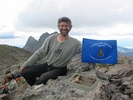
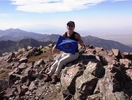
Cindy Howard,
owner of the
Westcliffe Inn
that we used for the event, made it up to
Columbia Point
later the same month, August 20, and I got this picture from her (click
to enlarge).
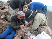
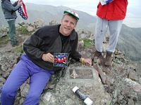
Before the expedition, I suggested to Scott that using a George W Bush quote on the plaque might be a bad idea. Unfortunately I was right, someone bashed on it with a rock!
Scott didn't make it to the top of
Columbia Point
the day we installed the plaque because he was busy guiding guests down
at the Humboldt saddle, and the weather was too poor for any of them to
summit either. Just over a year later, sometime in August 2004
(apparently Aug 16 based on when photos were created), he and others
returned with tools to repair the plaque, and I obtained these photos
(click to enlarge).
(Next trip report: 2003_0901-02_Boulderfield.htm)