September 12-21, 2008: Lake Powell, Utah
One of many
trip reports under the
SilGro home page for Alan Silverstein and Cathie
Grow.
Email me at
ajs@frii.com.
Last update: February 18, 2025
(Previous trip report: 2008_0817-24_LakePowell.htm)
Contents:
- September 12, Friday: Start the Fun Early
- September 13, Saturday: Rockhound Utah
- September 14, Sunday: Finally Floating
- September 15, Monday: Smith Fork Slot Canyon
- September 16, Tuesday: Up and Out, Over and Back (Warm Springs)
- September 17, Wednesday: Ticaboo Canyon, Paradise and Purgatory
- September 18, Thursday: Castle Butte or Bust!
- September 19, Friday: Tapestry Wall
- September 20, Saturday: Stanton Canyon and Marina Chores
- September 21, Sunday: Clean Up and Go Home
Less than a month after returning home from my August adventure... Off
I went again for my second
Lake Powell,
Utah,
houseboating trip of the summer. This time my wife
Cathie Grow
stayed behind, and I had four others in the crew: Regulars
Bob Laing
and
Perry Scott,
plus first-timers
Raj Basudev
and
Judy Walker.
We didn't find a ski boat, but we shared a fabulous time on the lake
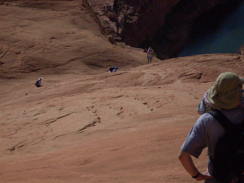
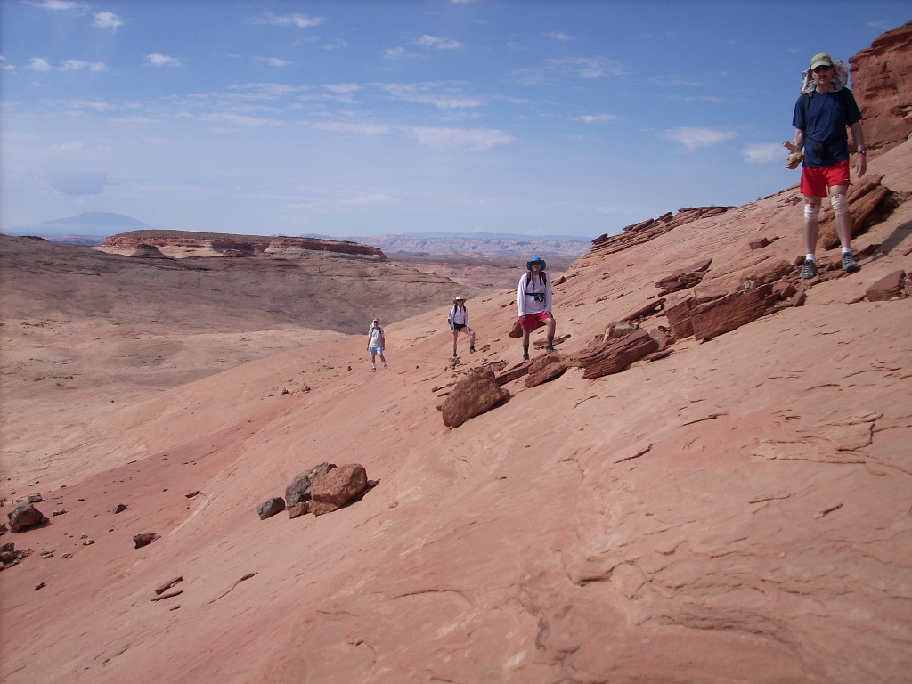
anyway! As it turned out everyone in the group was a serious hiker.
Personally I did six walks in six days, missing one... To set up the hikes
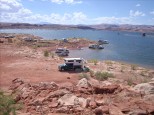
we moved the boat a lot, probably setting a record. We moored in a
different place every night, and tied up 10 more times during the
days, for a total of 17 anchorings!
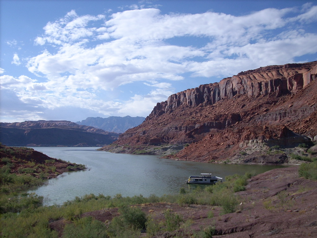
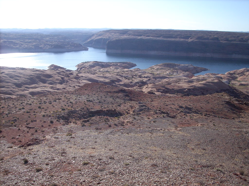
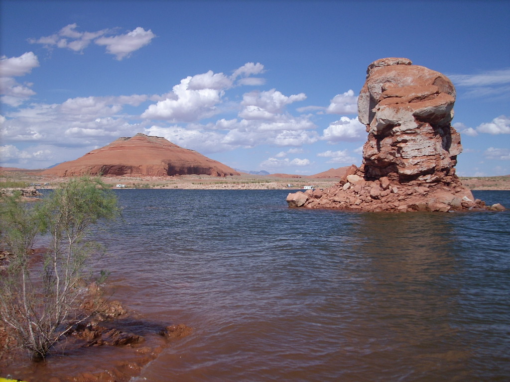
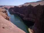
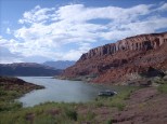
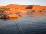
The pond had dropped about 5' in the last month to 3627', 73' below
full, but still higher than it was over the last five years. I wanted to
go north to
Good Hope Bay
for the first time since 2000, and we did. As expected it was
moderately crowded around the marinas, and nearly empty once we reached
the bay.
Also the weather was very nice for September, warm but not hot, no
precipitation all week, and not too windy either (until Saturday). The
moon was full Monday morning, so we saw lots of great moonrises, a
little later each night.
September 12, Friday: Start the Fun Early
The houseboat sat unused both the weeks before and after our trip. That
meant it was parked out at the buoy... I had to retrieve it at the
start, and later return it. This took some extra time and added to the
adventure, but it really wasn't too bad, even without a ski boat. I
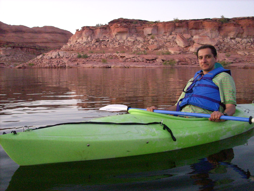
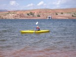
brought both of my flatwater kayaks, and with a little help from Bob I
was able to use one of them as a taxi.
Now since I had to go to the buoy, and the weather looked nice, I
decided to leave home earlier than usual, on Friday afternoon, and spend
two nights exploring on the way to the lake. To my surprise, Bob said,
"pick me up in west
Denver
on the way through," and Perry said, "I'm leaving Friday too, and I'll
caravan with you in my truck." So we did! We had a mini-vacation
together before starting the real one.
Friday morning I loaded the boats on my car and drove into work at
Avago
in
Fort Collins,
Colorado. I left again after a very short day at 12:45, picked up a
spare houseboat prop at a boat shop, met Perry at the next I-25 exit,
and then Bob at the I-70
Morrison
exit.
Here it was rainy as we departed again at 2:20 pm. We took advantage of
Perry's (open) truck bed to haul some of the (copious) cargo.
Fortunately the rain didn't bother the gear much, since it rained
intermittently through lunch in
Silverthorne,
and beyond.
We reached
Fruita
in western
Colorado
around 7 pm. I wanted to do the fresh-food shopping no earlier than the
next morning, so we stayed there. And despite clear weather, and
although prepared to camp out, we decided instead to share a cushy motel
room at the
Super 8.
We offloaded the exposed cargo to the room (a common theme the next few
days), then had a nice Mexican dinner at
Panchos.
I enjoyed the hot spa at the motel before bedding down on the floor by
an open window...
September 13, Saturday: Rockhound Utah
We realized we could leave the truck cargo in the room while shopping
"across the street" (I-70) at the
City Market,
so we did. We loaded up with produce on ice, checked out, lost track of
each other trying to buy a snack at the
McDonald's
(sorry Perry), and finally left
Fruita
at 10:35 am.
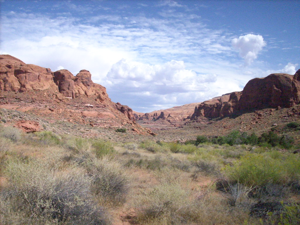
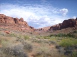
It was a gorgeous, clear, warm fall day in the high desert. We turned
south off I-70 to
Yellowcat Flat,
north of
Arches NP,
and drove south on gravel about seven miles towards the La Sals. We parked
in two different spots in the Morrison formation to wander around looking
for pretty agates of various kinds. Our total time off the highway was
4.5 hours, and we saw almost no one else. Bob had his own rock hammer,
and Perry had fun bashing stones using mine.
Back on I-70 we continued west to the "main" road south to
Moab.
Bob and Perry being agreeable, we did another side-trip, this time 3.5
hours until we returned; 15 miles down the pavement, then a very rough
unpaved road east into
Klondike Bluffs,
again about seven miles. I took them to a spot first shown to me over 10
years ago by
Steve Speer
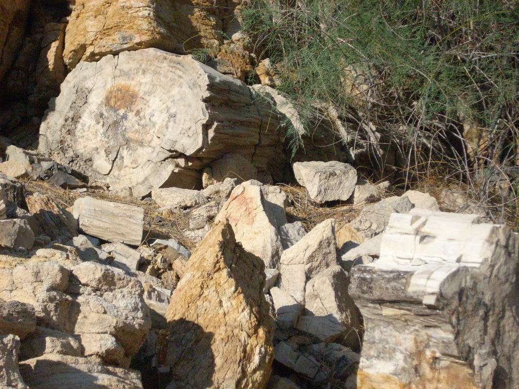
featuring big fossil logs (and small chips), agates, and even some dino
bone nuggets.
Back on I-70 once more, we proceeded the rest of the way to
Green River,
Utah,
arriving at 7:45 pm. To my surprise we all elected to share a (smaller)
motel room again rather than camp. We were lucky to get the very last
non-smoking room available at
Motel 6.
After unloading we visited the
Tradewinds
restaurant at the truck stop for a late, delicious dinner. Around 9:15
Raj and Judy (remember them?) showed up to join us. We'd been in touch
by cell phones, and as it turned out, they also stayed at the Motel 6.
September 14, Sunday: Finally Floating
We got an earlier start this morning. Bob and I in my car, and Perry in
his truck, took off at 7:50 am, bought some
Arbys
breakfast before the highway, and drove non-stop to
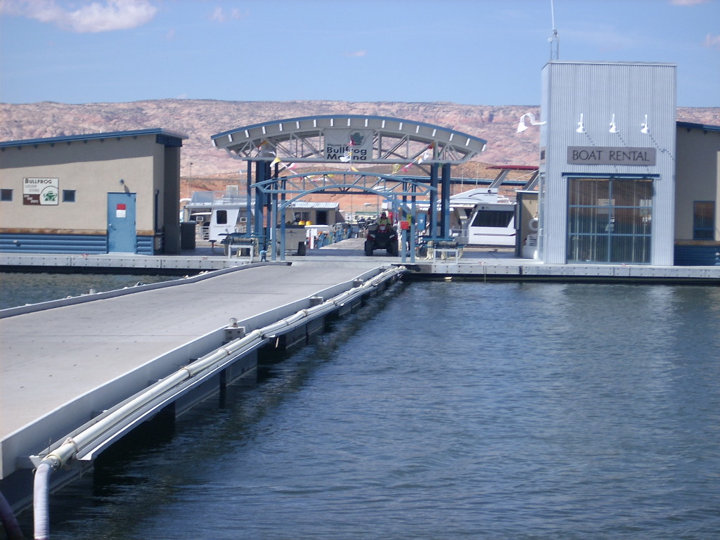
Bullfrog Marina
at 10 am. We went down to the boat rental dock, near the north buoy
field, and they launched me in my kayak at 10:35.
Ten minutes later I was on the houseboat alone, giving it a fast
going-over and prepping it for travel. I detached from the buoy cable
at 11:10, and we had the boat tied up (mooring #1) at
Hobie Cat Beach
at 11:45. (Sure enough it took over an hour extra to retrieve the
houseboat versus meeting a previous crew on shore.) It took two tries to
find a deep enough spot along shore, and this was not as early as I'd
originally hoped, but it was still plenty fine, and the weather was
great too.
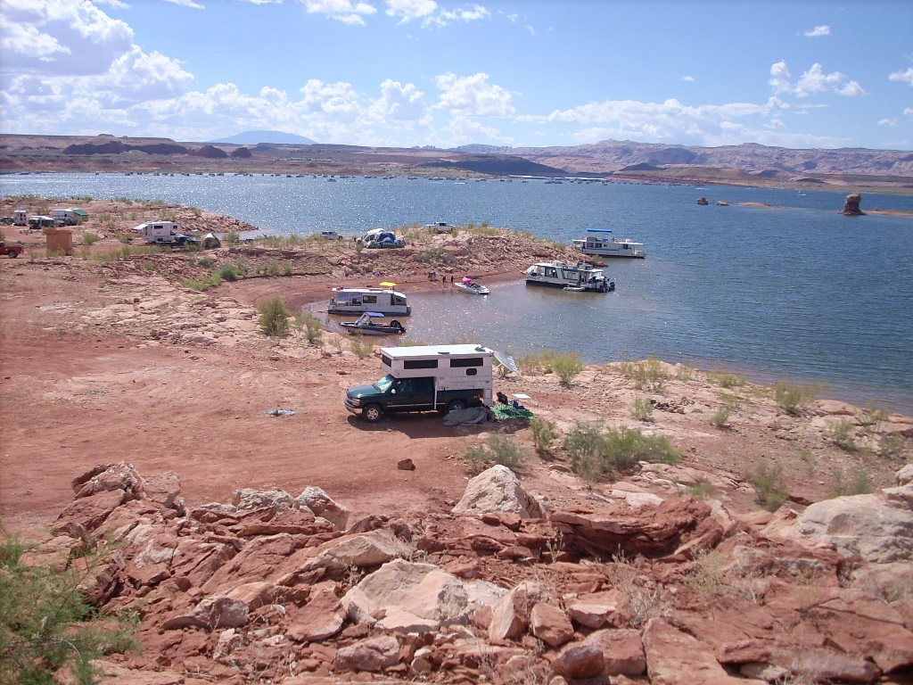
We unloaded both vehicles; talked Raj and Judy in her van down to the
boat by cell phone and got them unloaded; she bought herself a fishing
license; Perry bought block and crushed ice for the trip -- all the
usual logistics. We finally left Hobie at 2:20 pm, motored down
Bullfrog Bay,
turned left, and went north (upstream) for the week.
The first point of interest was a pass by
Stanton Canyon
just to look at it. Later we entered
Forgotten Canyon,
drove all the way to the end, couldn't quite see the
Defiance House
ruins (but knew they were nearby), got stuck briefly in shallow mud, and
finally tied up (#2) temporarily on the left side (river-right). This
was the beginning of a drawn-out comedy of errors that left me doubting
my houseboating skills! Just mucking around in the mud and vegetation
to place sufficiently solid anchor lines here was a prolonged affair.
 That done, with gusto the entire crew marched off the Wildwind, up the
rocky hill, around the corner, and... Came to a dead stop within
minutes atop a small hill. The bench on our side ended at water of
unknown depth reaching all the way to a cliff face. We could see the
ruins upstream a little bit, including the famous pictographs, but there
was no practical way to reach them... Sigh!
That done, with gusto the entire crew marched off the Wildwind, up the
rocky hill, around the corner, and... Came to a dead stop within
minutes atop a small hill. The bench on our side ended at water of
unknown depth reaching all the way to a cliff face. We could see the
ruins upstream a little bit, including the famous pictographs, but there
was no practical way to reach them... Sigh!
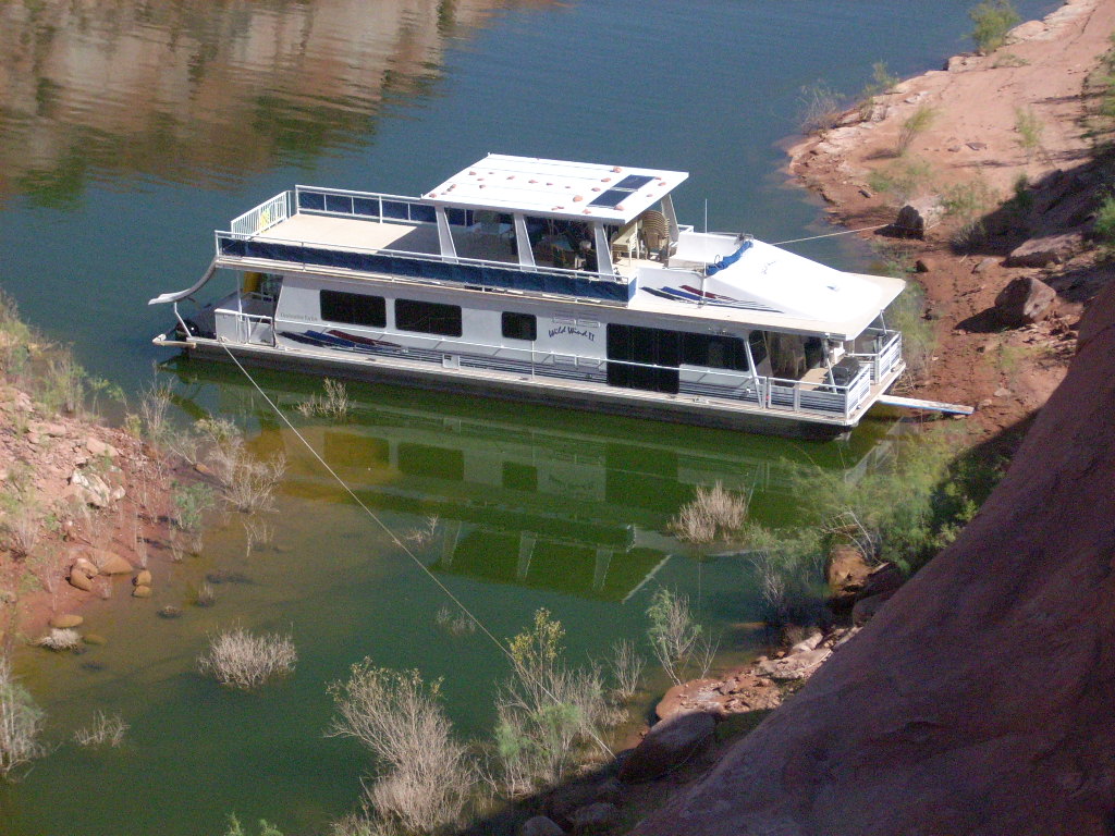
It was too late in the day to think about moving Wildwind to the other
side of the canyon, and another houseboat was already anchored there
anyway. In fact we saw their crew out on foot, getting lost trying to
bushwhack up the valley to see the ruins.
Then I had a brilliant idea -- "Let's tie up for the night nearby, and we can
take turns exploring by kayak, tonight and in the morning." We messed
around for an agonizingly long time pulling up at a couple of marginal
spots... To prove to myself that we were always in sight of other
boats, and would be intruding on them. "Forget it! We can return to
this canyon at the end of the week." (But by then nobody cared, and we
didn't!)
Well I still wanted to hike the
Smith Fork
slots (across the main channel from Forgotten) the next morning (and we
did), so next I took Wildwind out of the canyon and over there. We
spent a bunch more beautiful late-day minutes fruitlessly scouting
around several spots hoping for a tie-up near the mouth of the canyon.
Twice I had someone pin the boat on shore so I could run up and look for
anchoring. So close -- but nothing solid -- to heck with this too.
By now I was 100% ready to moor somewhere, and daylight was
getting short. We cruised back over to the east (Forgotten) side, and
found a small private cove off the main channel a little ways
downstream. The boulders here seemed pretty good -- but, testing one
line with the motors, we pulled it off -- sigh again. "I do know
what I'm doing, really!"
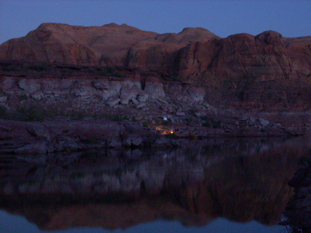
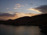
Around sunset (at 7:33 pm), quite tired of it all, I finally had the
boat secured (#3), and went for a walk! I knew there were moki steps
(holes pecked into the cliff wall hundreds of years ago) somewhere
nearby, but I couldn't remember where. Then I found them right across
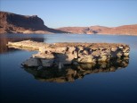
from the stern of the Wildwind! That was cool.
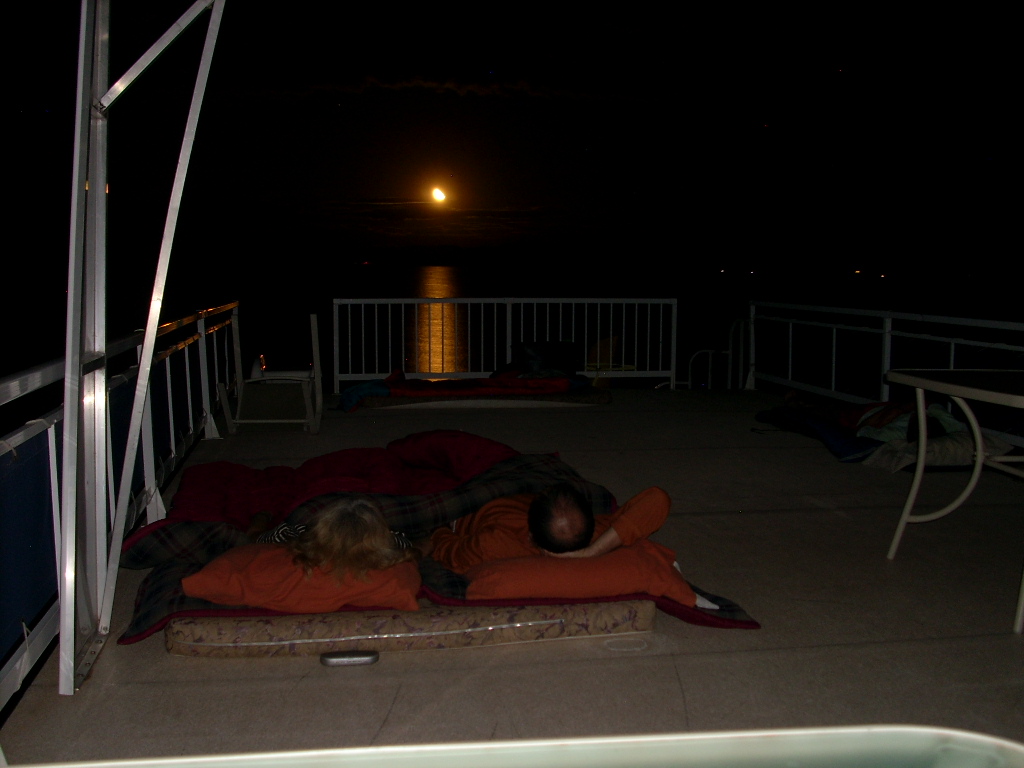
We enjoyed our first of seven dinners together on the roof, and watched a
full moon rise above the cliffs across from us. The first two nights it
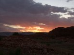
was calm enough to light a candle while dining. It was gorgeous!
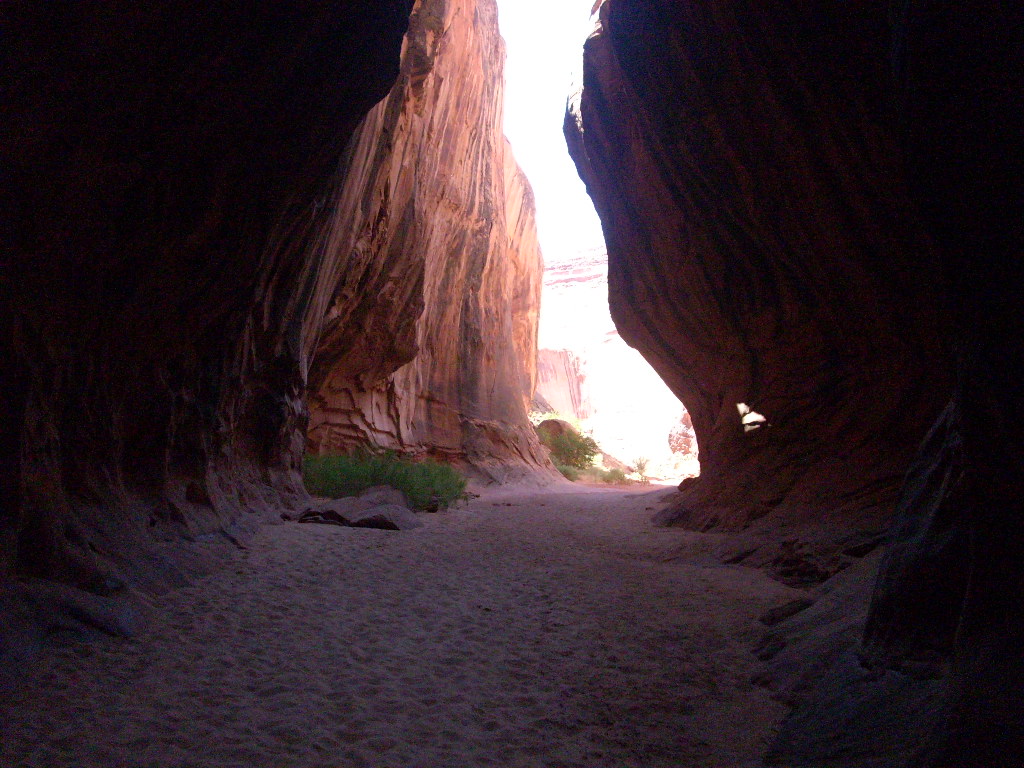
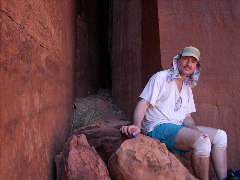
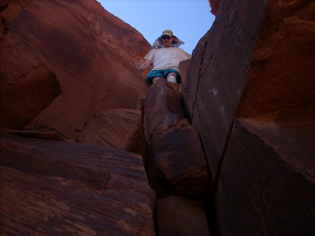
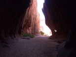
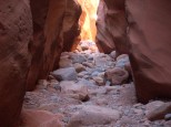
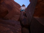
September 15, Monday: Smith Fork Slot Canyon
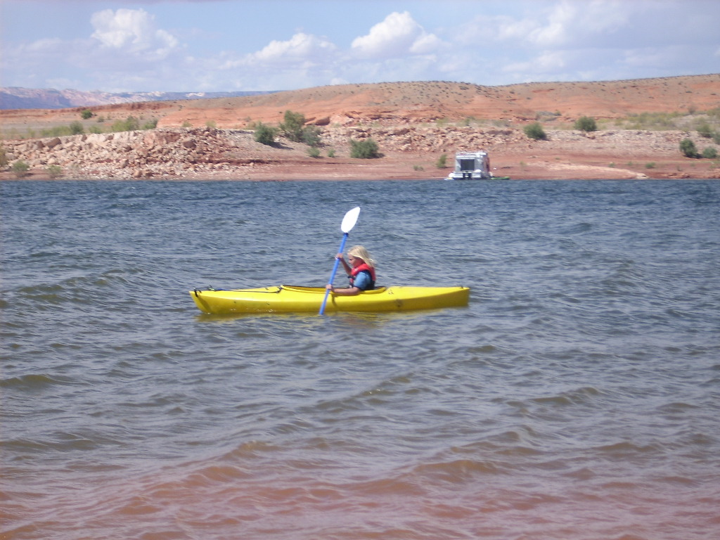
It was a lazy first morning on the lake. Judy fished, and everyone
played on the moki steps. I snorkeled a little, and found one golfball
on the bottom with Judy's previous initials marked on it (weird).
We detached and left around 11:30 am for the short trip across the
channel and up to the end of
Smith Fork
to visit the famous slot canyon (my first time too). There was just
one place, very tight, where we could barely tie up the Wildwind
(#4) near the end, but it sufficed. After getting all sweaty handling
this, I jumped in for a quick swim and to explore the small creek
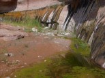
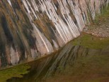
running nearby. There were a lot of bright green algae "blooms" here,
and all over the lake in fact.
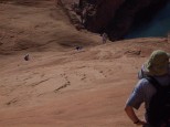
Everyone hiked together from 1:15 until 4:30 (3:15 round-trip), a few
back 15 minutes later than that. I'd heard that some swimming might be
required, so I wore a swimsuit and water shoes, and took only a light
pack, with bags for waterproofing it. As it turned out, while walking
in the water was pleasant, hiking boots would have been OK too. It had
been a dry season.
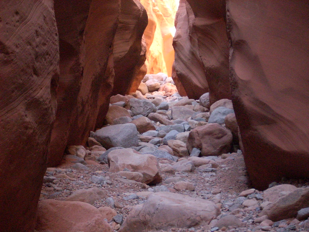
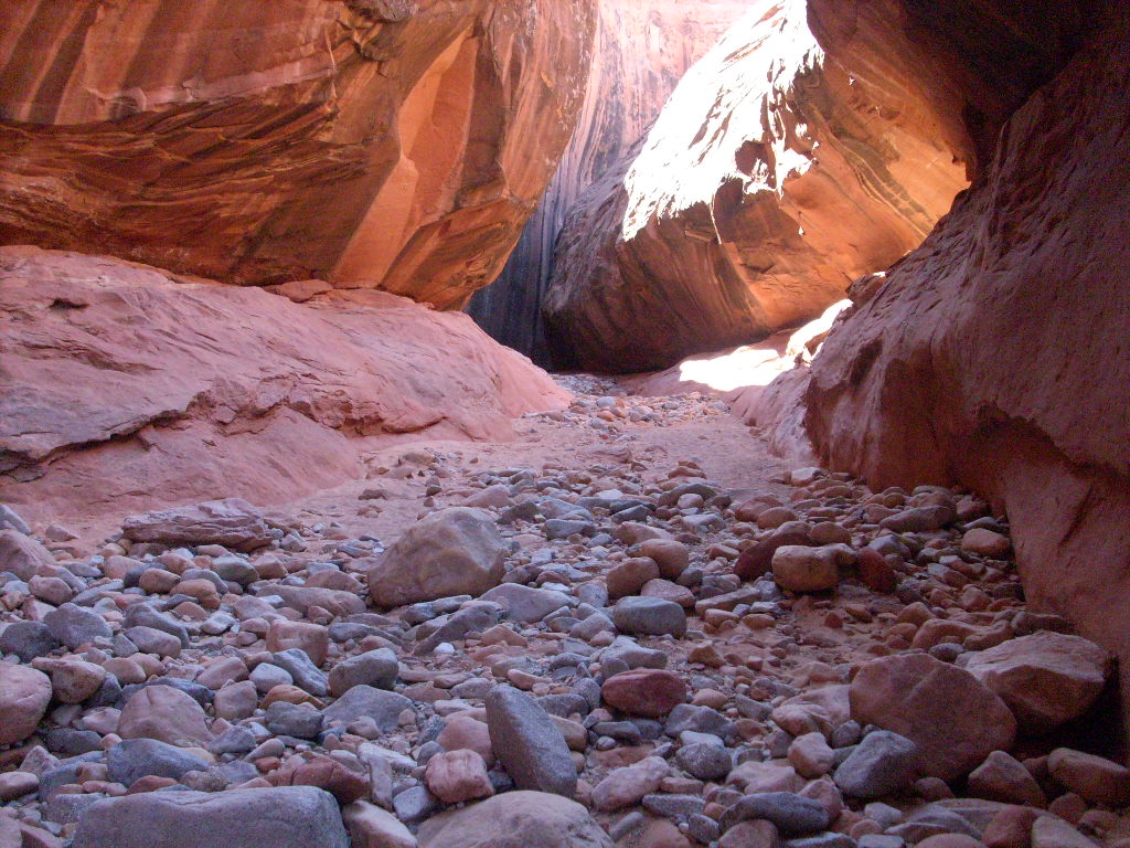
 I didn't have a map of the area, but had heard that the slots were 30-45
minutes walk upstream at this water level. What no one mentioned was an
ambiguous fork in the trail, down in the overgrown streambed, about 35
minutes in. I went up the right fork far enough to see a narrowing,
then told the others to follow me. As it turned out, this was a
worthwhile side-trip just a few hundred feet to a gorgeous, cave-like
dead-end "mini-cathedral" with a sandy plunge pool.
I didn't have a map of the area, but had heard that the slots were 30-45
minutes walk upstream at this water level. What no one mentioned was an
ambiguous fork in the trail, down in the overgrown streambed, about 35
minutes in. I went up the right fork far enough to see a narrowing,
then told the others to follow me. As it turned out, this was a
worthwhile side-trip just a few hundred feet to a gorgeous, cave-like
dead-end "mini-cathedral" with a sandy plunge pool.
Returning to the main drainage, I found a foot trail above the streambed
on the same side, an easier route, then met a couple of people walking
out. "Just another quarter mile," they said. I think it was closer to
1/3 of a mile, but then, sure enough, the gulch narrowed, and we found
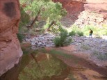
ourselves in a fantastic slot canyon.
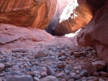 The floor varied from pink, purple, and white sandstone boulders to just
plain gray sand. The walls were sinuous and colorful too. We meandered
up at differing paces, each as far as they were inclined. I decided at
3:30 that I'd seen as much as I needed, and turned around to get back to
the houseboat ahead of the others.
The floor varied from pink, purple, and white sandstone boulders to just
plain gray sand. The walls were sinuous and colorful too. We meandered
up at differing paces, each as far as they were inclined. I decided at
3:30 that I'd seen as much as I needed, and turned around to get back to
the houseboat ahead of the others.
From the mouth of the slots I walked back fairly directly, and it really
was just 35 minutes total, one-way, without dawdling. Still the creek
stroll featured gorgeous reflections.
All aboard, we untied again, left at 5 pm, were out to the main channel
at 5:35, and stopped there to float a while and swim. After that, we
had enough daylight left to do one of my favorite things "up north" --
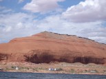
skim the mile-long base of the 650' tall
Tapestry Wall
as fast and close as I dared with the big boat.

 I wanted to hike up some inviting slickrock slopes beyond the Wall and
Warm Springs Canyon.
We eventually moored (#5) at what turned out to be just the right place,
the shallow end of the biggest canyon on river-right about 1.5 miles
upstream from Warm Springs. Raj and I took kayaks out to say hello to
some neighbors (unfortunately still barely in sight), and to view the
sunset colors at the main channel. We all enjoyed Mexican dinner on the
roof. It was very calm and pretty, with the neighbors' campfire glowing
in the distance as the full moon rose.
I wanted to hike up some inviting slickrock slopes beyond the Wall and
Warm Springs Canyon.
We eventually moored (#5) at what turned out to be just the right place,
the shallow end of the biggest canyon on river-right about 1.5 miles
upstream from Warm Springs. Raj and I took kayaks out to say hello to
some neighbors (unfortunately still barely in sight), and to view the
sunset colors at the main channel. We all enjoyed Mexican dinner on the
roof. It was very calm and pretty, with the neighbors' campfire glowing
in the distance as the full moon rose.
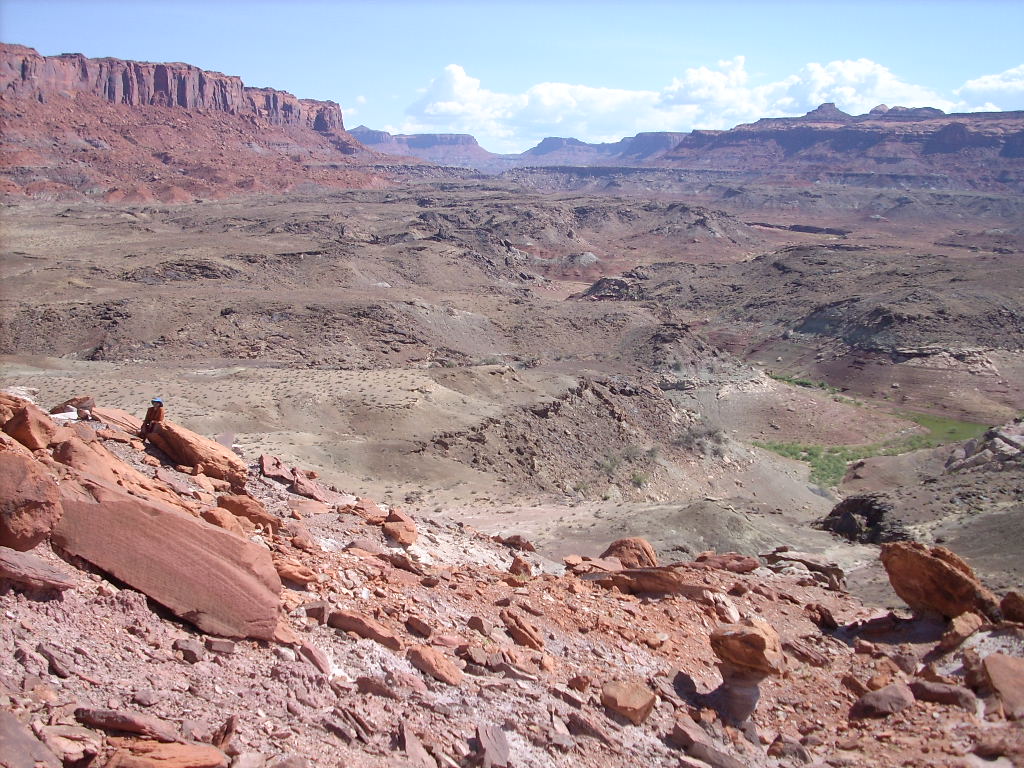
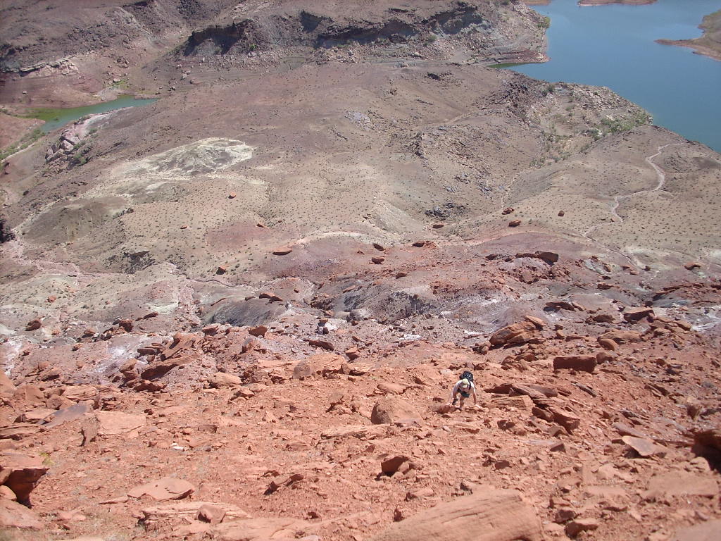
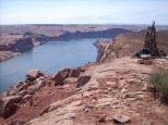
September 16, Tuesday: Up and Out, Over and Back (Warm Springs)
Somehow I conned everyone into joining me on a jaunt 900' up the
slickrock to a local 4524' high point. We secured the houseboat
and strode off at 9:25 am on another pretty morning. First we had to
scramble up the little hill by the houseboat, then walk across rough
flats towards the main hill (huge bare slickrock visible from the lake),
then find the best way to start up that slope.
 Our first rest in the shade was a huge outcrop on the initial Navajo
slickrock exposure above and to the left of the end of the canyon. From
there we tried to find the best route on the unrelenting inclined
hillside, avoiding anything uncomfortably steep for "frictioning". We
took our time, and eventually came over the top -- only to see the true
summit, set back farther, above a cliffy remnant layer of pink Entrada
sandstone perhaps 80' thick.
Our first rest in the shade was a huge outcrop on the initial Navajo
slickrock exposure above and to the left of the end of the canyon. From
there we tried to find the best route on the unrelenting inclined
hillside, avoiding anything uncomfortably steep for "frictioning". We
took our time, and eventually came over the top -- only to see the true
summit, set back farther, above a cliffy remnant layer of pink Entrada
sandstone perhaps 80' thick.
I was pleased that everyone was OK to keep going. We walked about a
quarter mile around to the right to find a sandslide route up to the
top. And then, on the brushy, coarse flats of
Ticaboo Mesa,
there was an old jeep road running right back to the edge of the cliff.
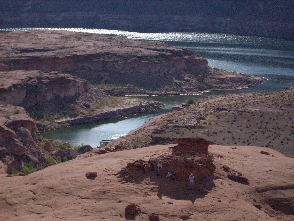
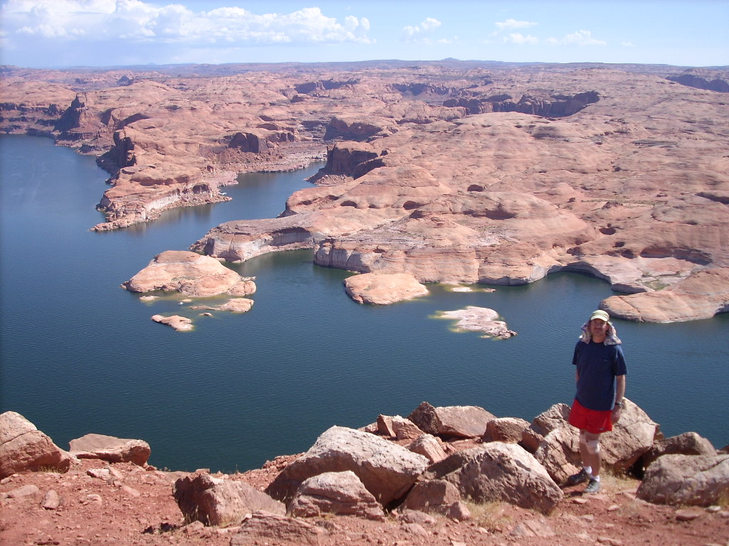
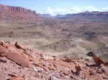
Total time so far, 1:40; views, excellent:
Navajo Mountain
in the distance; the
Tapestry Wall
closer beyond the dark cut of
Warm Springs Canyon;
the
Henry Mountains
to the northwest and north; a little of
Good Hope Bay
to the northeast; and so forth.
After a while three people started straight back down the ascent route for a
round-trip of 4:05. Meanwhile Bob and I, in radio contact with them,
strolled north on the jeep road to the next high point, then west from
there down a little to look over the edge. Surprise -- there was a
doable way down through the Entrada cliff here to keep going. The rest
of the crew being agreeable, we did.
Bob and I got onto several square miles of barren (and even shadeless),
hillocky, Navajo sandstone. We made a fast walk, mostly downhill, on
the slickrock, over a mile southwest toward the head of
Warm Springs Canyon.
Upon reaching that point just 35 minutes after leaving the group, we saw
a sinuous slot arriving at the pour-off, and no view down the canyon
either.
 Walking a little bit back east took us to a point where we could look
down about 400' to the lake, and out to the end of the canyon. It was
very nice, but now getting hot. We didn't stay long before starting a
return march, more direct and to the right of how we'd come down, trying
to minimize our gains and losses across the stone badlands. We had
plenty of water, but I wanted to rest and eat in the shade -- any shade
-- and there wasn't any for over a mile.
Walking a little bit back east took us to a point where we could look
down about 400' to the lake, and out to the end of the canyon. It was
very nice, but now getting hot. We didn't stay long before starting a
return march, more direct and to the right of how we'd come down, trying
to minimize our gains and losses across the stone badlands. We had
plenty of water, but I wanted to rest and eat in the shade -- any shade
-- and there wasn't any for over a mile.
In sight of our earlier 4527' high point to the north, we went right and
over the crest, up a drainage, to see the eastern slope of slickrock
again, and the houseboat 0.6 miles away up the main channel. We did a
high traverse in that direction, at risk of encountering an uncrossably
deep gully, but it worked out just right. We even found a small patch
of shade along the way.
 Bob and I descended a section of hillside steeper than anything we'd
walked up, but it worked out as a direct route. We made our long way
down to the houseboat at 3:30 (6:05 round trip). I was told I was beet
red from the heat, but I didn't feel too awful.
Bob and I descended a section of hillside steeper than anything we'd
walked up, but it worked out as a direct route. We made our long way
down to the houseboat at 3:30 (6:05 round trip). I was told I was beet
red from the heat, but I didn't feel too awful.
We untied the houseboat, backed out, turned, motored to the main
channel, and floated out there for another pleasant swim in deep, clean,
warm water decorated with fluorescent green algae swirls. Next we drove up to
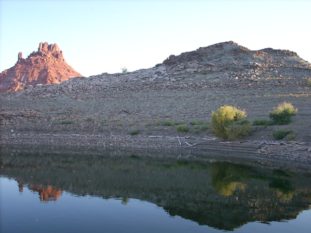
Good Hope Bay.
I pulled into the southeast bay and, following an old GPS waypoint, got
us as close as possible to a big fossil log I'd seen years ago.
We ran out of water 0.2 miles away. We tied up the boat (#6) at the
best spot I could find, although it was on the opposite side of the
overgrown creekbed.
As the lake went up and down, the tamarisks and tumbleweeds were
thickening along the shorelines. When the lake rose, it drowned the
weed patches. But since it was now up to within 5' of a 5-year high,
many of the back fingers were muddy, brushy nightmares.
Nonetheless we all went for a walk. Those of us in water shoes suffered
with stickery baby tumbleweeds, and the gray hillsides turned out to be
deep, soft, recycled volcanic ash. After a while I went down to the dry
creekbed, found a way to bushwhack across, and to my surprise, everyone
else followed me through the thicket.
 Before too much longer we found the log "right where I'd left it,"
weathering out of the ancient mudstone. While the others explored here,
I went back alone (ouch again), untied the boat, and moved it across the
channel. Beaching up against weedy rocks made a more direct and easier
route for the others to return. All aboard, at 6:20 pm, we drove back
into the main bay again.
Before too much longer we found the log "right where I'd left it,"
weathering out of the ancient mudstone. While the others explored here,
I went back alone (ouch again), untied the boat, and moved it across the
channel. Beaching up against weedy rocks made a more direct and easier
route for the others to return. All aboard, at 6:20 pm, we drove back
into the main bay again.
I wanted to hike
Ticaboo Canyon
the next day, but I had a bright idea. It was getting late, mooring was
unknown at the end of the canyon, and why bottle ourselves up? I called
a powwow, and everyone agreed it would be cool to instead stay on the
west side of the main bay (for moonrise later), out in the open. So we
did. And it was!
We found a marginal but doable spot (#7) just south of the spit that
marked the very end of
Ticaboo Canyon's
wide mouth on the bay. Some folks built and fed a campfire up on the
rocky shore. We shared a great steak dinner on the roof with a mild
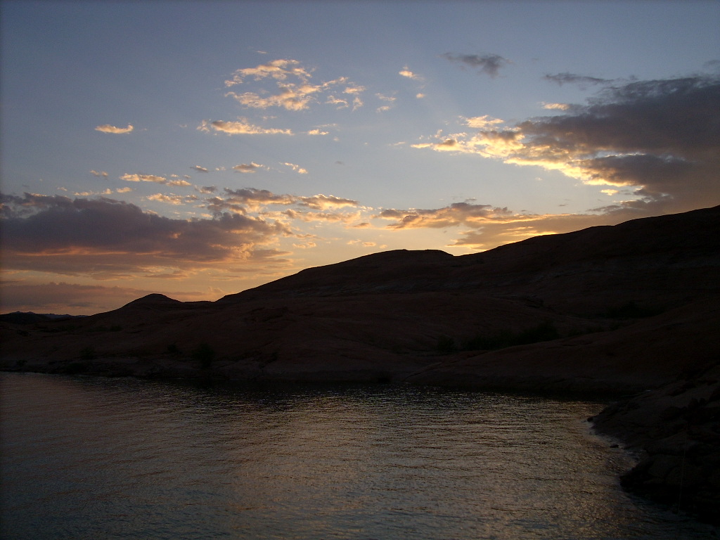
breeze. We watched a long time as a serene post-full moon crested the
cliffs across the bay, and then imperceptibly climbed the eastern sky.
It illuminated a few scattered drifting silver clouds. Way up to the
north beyond
Castle Butte,
we witnessed silent lightning flashes in the far, far distance.
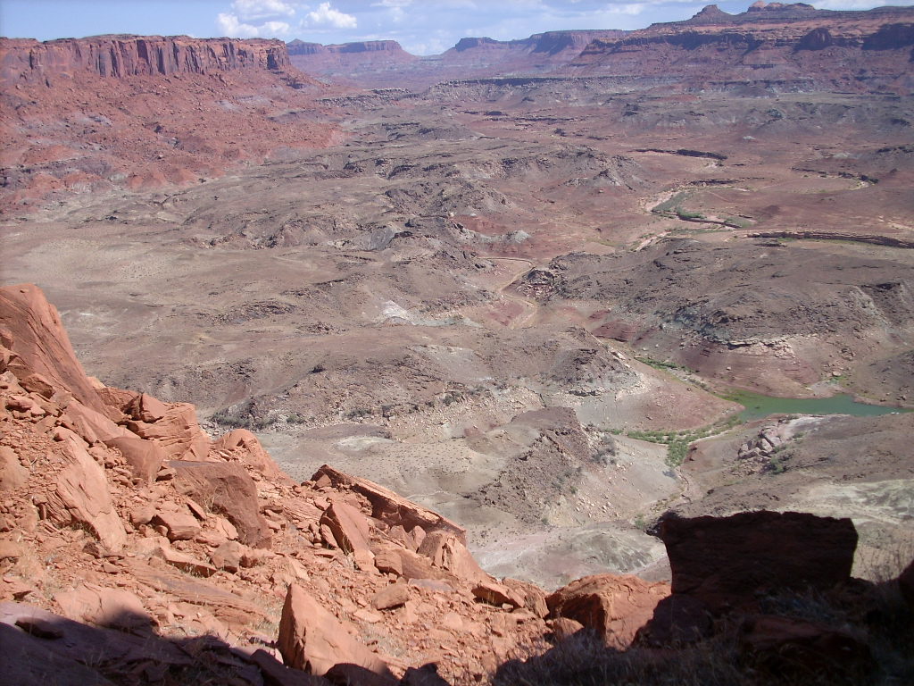
September 17, Wednesday: Ticaboo Canyon, Paradise and Purgatory
It was another lazy morning with lots of eye-candy in all directions.
 I took a walk with Raj up the nearby peninsula rocks to the north. As
usual, getting around and up to the high outcrop wasn't really hard,
less than 10 minutes, but it was farther and more tedious than I'd
guessed. Of course the view from the top was great.
I took a walk with Raj up the nearby peninsula rocks to the north. As
usual, getting around and up to the high outcrop wasn't really hard,
less than 10 minutes, but it was farther and more tedious than I'd
guessed. Of course the view from the top was great.
At about 10 am we untied and drove the Wildwind up
Ticaboo Canyon.
There were mirror reflections, and one very tight and shallow spot to
negotiate. We had it to ourselves as we moored (#8) near the end.
I make this sound quick and simple, but actually here's how it went:
Without realizing that we were only in about 4' of water, with a muddy
bottom, I put the bow against a cobble-rock shoreline. I had someone
pin the boat there with one engine. I ran off, up the 10' hill, then
several hundred feet upstream. I was pleased to find trails and
footpaths through the brush. After I was sure we could walk from the
houseboat up the canyon (remembering what happened Sunday in Forgotten),
I ran back to study the anchoring.
I saw that by moving a little bit downstream, we'd have an easier place
to do it. I stayed on shore and directed Perry at the helm how to back
off, turn a little, and move the bow maybe 50'. This took a little
trial and error. Also I was concerned at the muddy water being churned
up by the props, but no harm was done.
Once the nose was in the right place, I ran an anchor line out on each
side to whatever I could find, with the help of someone at the rear to
feed it out and then tie it. I used an anchor in sand on one side,
which apparently dragged a ways much later, when the others were back
before me and they had to fix it.
 So eventually the houseboat was secured, and we all walked off at 11:35
am. We bushwhacked a little to the mostly dry floor of the creek.
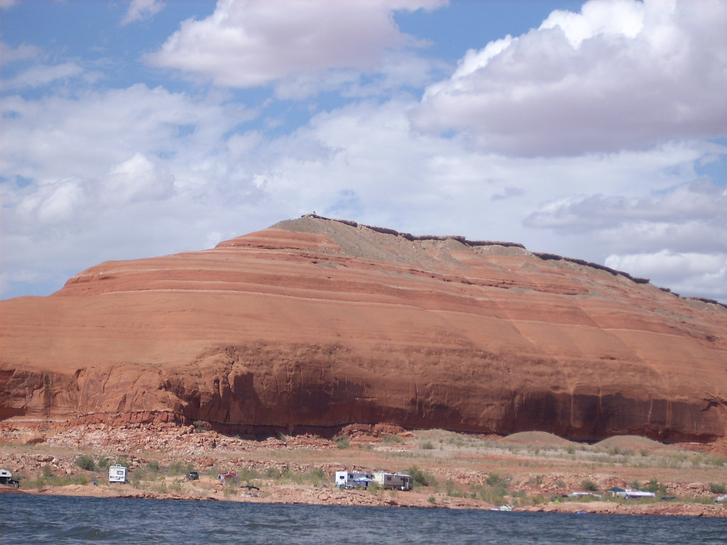
There were many pools richly green with algae, and some flowing water in
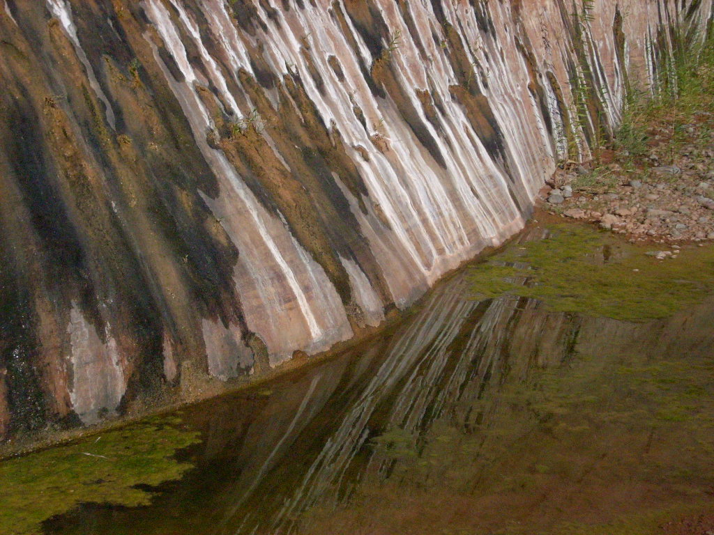
a few spots. Before too long we arrived at a curving, surreal "tapestry
wall" I vaguely remembered, stained brown and orange from permanent
springs. The whole wall had been underwater more than five years ago.
So eventually the houseboat was secured, and we all walked off at 11:35
am. We bushwhacked a little to the mostly dry floor of the creek.
There were many pools richly green with algae, and some flowing water in
a few spots. Before too long we arrived at a curving, surreal "tapestry
wall" I vaguely remembered, stained brown and orange from permanent
springs. The whole wall had been underwater more than five years ago.
It was a pleasant, cool day. It took us about an hour to reach what I
called, based on studying Google views, the "main fork." After
resting and regrouping in the shade there, we proceeded up the left
(major) drainage. It was a wide canyon with steep, colorful walls, and
a floor ranging from rocky to sandy.
 We kept going and after a while turned right at a second fork. I had
some idea where I was, but no map. I wanted to reach a nearly 5000'
hilltop between the main forks that I'd seen on Google maps. The nature
of the canyon varied as we walked, and there were nice glimpses of the southern
Henry Mountains
towering in the distance.
We kept going and after a while turned right at a second fork. I had
some idea where I was, but no map. I wanted to reach a nearly 5000'
hilltop between the main forks that I'd seen on Google maps. The nature
of the canyon varied as we walked, and there were nice glimpses of the southern
Henry Mountains
towering in the distance.
At some point I noticed that my cheap old digital camera in my belt
pouch with the worn-out velcro -- was gone. It must have fallen out
without me noticing. I wasn't too upset, because just a few days
ago it had developed some incurable problem of overexposing the images,
or at least it appeared so when played back on the screen. I hadn't yet
gotten around to asking Raj to download it to his laptop. I mentally
noted the spot, and decided to look for the camera on the return trip.
I kept taking pictures on my second, newer, "backup" digital camera. I
didn't like it very much because I thought it did a poor job. Well that
was my fault too; I'd forced it to ISO 400! (That's why some of the
pictures through Wednesday were grainy.) Later Raj helped me figure
this out, I fixed it, and it was great. (Whew.)
Anyway after two hours and more breaks, to my surprise everyone was up to
keep going, so we did. Before long I found a deer trail between brush
and trees on a long bench to the right, easier walking than the canyon
floor, although eventually we were back at it again. It was mostly dry,
with some sections of water emerging and forming pools.
 After a total of 2.5 hours, at around 2:10 pm, the majority decided they
were done. We were less than a mile from the hilltop goal, and 1.92
miles GPS direct from the houseboat, meaning probably three miles up
the canyon. I wasn't too disappointed about quitting; it had
been obvious for a while that we just didn't have enough time to get
that far. (Paradoxically, cooler weather, which is good for longer
hikes, means less daylight.)
After a total of 2.5 hours, at around 2:10 pm, the majority decided they
were done. We were less than a mile from the hilltop goal, and 1.92
miles GPS direct from the houseboat, meaning probably three miles up
the canyon. I wasn't too disappointed about quitting; it had
been obvious for a while that we just didn't have enough time to get
that far. (Paradoxically, cooler weather, which is good for longer
hikes, means less daylight.)
I sat in the shade with Bob for some lunch. We turned around at 2:40 pm
and trailed the others back, in radio contact. They got to the
houseboat at 4:30. I was somewhat slower... Because before long, I had
a small accident...
Here's an email I sent five days later, after I got home, which recounts
the tale:
  From:  Alan Silverstein <ajs@frii.com>
  Date:  22 Sep 2008 11:36:16 -0600
  Subject:  Alan's excellent [mis]adventure

  A brief note about a recent adventure...  No, not our week at Lake
  Powell, which was awesome, but stories and photos on that will come
  later.

  While we were there, last Wednesday, three miles up Ticaboo Creek, I
  stepped on a rock in the streambed that rolled under me and dumped me
  down violently a couple of feet.  I slammed hard on my left lower thigh
  onto a boulder.  This caused a fair bit of pain immediately, and ever
  since, but with ibuprofen I was able to hike out, and in fact hike some
  more on Thursday and Friday.  It was getting better, and there was no
  visible bruising.

  But, during the long drive home yesterday, my leg swelled up and turned
  various shades of purple around my knee.  I developed aches and tingles
  from my hip down to my ankle.  I got home at 10:45 pm, my wife helped me
  unload the car and get ready for bed, and we talked more...  Next thing
  you know, I was on the phone with an RN at NurseLine who asked lots of
  questions and then basically said, "I wouldn't wait until morning...
  You could die, or lose your leg."

  So, somewhere between 1 am and 3 am, I got a fabulous gurney ride
  through our amazing state-of-the-art emergency room at PVH on Lemay to
  visit Ultrasound and X-ray...

  My leg still looks awful, and it aches a lot, but they mostly ruled out
  anything too serious.  Whew.

  And that's really why I got in late today.  :-)
 So back to Wednesday: I limped out with Bob, trying to find and retrace
my tracks based on my unique boot sole impression. I did pretty well,
but I never did find that old camera! And at the main fork, getting
worse rather than better, I had to borrow Bob's collapsible walking pole
for the rest of the journey.
So back to Wednesday: I limped out with Bob, trying to find and retrace
my tracks based on my unique boot sole impression. I did pretty well,
but I never did find that old camera! And at the main fork, getting
worse rather than better, I had to borrow Bob's collapsible walking pole
for the rest of the journey.
I gutted out the return, which was more and more painful. We reached
the houseboat at 5:25 pm (5:50 round trip). There was no visible
surface bruising on my thigh, but I could hardly bend my left knee.
I needed help to deanchor. We drove out into a mild wind, crossed the
bay, and then floated and swam a while. Even being in the water was
painful on my leg. I assumed I was done hiking for the week, which was
a real bummer.
We cruised upstream (north) a mile or two further towards
Castle Butte.
There were almost no boats in
Good Hope Bay,
but there was one in the gulch where I would have liked to park
(for walking around the next morning). Oh well, we motored back out and
south a little to a random spot (tie-up #9) in the lee of the now
persistent wind, due south of the Butte, just in sight of the upper half
of it. This turned out to be a really pretty place, next to a small
island.
 We shared Italian dinner on the roof at about 7 pm. While eating a
chunk of rock randomly fell off the island, making a large noise and a
small splash. That was weird. Anyway, we enjoyed watching a late
moonrise, an ISS (International Space Station) pass, and an
Iridium flare (satellite solar panel flash).
We shared Italian dinner on the roof at about 7 pm. While eating a
chunk of rock randomly fell off the island, making a large noise and a
small splash. That was weird. Anyway, we enjoyed watching a late
moonrise, an ISS (International Space Station) pass, and an
Iridium flare (satellite solar panel flash).
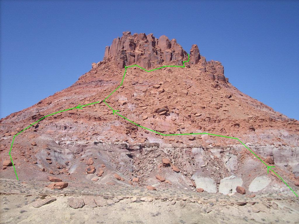
September 18, Thursday: Castle Butte or Bust!
 It was a little hard to sleep because in certain positions my banged-up
thigh hurt a lot. I was awake at 5:51 to watch another Iridium
flare, but as expected it was washed out by the post-full moon.
Back to bed, sleep in... Later, a pretty morning.
It was a little hard to sleep because in certain positions my banged-up
thigh hurt a lot. I was awake at 5:51 to watch another Iridium
flare, but as expected it was washed out by the post-full moon.
Back to bed, sleep in... Later, a pretty morning.
My leg felt better. We moved Wildwind partway up
Blue Notch Canyon,
beyond the other boat, still on the same side (river-right), in a
shallow, muddy finger (mooring #10), out of sight of anyone. There was
Moenkopi formation fossil ripple rock up the hill. I found it while
walking around a little to assess my leg, which really wasn't doing too
badly.
So at 10:50 I set out on a "short" hike with Bob and Raj up the hill,
onto higher flats maybe a hundred feet above us. We found an old
abandoned road past the base of
Castle Butte,
and lots of petrified wood chunks scattered around in spots.
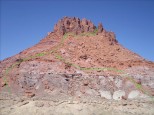 Near the edge of the Butte we studied the hillside, then went up one
steep ridgelet that got us through some broken Chinle cliffs (and below
others). Raj was happy going up this far and no further. He sat a
while as Bob and I traversed around (clockwise), and found a somewhat
easier slope covered with boulders of various sizes. We continued up
this steep, somewhat loose, but surprisingly doable hillside.
Near the edge of the Butte we studied the hillside, then went up one
steep ridgelet that got us through some broken Chinle cliffs (and below
others). Raj was happy going up this far and no further. He sat a
while as Bob and I traversed around (clockwise), and found a somewhat
easier slope covered with boulders of various sizes. We continued up
this steep, somewhat loose, but surprisingly doable hillside.
 Also I was pleasantly surprised how good my leg felt. Once in a while
if I bent my knee too far, I got a sharp reminder in the thigh muscle,
but it wasn't debilitating. I knew I might hurt it more again on the
way down, but I really wanted to keep going. And I'm really glad I did!
The climb wasn't terribly long, hot (just warm), or risky, and the
scenery was fantastic.
Also I was pleasantly surprised how good my leg felt. Once in a while
if I bent my knee too far, I got a sharp reminder in the thigh muscle,
but it wasn't debilitating. I knew I might hurt it more again on the
way down, but I really wanted to keep going. And I'm really glad I did!
The climb wasn't terribly long, hot (just warm), or risky, and the
scenery was fantastic.
 Bob and I reached some blocks with huge clefts at the base of the
Wingate formation sandstone (4330' GPS) at 12:10, 1:20 up from the boat.
We rested here, talked with the other three by radio, and flashed them with
my signal mirror -- we could just barely see the back of the houseboat
over the hillside.
Bob and I reached some blocks with huge clefts at the base of the
Wingate formation sandstone (4330' GPS) at 12:10, 1:20 up from the boat.
We rested here, talked with the other three by radio, and flashed them with
my signal mirror -- we could just barely see the back of the houseboat
over the hillside.
 After a while we proceeded back into the sunshine, down a little, around
a few hundred feet north (counter-clockwise), and up to another patch of
shade, higher than before at 4420'. The map on the boat said the summit
was 4527', and it was so rugged I knew we weren't going all the way
there anyhow. But taking only my camera, I left my pack and explored
further up the narrow, steep V above us. It turned into a nearly
vertical rocky chimney, but it was climbable!
After a while we proceeded back into the sunshine, down a little, around
a few hundred feet north (counter-clockwise), and up to another patch of
shade, higher than before at 4420'. The map on the boat said the summit
was 4527', and it was so rugged I knew we weren't going all the way
there anyhow. But taking only my camera, I left my pack and explored
further up the narrow, steep V above us. It turned into a nearly
vertical rocky chimney, but it was climbable!
This route gave us access to the broken "north ridge" of
Castle Butte,
with a view over the far side, up the rest of
Good Hope Bay.
We were at least 50' higher than our packs, so within 50' of the true
summit. It was fantastic.
We carefully returned to our packs, then descended the steep, loose
hillside, 1:45-2:50 back to the houseboat, just 4:00 round-trip.
Reaching the road only took us 38 minutes, partly because we walked down
a different ridgelet, more to the right, that we could see from above
was easier. Again I had to be careful with my left leg, but other than
some painful jolts, no harm was done.
Once back on the houseboat we wasted no time moving out at 3:10. I
wanted cleaner water in which to swim, but then figured we might as well
go all the way south a few miles to...
Popcorn Canyon!
It was the first time I'd been back there since the
USGS Board on Geographic Names
accepted (in 2005) my proposal to name this canyon, along with a few other
Glen Canyon
features. (Meaning no more double-quotes here around the name since
it's official and not informal.)
 We tied up (#11) on a small-rocky and not-too-overgrown shore 0.16 miles
from
"Popcorn Beach",
and all strolled over to see it. After a pleasant time playing here, I
took a nice long swim off the back of the houseboat, then got it going
again at 5:50 pm.
We tied up (#11) on a small-rocky and not-too-overgrown shore 0.16 miles
from
"Popcorn Beach",
and all strolled over to see it. After a pleasant time playing here, I
took a nice long swim off the back of the houseboat, then got it going
again at 5:50 pm.
We motored downstream toward the
Tapestry Wall
as far as we could get before running out of daylight, and it worked out
great. We found a very sweet spot (#12) at 7:10 pm, one we had passed
up on Monday to go farther north, open to a wide bay and in sight of a
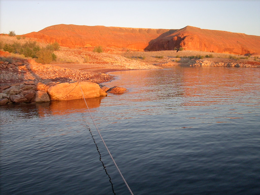
glorious sunrise on the Tapestry Wall the next morning. It took long
anchor lines, but the wind wasn't bad, and the lake was 23' deep off the
stern.
That evening we enjoyed a rooftop dinner of burgers and brats before
twilight, plus a very bright (-8) Iridium flare. After eating, I
did a solo night kayak to some neighbors (a fishing party) near the mouth of
Warm Springs Canyon,
about a mile away, and back as the moon rose. It was a lovely, warm,
calm night.
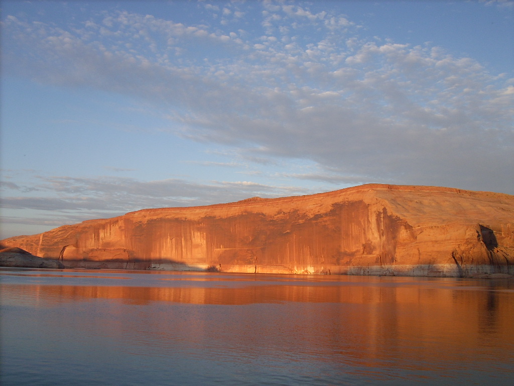
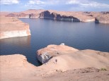
September 19, Friday: Tapestry Wall
 I limped awake early, quietly, to shoot way too many pictures of a
slowly progressing, awesome golden sunrise on the
Tapestry Wall.
The nearby reflections were splendid too. Later I did a little
snorkeling, but we still pulled out before 9 am. We drove a relatively
short distance, maybe three miles, to the downstream end of the Wall to
start a hike to the top of it.
I limped awake early, quietly, to shoot way too many pictures of a
slowly progressing, awesome golden sunrise on the
Tapestry Wall.
The nearby reflections were splendid too. Later I did a little
snorkeling, but we still pulled out before 9 am. We drove a relatively
short distance, maybe three miles, to the downstream end of the Wall to
start a hike to the top of it.
In the past I'd gotten onto the slickrock about one mile from the
summit, but this area had been a sheer cliff for many years since the
lake dropped. I'd heard there was a way up, "further south", and sure
enough, the next canyon downstream was it. I figured if my leg was OK
for walking, and we could find a decent spot to tie up the boat, I'd
join the group. Otherwise I'd just drop them off and float around
waiting. Well we found a marginal but acceptable mooring (#13), given
it was another calm day, and I went up the hill with them.
All five of us loaded up and walked off at 10:15 to begin a grinding stroll
up massive, bare sandstone ridges. We found some old cairns, and we
left more behind us as we went, but we still missed the last set coming
down, thus making a small loop.
 Anyway the first perhaps 500' of ascending felt long and slow. I must
have been tired, and my leg hurt enough to make me more careful. We got
to where we could see a long traverse north, still mostly climbing but
less steeply, to a pink Entrada clifftop above the bare red/gray Navajo
sandstone.
Anyway the first perhaps 500' of ascending felt long and slow. I must
have been tired, and my leg hurt enough to make me more careful. We got
to where we could see a long traverse north, still mostly climbing but
less steeply, to a pink Entrada clifftop above the bare red/gray Navajo
sandstone.
 Following cairns and a path angling to the right, we reached the sandy,
scrubby, rolling top of
Ticaboo Mesa
(4250') about 0.9 miles from the boat and 0.6 from the conical summit
plainly visible in the distance in front of assorted
Henry Mountains.
Following cairns and a path angling to the right, we reached the sandy,
scrubby, rolling top of
Ticaboo Mesa
(4250') about 0.9 miles from the boat and 0.6 from the conical summit
plainly visible in the distance in front of assorted
Henry Mountains.
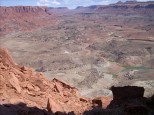
The hilltop (4312') was only about 60' higher, but a long walk to reach.
We spread out, each taking our own route.
 Raj accompanied me close to the edge of the cliff, with increasingly
spectacular views down and out over the
Tapestry Wall.
We could see part of it curving to the right upstream in the distance.
Raj accompanied me close to the edge of the cliff, with increasingly
spectacular views down and out over the
Tapestry Wall.
We could see part of it curving to the right upstream in the distance.
 I reached the hilltop at 11:50, that is, 1:35 from the boat; not
a terribly long journey, but it felt tedious. The others sauntered up
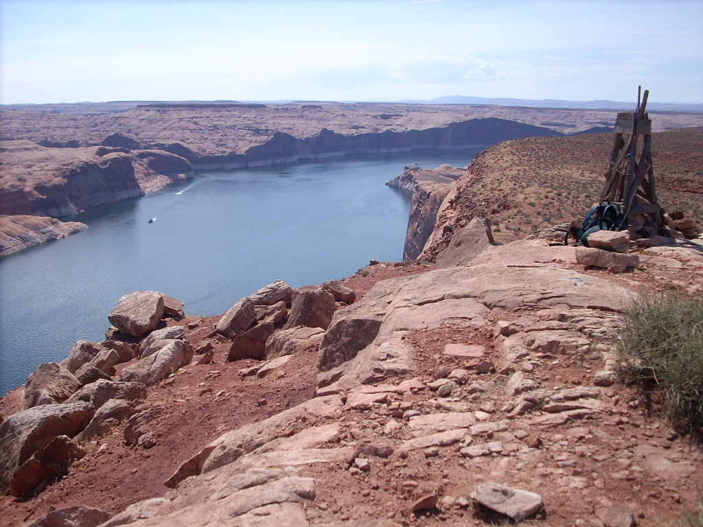
over time. The weatherbeaten old wooden four-legged tower was still
standing on the summit. It was such a gorgeous day that I lingered
there a long while, as others came and later went. What a grand view
for lunch!
I reached the hilltop at 11:50, that is, 1:35 from the boat; not
a terribly long journey, but it felt tedious. The others sauntered up
over time. The weatherbeaten old wooden four-legged tower was still
standing on the summit. It was such a gorgeous day that I lingered
there a long while, as others came and later went. What a grand view
for lunch!
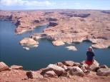 Way down below on the lake, we saw people moor their ski boat in a
lagoon-like area and swim around. I also watched the comical
meanderings of a large houseboat... You could guess what they were
thinking... "Is this
Cedar Canyon?
No, let's turn back out... Is this Cedar? Yes..." They disappeared up
the gulch, turning left and right to study the shoreline, only to
reappear a while later. Finally they crossed up the channel and
moored... Right where we had been the previous night!
Way down below on the lake, we saw people moor their ski boat in a
lagoon-like area and swim around. I also watched the comical
meanderings of a large houseboat... You could guess what they were
thinking... "Is this
Cedar Canyon?
No, let's turn back out... Is this Cedar? Yes..." They disappeared up
the gulch, turning left and right to study the shoreline, only to
reappear a while later. Finally they crossed up the channel and
moored... Right where we had been the previous night!
I hung out until 12:45, then went down pretty much the same way I'd come
up. Despite Perry's good idea of leaving separated tracks across the
mesa, the "down" point was not obvious. I used my GPS to head for the
spot... "Four degrees right of
Navajo Mountain..."
And a while later, "now it's four degrees left..." It didn't seem
correct, I started to doubt the GPS unit, but ultimately it did lead me
right back to the cairn we'd placed above the dropoff.
We arrived at the Wildwind at 2:15 (1:30 down, 4:00 round trip). I was
relieved to find that no wind had disturbed our floating home. We took
a refreshing swim; just 9' deep at the stern, but clear and green.
Motoring out at 3:35, it dropped rapidly to 120'.
It was time to make some miles toward the marinas. But passing the
mouth of
Smith Fork,
I really wanted to run up the slope on the downstream side that I'd
first eyed so many years ago. There were some boat-wake waves and a
little breeze, but I thought I had the Wildwind tied up adequately to
shore with one line... Nope! (So I'm not counting this as a mooring!)
 Perry and Bob went up the hill, and when they were near the top I
followed them. When I was most of the way up, the boat came loose
despite Raj trying to resecure it. I had to call Judy on the radio, and
tell her how to start a motor and drive it back to shore. Oh well!
Nonetheless we got a good fast look, and confirmed the "up and out"
access point there.
Perry and Bob went up the hill, and when they were near the top I
followed them. When I was most of the way up, the boat came loose
despite Raj trying to resecure it. I had to call Judy on the radio, and
tell her how to start a motor and drive it back to shore. Oh well!
Nonetheless we got a good fast look, and confirmed the "up and out"
access point there.
Later I looked for a good place along river-right, near
Moki Canyon,
for the rest of the crew to go for a hike while I rested my sore leg and
cooked dinner. Parking and anchoring wasn't trivial, and there was a
dead fish floating in our cove... But we did find a nice, anonymous
little bay exactly one mile (at 276 degrees bearing) from the mouth of
Moki, across the channel, southeast of the 4031' hilltop. We were
secured (#14) by 5:30 pm.
The others left on a walk at 5:50, which ended up being 80 minutes
total, to the higher flats above the lake, out of sight. I suggested
they go to the local high point for a wraparound view of the lake
(Colorado River)
from our peninsula, but they didn't make it that far.
 Meanwhile I enjoyed tidying the boat, barbecuing chicken (not really
knowing how, but they did eat it), etc. We shared dinner together on
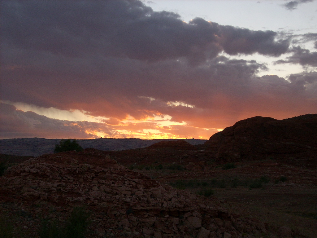
the roof once more, before dark, under a lovely, partly cloudy sunset.
There was a good stiff wind, but it was up our tail, which was OK with
me since there wasn't room for big waves to form. We saw the ISS
again, and another Iridium flash.
Meanwhile I enjoyed tidying the boat, barbecuing chicken (not really
knowing how, but they did eat it), etc. We shared dinner together on
the roof once more, before dark, under a lovely, partly cloudy sunset.
There was a good stiff wind, but it was up our tail, which was OK with
me since there wasn't room for big waves to form. We saw the ISS
again, and another Iridium flash.
September 20, Saturday: Stanton Canyon and Marina Chores
I had big plans for today: Take the crew to
Stanton Canyon,
drop them off to hike up the
"MonoTit"
hill west of the canyon (I'd been up it at least twice before), and
meanwhile, hobnob with folks from WaynesWords.com at the fall "Shad
Rally" campout. Later visit
Halls Crossing Marina
for dock duties, then beach somewhere near
Bullfrog Marina
for the night. But it was a pleasant morning, and there was no rush.
Wearing just water shoes and a light pack, but with a radio and a water
bottle, I took my sore leg for a stroll up the slickrock. It was only
10 minutes to the rim above, so I talked with folks on the boat and kept
walking. In the distance was a small cobble-covered, cone-shaped
hill that looked interesting -- and it was -- and it only took me 12
more minutes to get to the top of it.
 Well at 4002' it wasn't as high as the bluffs to the west, but it had an
even more spectacular view of the lake than I recalled from the higher
spot. I could see continuous water for all but about 40 degrees of
panorama! I called down to the boat again, told them what they could
share with a 25-minute hike, but I guess they were too mellow, 'cause no
one took the bait.
Well at 4002' it wasn't as high as the bluffs to the west, but it had an
even more spectacular view of the lake than I recalled from the higher
spot. I could see continuous water for all but about 40 degrees of
panorama! I called down to the boat again, told them what they could
share with a 25-minute hike, but I guess they were too mellow, 'cause no
one took the bait.
I wandered back down, again cursing the pain in my leg at points, but it
still functioned OK. I was back at about 9:40 am, and had been out for
70 minutes! There still wasn't any hurry, so I snorkeled a little,
avoiding the floating dead fish, to unhook Judy's snagged line.
Eventually we took off for
Stanton Canyon.
When we got there, I couldn't find an obvious sign of the Rally! I took
the boat through 6-foot-deep shallows to the west where I saw big tents
on shore, but it was some kind of a family reunion! Feeling silly, I
did a 180 back east, and then I recognized
Pete Klocki's
houseboat, the Pattycake, which I'd only known about from Web postings.
Well finally I realized it was too far for the hikers, so we kept going
north up
Stanton Creek
anyway. We parked in a nice place (#15) surrounded by other boats (and
cars that had come down the road for camping), launched the other four
afoot, and -- why walk when you can paddle? -- I took a kayak ride,
which turned out to be 0.4 miles, back to Pattycake. I was out 12:30 -
3:15, returning home the same time as Raj and Judy. (Bob and Perry got
back later at 3:50.)
 Anyway I beached my kayak by the Pattycake, requested permission to come
aboard, and hung out on the stern a while talking with Pete and others.
Then I took a walk up a nearby hill to eat some lunch and try reaching
my crew by radio -- which was surprisingly difficult. Eventually I
heard they were making slow progress, having had to walk a mile or more
to the north end of the hill and the north saddle to get on top.
Anyway I beached my kayak by the Pattycake, requested permission to come
aboard, and hung out on the stern a while talking with Pete and others.
Then I took a walk up a nearby hill to eat some lunch and try reaching
my crew by radio -- which was surprisingly difficult. Eventually I
heard they were making slow progress, having had to walk a mile or more
to the north end of the hill and the north saddle to get on top.
 It was another gorgeous, sunny, warm but not too hot,
Lake Powell
fall afternoon. But the wind picked up as the forecast had predicted.
Waiting for Perry and Bob to reach the top of the hill, I went back down
by Pattycake and offered short kayak demo rides to five very cute kids,
whom I learned later were all from one family.
It was another gorgeous, sunny, warm but not too hot,
Lake Powell
fall afternoon. But the wind picked up as the forecast had predicted.
Waiting for Perry and Bob to reach the top of the hill, I went back down
by Pattycake and offered short kayak demo rides to five very cute kids,
whom I learned later were all from one family.
 The hikers arrived at the south end of the hill, could barely stand up
in the gale force wind, and stayed only long enough for me to take some
telephotos. It was fun pointing them out to the "Wordlings", who were
suitably impressed.
The hikers arrived at the south end of the hill, could barely stand up
in the gale force wind, and stayed only long enough for me to take some
telephotos. It was fun pointing them out to the "Wordlings", who were
suitably impressed.
 While Bob and Perry retraced their steps I paddled like mad into the
wind and big waves to the southernmost boulders across the canyon. I
stopped on a beach for a while, then scrambled around the base of one of
the "Haystack" pillars, presently a small island. The downwind return
to the houseboat was very fast, 10 minutes with a huge tailwind and
being overtaken by large rollers.
While Bob and Perry retraced their steps I paddled like mad into the
wind and big waves to the southernmost boulders across the canyon. I
stopped on a beach for a while, then scrambled around the base of one of
the "Haystack" pillars, presently a small island. The downwind return
to the houseboat was very fast, 10 minutes with a huge tailwind and
being overtaken by large rollers.
Raj and Judy took a short tour in the kayaks while I prepared myself and
the boat for departure.
By the time the last hikers returned I was an hour "behind schedule",
and not thrilled about the strong winds. Regardless, we made waves for
the
Halls Crossing Marina,
with a short "hot stop" on the beach by Pattycake to donate some extra
ice to them. We went through the fuel and water docks without
incident, despite the incessant adverse gusts, 5:00-6:30 pm, although
with the usual small gotchas to be overcome.
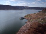
Next we drove posthaste a few miles across to southwest
Bullfrog Bay
-- crowded with other boats -- finally found an adequate spot, and were
tied up (#16) just 18 minutes before sunset (7:24 pm).
 There wasn't time left to do a long walk up a nearby hill for sunset, so
some of us just strolled around the area. I found myself on top of
"Garys Rock",
previously a barely submerged, prop-eating, boat-dinging island way out
in the bay. It was yet another pretty sunset. We watched two
more ISS passes about 90 minutes (one orbit) apart, and later a
gorgeous waning gibbous moonrise around 10:30 pm.
There wasn't time left to do a long walk up a nearby hill for sunset, so
some of us just strolled around the area. I found myself on top of
"Garys Rock",
previously a barely submerged, prop-eating, boat-dinging island way out
in the bay. It was yet another pretty sunset. We watched two
more ISS passes about 90 minutes (one orbit) apart, and later a
gorgeous waning gibbous moonrise around 10:30 pm.
What a great week it had been! And personally I was out on foot for
about 24.5 hours on six significant hikes, not even counting a number of
shorter strolls, and even being abbreviated by the injury.
September 21, Sunday: Clean Up and Go Home
 Going-home day from the lake was always tedious... I awoke too early,
dragged out of my sleeping bag at 6:40 am a little tired, and continued
cleaning and packing along with everyone else. We moored at
Hobie Cat Beach
(#17, final tie-up if you don't count the buoy) at about 9:30-11:10 am.
I released the rest of the crew at about 10:55, then Bob and I reversed
the buoy procedure from a week ago. He helped me deanchor and drove my
car around while I took the houseboat alone to the north buoy field.
Going-home day from the lake was always tedious... I awoke too early,
dragged out of my sleeping bag at 6:40 am a little tired, and continued
cleaning and packing along with everyone else. We moored at
Hobie Cat Beach
(#17, final tie-up if you don't count the buoy) at about 9:30-11:10 am.
I released the rest of the crew at about 10:55, then Bob and I reversed
the buoy procedure from a week ago. He helped me deanchor and drove my
car around while I took the houseboat alone to the north buoy field.
Despite a persistent breeze, I got the houseboat attached OK to
buoy 501 at 11:30... Shut it down, and finished putting it
away for at least the next couple of weeks. Underway by kayak at noon,
oops, I had to run back a minute to retrieve the windsock I'd forgotten
hanging on the bow!
 On the beach by the rental dock we added the second kayak to the roof of
my car, then both took a last swim and bath. We departed
Bullfrog Marina
at 12:55; not great, but could be worse. The car was jammed with gear
again.
On the beach by the rental dock we added the second kayak to the roof of
my car, then both took a last swim and bath. We departed
Bullfrog Marina
at 12:55; not great, but could be worse. The car was jammed with gear
again.
The drive home was long but blissfully uneventful. We went through
Fruita
at 5:15 pm. Later in southwest
Denver
I did a 26-minute round-trip detour to drop Bob (and his many pounds of
Utah rocks) with a friend at the
Morrison
exit. I pulled into my own driveway at 10:45 pm, and Cathie helped me
unload the car.
That's normally the end of the story... There's always a lot of
followup trivia in the week or two after, putting everything away,
making repairs, etc; not interesting to write about. But as you've
already read, heading for bed around midnight, Cathie and I decided that
a trip to the PVH ER was warranted first! During the long ride
home my left leg had developed a bad attitude. Fortunately the doctor
concluded that my leg injury was "just a flesh wound," and I straggled
into work the next day limping and exhausted. It hurt a distracting lot
for about two more weeks, but eventually was good as new.
(Next trip report: 2009_0820-22_ElkRangeFourteeners.htm)
 That done, with gusto the entire crew marched off the Wildwind, up the
rocky hill, around the corner, and... Came to a dead stop within
minutes atop a small hill. The bench on our side ended at water of
unknown depth reaching all the way to a cliff face. We could see the
ruins upstream a little bit, including the famous pictographs, but there
was no practical way to reach them... Sigh!
That done, with gusto the entire crew marched off the Wildwind, up the
rocky hill, around the corner, and... Came to a dead stop within
minutes atop a small hill. The bench on our side ended at water of
unknown depth reaching all the way to a cliff face. We could see the
ruins upstream a little bit, including the famous pictographs, but there
was no practical way to reach them... Sigh!