August 17-24, 2008: Lake Powell, Utah
One of many
trip reports under the
SilGro home page for Alan Silverstein and Cathie
Grow.
Email me at
ajs@frii.com.
Last update: July 26, 2024
(Previous trip report: 2008_0614-15_Wyoming.htm)
Contents:
- Saturday, August 16: Rain and Sunshine
- Sunday, August 17: Rapid Transit
- Monday, August 18: Hike Unnamed Canyon
- Tuesday, August 19: Long, Far, High, Hot
- Wednesday, August 20: Recuperate on the Water
- Thursday, August 21: Up, Out, Back, Hot!
- Friday, August 22: Back Toward "Civilization"
- Saturday, August 23: The Rest of the Way Back
- Sunday, August 24: Flowing Home
It was another glorious week at
Lake Powell,
Utah!
The trips were all similar, but all different too... Why bother writing
about another trip? Well it helped me remember, it was fun to reread
years later, and maybe it entertained others; so here went again, the
Alan's-eye-view of a great vacation...
This time some people canceled, so we had a surprisingly small crew --
just me, my wife
Cathie Grow,
and
Doug and Rita Baskins.
One houseboat, one ski boat, one small sailboat, one kayak. Full moon
came a day before the trip started, so we enjoyed post-full moonrises
early in the week, and dark, starry skies later.
Thanks to new engines on the houseboat, it went very fast. We spent
four nights in
Piute Bay,
20 miles up the
San Juan River!
It was bummer windy most days for Doug and Rita, ruining their skiing
and fishing, but it helped me stay a little cooler on some long hikes.
I was afoot alone three separate days for around 22 hours total! One hike
took me further and higher than ever before at Glen Canyon (I think).
The lake rose a lot during the previous spring. At 3632', it was higher
than it had been for about five years, and only 70' below full pool.
Saturday, August 16: Rain and Sunshine
It was a relatively easy departure, after the usual prior
weeks/days/hours of planning and packing. Except, due to heavy rain
Friday night, I didn't put the little boats on my car until Saturday
morning -- and it was still raining. We left home at 9:30 am, hit a
dead stop in the rain at I-25 exit 240, detoured through
Longmont
and
Boulder,
and finally it quit raining on us, on the way uphill west out of
Denver.
There was fresh snow on some high-country summits -- in mid-August!
So we lost a little time. We didn't leave lunch in
Silverthorne
till 1 pm, but we still got our produce shopping done in
Fruita
quickly by a little after 5 pm. Thus we had time to detour again, this
time for fun, about 37 miles into
Utah,
seven miles south on a gravel road to
Yellowcat Flat
north of
Moab
and Arches. It was cool, breezy, quiet, and gorgeous while I
rockhounded agates for an hour and Cathie read a book.
We arrived at
Green River,
Motel 6, before 8 pm. Nice Mexican dinner at
Ben's Cafe
as usual, but it was too chilly to swim in the unheated pool after that!
Sunday, August 17: Rapid Transit
Cathie and I got a reasonably early start and arrived at
Bullfrog Marina
just before 10 am. My cell phone coverage turned back on, and there was
a message from the previous houseboat owner wanting to hand off the boat
to me an hour earlier! Oops. Next thing you know, pulling into the gas
station, there's Doug and Rita in his truck. He'd already found, walked
through, and accepted the houseboat, releasing the other folks to head
for home. So we drove right on down to
Hobie Cat Bay
and the Wildwind II.
Even though unloading went fast and smoothly, we still didn't leave the
beach until 12:30. I had to drive back up to the Boat Shop to try
buying engine oil filters (35-877761K04, but all they had was -67K04).
And a couple more bags of ice too, but the store was closed... I was
zero-for-two.
Doug and Rita ski boated to
Halls Crossing Marina
for a fishing license and ice while Cathie and I ended up floating
around a while in the bay to handle a few loose ends. So we were behind
Doug and Rita again, and we didn't pass Halls until 1:30. This was
still plenty early compared to past experiences.
Now here's the crazy part... The boat had two new, more powerful (and
yet more fuel-efficient) 115 HP engines. As a result it would cruise at
9.3 MPH with nothing on tow, or 7.5-8 MPH with one ski boat behind it.
Wow! Compared with the old 5.5-6, we were flying! And we did --
right down the lake much farther than I've ever gone in the first
afternoon, nearly to the mouth of the
San Juan River
by about 6:20 pm!
 Along the way we floated briefly while I snorkeled down about 10' to
touch the top of the
"Devils Potty Arch",
a frequent milestone finally hidden back under water. Later elated to
be so far south, and getting tired of driving, we tied up on river left
in an odd spot along the main channel with a great view of
Navajo Mountain,
setting me up for a hike the next day, with an hour and a half left
until sunset. I got the sailboat rigged and took it for a spin, then
kayaked across the lake and back. Whee!
Along the way we floated briefly while I snorkeled down about 10' to
touch the top of the
"Devils Potty Arch",
a frequent milestone finally hidden back under water. Later elated to
be so far south, and getting tired of driving, we tied up on river left
in an odd spot along the main channel with a great view of
Navajo Mountain,
setting me up for a hike the next day, with an hour and a half left
until sunset. I got the sailboat rigged and took it for a spin, then
kayaked across the lake and back. Whee!
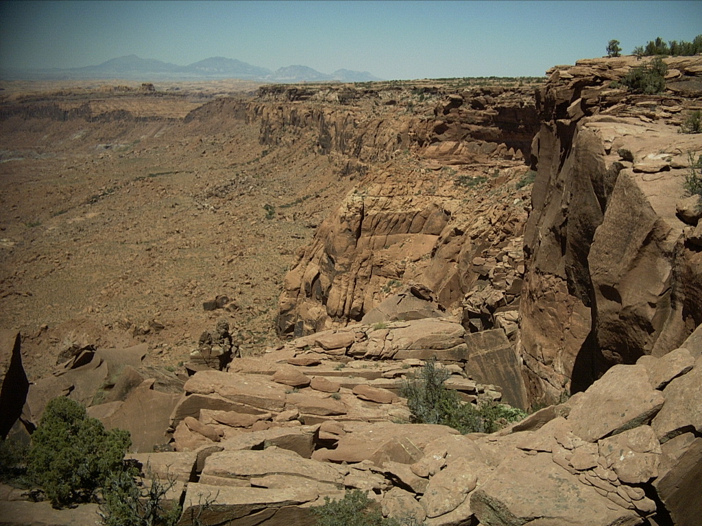
Monday, August 18: Hike Unnamed Canyon
Happy to be all way way down here on a Monday morning, I set out alone
at 8:35 am for an exploratory hike of a nearby but hidden box canyon
whose mouth was never under water. I loved the way things worked out...
I'd examined this obscure canyon last summer from
"The Balcony"
nearby across the lake, thought it would be fun to traverse sometime,
but never expected the opportunity would materialize so soon.
 I had to get up from the lake onto higher flats, previously submerged,
then walk a long way, at least 10 minutes, east toward cliffs. I
noticed, entered, explored, and came out of a "small" (by
Glen Canyon
standards) dimple with a huge dryfall, oasis, and tapestry wall. From
there I turned hard right and hoofed north along the base of the cliffs
around and into the main box canyon.
I had to get up from the lake onto higher flats, previously submerged,
then walk a long way, at least 10 minutes, east toward cliffs. I
noticed, entered, explored, and came out of a "small" (by
Glen Canyon
standards) dimple with a huge dryfall, oasis, and tapestry wall. From
there I turned hard right and hoofed north along the base of the cliffs
around and into the main box canyon.
It was a clear, sunny, relatively cool morning, one of those times when
you can't believe the crisp colors and the glowing cottonwood trees. I
continued all the way -- a long way -- to the back of the canyon, first
along the right side, then down on the stone floor, then some
bushwhacking. I startled and watched a triplet of deer traipse away
high above me.
Finally I had to climb some steep, deeply eroded sandstone rubble,
perhaps a hundred feet. Apparently there'd been a major spall off the
cliffs above that had filled the end of the canyon and not yet eroded
away.
Thanks to the rubble pile, the small flat at the back wall was dry -- no
plunge pool. I rested here, 9:45-10:10, enjoyed the long view out of
the canyon, and observed that I was over a mile (GPS) from the
houseboat.
After a while I returned to the canyon floor and trekked back out. This
time I went up on the opposite bank a lot. It was quiet, remote, and
peaceful, with stark contrasts; big boulders, and small overgrown oases
of trees.
 Again at the mouth of the canyon I made another right and continued a
surprisingly long way north to a high saddle overlooking the
Colorado River
upstream toward
Cottonwood Canyon
and the
"Marching Elephants".
I could pick out the
"Golden Arches"
in the distance. From here I proceeded west and found a scrambling way
to ascend an anonymous 3940' bump along the river with a white limestone
cap and a fine view, including across and a ways up
Llewellyn Gulch.
Again at the mouth of the canyon I made another right and continued a
surprisingly long way north to a high saddle overlooking the
Colorado River
upstream toward
Cottonwood Canyon
and the
"Marching Elephants".
I could pick out the
"Golden Arches"
in the distance. From here I proceeded west and found a scrambling way
to ascend an anonymous 3940' bump along the river with a white limestone
cap and a fine view, including across and a ways up
Llewellyn Gulch.
After another while, I came down again and strolled 0.8 miles back to
the houseboat at 12:25 (3:50 round trip), picking up a little old trash
along the way. It had been a good outing, although I was a little
tired, sore, and hot (it was now over 90 degrees) by the end of it.
Starting at 1:10 pm, we moved the houseboat the rest of the way up to
Piute Bay
up the
San Juan River,
about 20 river miles upstream from the mouth. Going through the
now-resubmerged "oxbow shortcut" between Cha and Piute was fun and
challenging. As expected, there were very few boats of any kind that
far up the river.
We hunted for a good spot near the mouth of
"Lost Sail Bay",
the next canyon west of
Neskahi Wash,
and were moored by about 4:30 pm. Due to the rising lake, also as
expected the shorelines were overgrown with tamarisks, and, steep and
muddy. We found a spot a ways out, and made do, but when the wind came
up that evening (and most of the rest of the trip!), I regretted being
so exposed to the bay to the northwest.
 Regardless, it was only Monday evening, the second night of the trip,
and we were anchored in
Piute Bay
for the first time in years! It was vast, serene (except for the wind
and waves), and peaceful.
Regardless, it was only Monday evening, the second night of the trip,
and we were anchored in
Piute Bay
for the first time in years! It was vast, serene (except for the wind
and waves), and peaceful.
Tuesday, August 19: Long, Far, High, Hot
Well at least the crummy mooring site positioned me for a repeat hike up
the high hill south of the bay, west of
Neskahi Wash.
My marked-up map said I'd been up there in 2001, but I had virtually no
recollection of that hike, which is unusual. I wanted to do it again
and go further south to explore, so I did.
For some reason my left knee was a little sore. Also unusual, so I took
one ibuprofen before starting out, something I don't often do. I did,
however, take nearly a gallon of water in deference to the hot weather,
because I wanted to have plenty of time to wander around up there.
I walked off the boat just before 9:30 am, was out nearly 10 hours in
temps above 90 degrees, and ran out of water 45 minutes before reaching
the lake. I got Doug to pick me up in his ski boat to allow me to make
a loop, and to save maybe half an hour more downhiking at the end.
My knee didn't hurt much as I bushwhacked up through tamarisks, and then
followed the highest possible terrain as it wandered slowly to the south
up the hill. There were burro trails and signs everywhere. I passed a
nice hollow containing huge, black fossil logs, a little "petrified
forest." It was already warm, and I wondered why I was bothering at
all, but I felt OK, and it was good to get some exercise.
After 1.5 hours I reached some high, deep shade on the cliff wall above
the west-bearing talus slope, just below the apparent top. I took a
nice long break here to talk with the houseboat by radio.
 Next I topped out at the base of the 5203' pinnacles and, again, had
surprisingly little recollection of the terrain. "Oh, right, there's a
back side canyon behind this narrow ridge, it's a catwalk up to the
left." So I did. Cathie saw me through binoculars on her skyline. A
little more scrambling got me to the upper flats, where I was surprised
not to find a past cairn, so I built one -- which came in handy hours
later.
Next I topped out at the base of the 5203' pinnacles and, again, had
surprisingly little recollection of the terrain. "Oh, right, there's a
back side canyon behind this narrow ridge, it's a catwalk up to the
left." So I did. Cathie saw me through binoculars on her skyline. A
little more scrambling got me to the upper flats, where I was surprised
not to find a past cairn, so I built one -- which came in handy hours
later.
The top of the hill was a rolling, scrubby (with junipers), long
peninsula. I wandered mostly south toward my previous high point. I
took more breaks in tree-shade at (GPS elevations) 5265' (noon) and
5390' (1:20). I pulled my boots off to air out and rest my feet three times
through the day... Ahhh.
 The map indicated that the next canyon west of
Neskahi Wash,
which I called
"Lost Sail Canyon",
made a sharp left east to a higher bowl. Getting to the far rim,
including the saddle to the west in the very long, unreachable
penninsula between
Piute Bay
and this canyon, would require a long trek around. I decided not to try
that, and instead reached a high point overlooking the bowl on the east
side. Here I talked with Cathie by radio, and actually had her write
down my GPS coordinates.
The map indicated that the next canyon west of
Neskahi Wash,
which I called
"Lost Sail Canyon",
made a sharp left east to a higher bowl. Getting to the far rim,
including the saddle to the west in the very long, unreachable
penninsula between
Piute Bay
and this canyon, would require a long trek around. I decided not to try
that, and instead reached a high point overlooking the bowl on the east
side. Here I talked with Cathie by radio, and actually had her write
down my GPS coordinates.
Next I considered whether it was time to head back. I'd already come a
long way, and it was hot, but I had plenty of water and time left. It
was only a few hundred feet down into the gulch to see if I could walk
back down the canyon floor. What the heck, I started into it.
Then I found an unexpected cliff of at least 50' height. No way down
past that. I had to climb back up a lot. I nearly turned around here
again, but I thought, "it will always bug me if I don't go down and
check out this wash." So I wandered left (upstream) until I found the
first doable place to get down to the floor.
 There were large tinajas (water pools) here, which was nice for getting
my shirt wet. Some had very unusual daily evaporation rings on them...
I could count 12-14 days since the last heavy rain.
There were large tinajas (water pools) here, which was nice for getting
my shirt wet. Some had very unusual daily evaporation rings on them...
I could count 12-14 days since the last heavy rain.
And then it wasn't far down the rocky gully floor to the... Hundred
foot drop-off! Bummer! No way into the lower canyon from here! An
unexpected headwall at high elevation; 4985' said the GPS. A little
shade tree perched on the rim... Another stop to relax and cool down.
Still no panic, but next it was definitely time to head back toward
home.
At 3 pm, with 5+ hours of daylight, I started my return. Look at that,
there was a scramble up the left side of the little gully! That would
save some time and distance. I followed it to some higher flats, and
those up to higher cliff bands. It should be a simple matter to get
through the last rim to the top of the peninsula again...
Or, not. This was really hard! Wandering generally in the right
direction, I found a steep, overgrown, dirty oasis, and bushwhacked my
way through one cliff band. It reminded me of being a kid in a jungle
gym, but much harder and scratchier. I was sweating and panting after I
got through it.
And, I still wasn't on top! I continued north looking for a way through
the last layer... More steep, overgrown bushwhacking. One spot looked
OK, but wasn't, I had to back down a little... And so on. Eventually I
got myself to the top again, wondering why it had been so hard.
My stomach-ache started around here. Something to do with heat,
exertion, maybe electrolytes... Kind of a mild cramp, but it got much
worse any time I had to go uphill... Sigh.
Taking it easy and trying to enjoy the view, I trekked south along the
rim, up and down, nearer and farther, in and out of bushes. I knew I'd
been down the "back side canyon" the last time. My map said, "bushy but
OK." I wanted to go that way again just for variety and shade. But it
wasn't clear how soon it would be time to drop into it.
To my surprise I suddenly reached my north point cairn. Well it was
after 5 pm, 5:10 in fact, so the time and distance made sense, but it
still came up unexpectedly out of the bushy, rocky fog. After a break
here, I found my way down the back side canyon, which had lots of good
shade -- and was indeed quite a bushwhack. No serious rock downclimbing
though.
 This route deposited me back on the top of the Chinle formation "a short
distance from the lake." Or at least I hoped so. Actually it took me
something like another hour and a half! Conserving my remaining water
and trying to stay cool, I carefully descended the bouldery, hardened
mud slopes, chock-full of big chunks of petrified wood. I passed an
oasis (very little actual water, all muddy from the burros) and found a
way into the canyon floor.
This route deposited me back on the top of the Chinle formation "a short
distance from the lake." Or at least I hoped so. Actually it took me
something like another hour and a half! Conserving my remaining water
and trying to stay cool, I carefully descended the bouldery, hardened
mud slopes, chock-full of big chunks of petrified wood. I passed an
oasis (very little actual water, all muddy from the burros) and found a
way into the canyon floor.
This led to a pleasant downhill walk for a while... Until I reached an
impassible dryfall in rugged mudstone... Crap. I had to climb
tediously back up and out on steep, brittle hillsides. I finally got to
a ridgeline, and told Doug on the houseboat by radio that it would be a
while yet before I was ready for pickup. My stomach cramps from
ascending again were severe now, and I had to rest some for them to
settle down.
After that it wasn't so bad. Somewhere along here I finished off my
water. I just walked down the wide canyon with few obstacles, a couple
of small falls and boulder piles to step down, nothing awful. Got to
the lake at 7:22 pm... Told the houseboat by radio, stripped naked, and
went for a swim!
They brought me at my request a swimsuit, shampoo, ibuprofen (I took two
more) and a liter of iced and flavored water. Yay! Later that night,
vodka. I felt OK the next morning too! I was surprised at how little
I'd actually trashed my body.
Wednesday, August 20: Recuperate on the Water
 Recuperation day... I flagged for the waterskiers.
We moved the houseboat at around 10:30 am about 1.5 miles upstream to near the
Neskahi Wash
mouth. We messed around a while trying to find an ideal spot closer to
the wash, but with good wind protection, anchoring, and minimal weeds
(tamarisk). We finally snagged one on river left a short distance from
the mouth. There was petrified wood all over the gravel bar.
I decided to go for a long solo sail... Went out on my little boat for
2.5 hours, across the bay (nice strong winds, sorry Doug), to the far
north shore, and walked up a hill. I snagged a tire on a rim from the
shore by the lake, and brought it back for disposal at the marina.
Later I pulled up on the island near Neskahi, and wandered around it on
foot. Mellow...
 Looking back, I could see where I'd hiked the previous day (on the
right), and hoped to hike the next day.
Looking back, I could see where I'd hiked the previous day (on the
right), and hoped to hike the next day.
After a while back at the houseboat, I kayaked up
Neskahi Wash
to the end of the water, 0.51 miles GPS from home. I wandered by foot a
little farther up the streambed, and found an old friend, lost for many
years... A huge boulder with cavernous openings that resembled a
dinosaur skull. I'd photographed friends on/in it back in 1994!
At about 7 pm I paddled into blinding sunlight and reflections straight
back to Wildwind to have a steak and salad dinner on the roof with
Cathie at sunset. Nice! After cleaning up, we sailed together under
the stars as the wind died down...
Thursday, August 21: Up, Out, Back, Hot!
I woke up and flagged for the skiers again. Then I set out on a "short"
hike that really did me in. It was "only" eight hours compared to my 10
afoot on Tuesday, and by rationing on the way down, I had some water
left when I got to the lake, but I was really hot, dry, and kind of sick
for a few hours afterward. Aside from that, it was a great outing!
I walked off the houseboat at 9:37 am with Rita and Cathie in tow. They
accompanied me to near the top of the dark, cone-shaped hill a ways up
Neskahi Wash.
Once there I was surprised to see how far it was from the boat, just
over half a mile GPS. We sat in the shade a while, I took off over the
top of the hill, and they wandered back to Wildwind for a 1:20
round-trip excursion.
Next I went south and then east around a finger of the wash, skirting a
small slot side canyon, eventually dropping to the floor of the main
wash. My goal was a talus slope high on the cliffs east of the wash, an
unknown distance away. But first I had to descend, then walk up the
wash in that general direction.
A few minutes farther up Neskahi, I came to a dryfall I'd visited before
and marked on my map. It was easy to get around that on a burro trail
to the right. Just above it, as expected, was a major fork. I couldn't
see my goal from down low, but I thought it was time to make a left and
head there more directly.
This turned out to be a big mistake! But it took me hours to figure it
out. The left fork soon became mostly boulder-choked on the gully
floor, so I followed faint animal trails on the hillsides. After
climbing up a while, I had to drop and cross a drainage, and this
repeated a few times. I mostly went uphill and toward my goal, which I
could now mostly see in the distance, but it was slow and
time-consuming. It would have been frustrating except I was still
enjoying it. I rested in precious boulder shadows when I could. "Walk
in the sun, rest in the shade."
Although it was already hot, and I could see it was going to take longer
than I'd hoped, I had plenty of time and water, so I kept going... And
going... And going. Little by little I got to the relative flats at
the base of the homestretch. Here I heard and saw one burro in the
distance. It eyed me warily and did a wide circle around me. I
wondered how it survived in the intense heat.
 I also watched an unexpected arch high in the cliff wall to the right,
above me, grow closer and larger.
I also watched an unexpected arch high in the cliff wall to the right,
above me, grow closer and larger.
Starting up the homestretch I was surprisingly worn out. I had to stop
frequently to rest, cool, and let my heart-rate drop. Still while time
was going by, there didn't seem to be any reason to give it up -- I just
had to manage my remaining resources. I toiled up the hill past a green
oasis of shrubbery, through burro-trampled areas, onto the final slope,
and steeply up the thin shade along the cliff on the right.
At the top of this talus slope there was a faint trail around to the
right leading into a domain of huge boulders spalled off the cliffs
above. I realized that while the burros came this high, no way could
they get further. I searched around and backtracked several times,
noting my route carefully, to find cracks or flats by which I could make
progress, avoiding bushwhacking. I saw a couple of heartening cairns --
someone had been here before, far from anywhere in particular!

 Wending my way wearily through the boulder pile, I reached another flat
area just below the final 30' or so, and then I found a way up through
that. A "mere" 4:27 from starting, I was finally on top! The GPS said
5560' -- higher than I'd ever hiked above the lake -- and 2.89 tough
miles from the houseboat. The view was fantastic, of course -- most of
Piute Bay
to the north, and along the cliffs north to the
Henry Mountains.
Wending my way wearily through the boulder pile, I reached another flat
area just below the final 30' or so, and then I found a way up through
that. A "mere" 4:27 from starting, I was finally on top! The GPS said
5560' -- higher than I'd ever hiked above the lake -- and 2.89 tough
miles from the houseboat. The view was fantastic, of course -- most of
Piute Bay
to the north, and along the cliffs north to the
Henry Mountains.
It was a already a bit after 2 pm, and I knew I had a long way back.
But I also needed to rest, eat, and drink. After hunting around for 10
minutes I accepted a small patch of shade of one little juniper that at
least had something of a view over the rim. I took off my boots, ate
lunch, talked with the houseboat by radio, flashed them with my signal
mirror, etc. I allowed myself an hour, which was barely enough recovery
time.
A bit after 3 pm, down to 1.2 liters of water remaining, but better
rested, it was time for me to get the hell back home while I still
could. I reluctantly bagged any notion of wandering over to see the
arch I'd spotted. Fortunately the descent was not too bad, although I
couldn't find and follow exactly the same path through the boulder
jumble. Thirty minutes later I was down by the green patch again, and
onto the flats.
I knew I had to return as directly as possible, not as the crow flies,
but along the easiest terrain. Studying it from above, this meant
staying on the highest ground possible, to the left of where I'd come
up, until forced to drop into
Neskahi Wash.
This worked out remarkably well, which was a blessing! It was still a
long slog, almost completely downhill, which was good because I got
another stomach-ache any time I had to walk uphill very far. Eventually
after nearly 1.5 hours, at 4:30, I dropped into a gully, through Chinle
badlands, and found a way to reach the shade on the floor of
Neskahi Wash.
The GPS said I was now 1.9 miles direct from the houseboat... I'd
covered less than half the horizontal distance from the top, but the
rest should be simpler.
Strolling down the floor of the main wash was relatively easy (not
boulder-choked), with frequent shade, which was a good thing since I was
minimizing drinks of my remaining water. I still felt pretty lousy, and
had to stop every hundred yards or so for a brief rest. Fortunately I
wasn't hungry, because I'd already decided I couldn't afford to eat
anything more, being short on liquid.
 I'd hoped to walk all the way back to the houseboat, and not bother Doug
for a closer pickup. But after a while I realized that it was worth
asking. So I walked by the "dinosaur skull" rock without climbing out
of the wash, reached the lake deep in Neskahi at 5:44 pm (8:07 round
trip), called the boat to say "come get me," and took a swim again!
I'd hoped to walk all the way back to the houseboat, and not bother Doug
for a closer pickup. But after a while I realized that it was worth
asking. So I walked by the "dinosaur skull" rock without climbing out
of the wash, reached the lake deep in Neskahi at 5:44 pm (8:07 round
trip), called the boat to say "come get me," and took a swim again!
Once back on Wildwind, eating and drinking, I figured I had it made...
But I was surprisingly sick, even feverish, for about two hours.
Eventually I felt better, and was greatly relieved. It was nice
watching the sun set on my distant high point.
It was a starry night with a late moonrise. For some reason I couldn't
sleep for a long time, although I felt about normal.
Friday, August 22: Back Toward "Civilization"
The next morning I was doing remarkably well. But I knew better than to
attempt another long, solo hike in the heat. My prolonged exploration above
Neskahi Wash
cost me a perfect opportunity to hike from
Wilson Creek
to
Cottonwood Canyon,
about seven miles one-way. It's something I'd wanted to do for a long time,
my wife was on the trip (so the houseboat could legally move without
me), Doug and Rita had a ski boat and ham radios, and they were mellow
about the day's events. But it just wasn't a smart idea.
Instead I cooked eggs for breakfast, ate well, and snorkeled a lot. We
headed downstream at about 11:30 am into a continued fierce headwind and
some whitecaps, making only about 7.3 MPH instead of 8.5. On the way
out of
Piute Bay,
we saw only one other houseboat in the bay!
It was a slow drive to the mouth of the
San Juan River,
which we reached at 2:40 pm. We hung a right and continued toward the
marinas. After a total of six hours of driving, at 5:30 pm, we moored in
a sheltered cove just downstream of the upstream arm of the
Rincon.
That evening I kayaked around the area, including exploring for the
first time one of the floating restrooms ("your entry fees at work").
Nice, but hard to get up/down from a kayak! Good thing I didn't have a
holding tank aboard that I needed to empty.
Near shore, far from any boats, I found a yellow plastic float with a
line attached to a sturdy rubberized bag sitting on the bottom. It
wasn't until I got home and did a little Web searching that I figured
out it was an off-shore jet ski anchor device.
 I returned to Wildwind at about 7:15... Then enjoyed a fine hamburger
and salad sunset dinner on the roof with Cathie.
I returned to Wildwind at about 7:15... Then enjoyed a fine hamburger
and salad sunset dinner on the roof with Cathie.
It was a starry, calm night, and we sailed around the area for
over two hours. Later falling asleep on the roof, I enjoyed the "dancing"
bats overhead. I shined a flashlight straight up to attract bugs, which
brought the bats closer. I could hear their fluttering wings as they
flashed in and out of the beam.
Saturday, August 23: The Rest of the Way Back
 It was a good morning to sleep in. I woke up with another stomach-ache,
but later snorkeled down to free Rita's snagged fishing line. We
departed at 11:15, and tied up 12:30-1:15 at the dinosaur tracks across
from
Annies Canyon
to look for and find them for my first time. It was also a nice spot
for me and Cathie to swim.
It was a good morning to sleep in. I woke up with another stomach-ache,
but later snorkeled down to free Rita's snagged fishing line. We
departed at 11:15, and tied up 12:30-1:15 at the dinosaur tracks across
from
Annies Canyon
to look for and find them for my first time. It was also a nice spot
for me and Cathie to swim.
After a fast, uneventful couple of dock duties at
Halls Crossing Marina
3:00-4:30 pm, we made
Hobie Cat Beach
at 5:00 and stayed until 6:20. We offloaded as much of our junk as we
could to my car, including the two little boats. Lots of work, took lots
of time, but so it went...

 Our next stop was the buoy for the night, a mile and a half way up
Bullfrog Bay.
We tied up nearly perfectly at 7 pm, in time for sunset, but it was
still too windy for the skiers. We enjoyed swimming, snorkeling, and
sunset God-beams in the sky around 8 pm.
Our next stop was the buoy for the night, a mile and a half way up
Bullfrog Bay.
We tied up nearly perfectly at 7 pm, in time for sunset, but it was
still too windy for the skiers. We enjoyed swimming, snorkeling, and
sunset God-beams in the sky around 8 pm.
This was a mellow, enjoyable interlude, all four of us lounging in or near
the water with nothing more to do for a while. I found it interesting
looking down 120' into murky twilight darkness, swimming upside down
below the pontoons, and exploring for the first time the massive cable
system about 10' below the buoy.
Sunday, August 24: Flowing Home
 We awoke to a pretty sunrise and went with the flow... Packing and cleaning.
Doug and Rita ran me and Cathie back to
Hobie Cat Beach
by ski boat at 9:40 am. We dumped our stuff out on a tarp, finished
loading my car, took a last swim, and drove away from
Bullfrog Marina
unusually early, before 11 am.
We made seven stops on the way home... All the way to
Green River
for lunch for a change, and we had time to meet my daughter
Megan Silverstein
for dinner in
Westminster
too. The last hour's drive put us in the driveway at 10:30 pm, just
enough time left to unload the car before bed.
(Next trip report: 2008_0912-21_LakePowell.htm)
 Along the way we floated briefly while I snorkeled down about 10' to
touch the top of the
"Devils Potty Arch",
a frequent milestone finally hidden back under water. Later elated to
be so far south, and getting tired of driving, we tied up on river left
in an odd spot along the main channel with a great view of
Navajo Mountain,
setting me up for a hike the next day, with an hour and a half left
until sunset. I got the sailboat rigged and took it for a spin, then
kayaked across the lake and back. Whee!
Along the way we floated briefly while I snorkeled down about 10' to
touch the top of the
"Devils Potty Arch",
a frequent milestone finally hidden back under water. Later elated to
be so far south, and getting tired of driving, we tied up on river left
in an odd spot along the main channel with a great view of
Navajo Mountain,
setting me up for a hike the next day, with an hour and a half left
until sunset. I got the sailboat rigged and took it for a spin, then
kayaked across the lake and back. Whee!