 CAPTION CAPTION
|  PREVIOUS PREVIOUS |
 INDEX
INDEX
| NEXT (or just click anywhere on image) (or just click anywhere on image) |
| CAPTION
| PREVIOUS |
INDEX
| NEXT (or just click anywhere on image) |
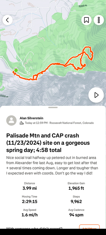
This was my inefficient actual route, much tougher than I expected! Nominal gain to the top of Palisade Mountain was only about 900', but if the app is to be believed, somehow I doubled that. First, the good social trail disappeared in the burn zone, and I found a very difficult way to the top, taking 1:32 for 1.5 mi to get there. Second, it was also tough and apparently disorienting making my way down, north, east, and back south from the summit to the crash site.
A2_HikeStravaMap.png (243 Kb) (under photos/25/0503_PalisadeMtnCAP_CrashSite/)
By Alan Silverstein, ajs@frii.com (page updated Tue Mar 10 18:16:39 MDT 2026)