 CAPTION CAPTION
|  PREVIOUS PREVIOUS |
 INDEX
INDEX
| NEXT (or just click anywhere on image) (or just click anywhere on image) |
| CAPTION
| PREVIOUS |
INDEX
| NEXT (or just click anywhere on image) |
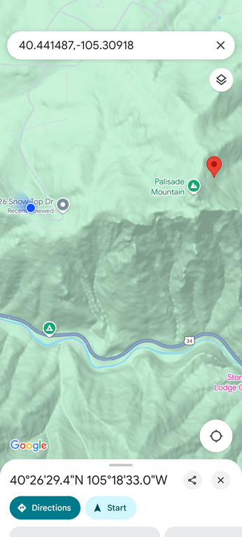
The blue dot is where I parked, and the red pin is the coordinates I had for the wreck site, which turned out to be accurate, and invaluable.
A1_OverviewMap.png (318 Kb) (under photos/25/0503_PalisadeMtnCAP_CrashSite/)
By Alan Silverstein, ajs@frii.com (page updated Tue Mar 10 18:16:39 MDT 2026)