 CAPTION CAPTION
|  PREVIOUS PREVIOUS |
 INDEX
INDEX
| NEXT (or just click anywhere on image) (or just click anywhere on image) |
| CAPTION
| PREVIOUS |
INDEX
| NEXT (or just click anywhere on image) |
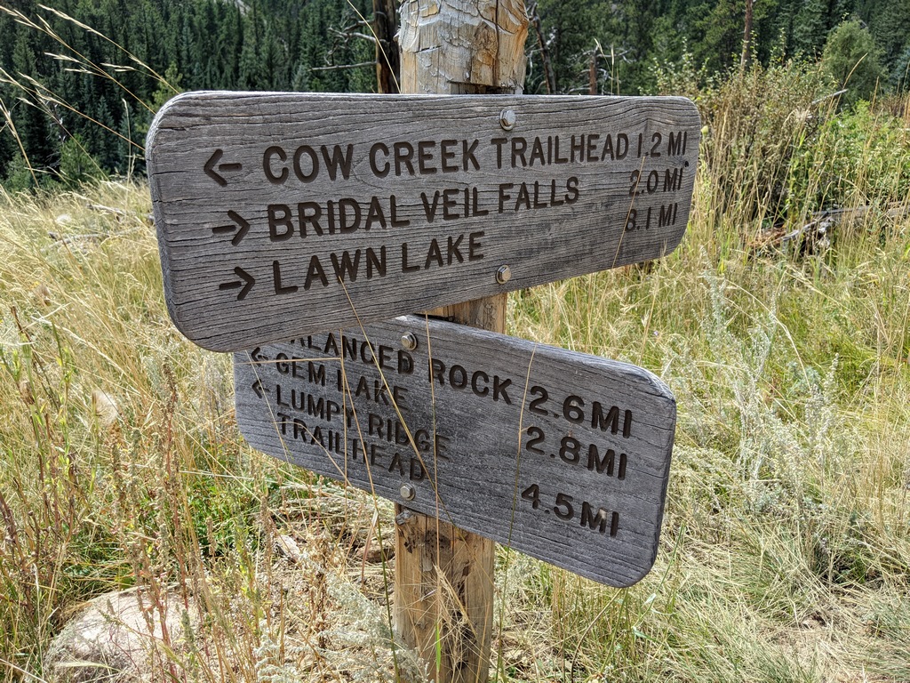
Only about 22 minutes later and nearly a mile east I turned right here, downhill to cross the creek, and climbed (slowly and painfully) up to Gem Lake. In a pinch I could have kept going straight for a much shorter walk downhill to a nearer trailhead, but then ended up several road miles around from my car.
F1_GemLakeJctSign.jpg (499 Kb) (under photos/23/0902_LumpyRidgeLoop/)
By Alan Silverstein, ajs@frii.com (page updated Tue Mar 10 18:16:39 MDT 2026)