 CAPTION CAPTION
|  PREVIOUS PREVIOUS |
 INDEX
INDEX
| NEXT (or just click anywhere on image) (or just click anywhere on image) |
| CAPTION
| PREVIOUS |
INDEX
| NEXT (or just click anywhere on image) |
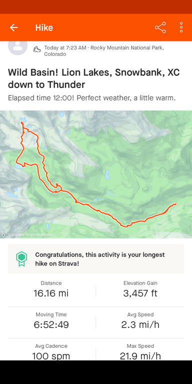
It's subtle, but this shows how I took the shorter, steeper north trail going up, while Don parted from me a while to do the longer route past Calypso Cascades and Ouzel Falls. We both took the shortcut on the way back. At upper left are Lion Lakes #1 and #2, Snowbank, and downhill to the south, Thunder.
A_StravaMap.png (204 Kb) (under photos/23/0820_WildBasinSnowbank/)
By Alan Silverstein, ajs@frii.com (page updated Tue Mar 10 18:16:39 MDT 2026)