 CAPTION CAPTION
|  PREVIOUS PREVIOUS |
 INDEX
INDEX
| NEXT (or just click anywhere on image) (or just click anywhere on image) |
| CAPTION
| PREVIOUS |
INDEX
| NEXT (or just click anywhere on image) |
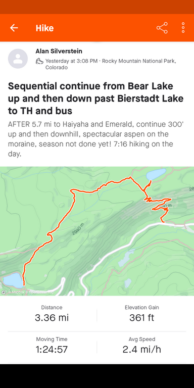
Latter 1/3 of the full 9.1 mi hike. The hillside photos you'll see at the end were of the gorgeous aspen while descending from Bierstadt Lake.
A2_MapSecondPart.png (179 Kb) (under photos/22/1009_RMNP_HaiyahaEtc/)
By Alan Silverstein, ajs@frii.com (page updated Tue Mar 10 18:16:39 MDT 2026)