 CAPTION CAPTION
|  PREVIOUS PREVIOUS |
 INDEX
INDEX
| NEXT (or just click anywhere on image) (or just click anywhere on image) |
| CAPTION
| PREVIOUS |
INDEX
| NEXT (or just click anywhere on image) |
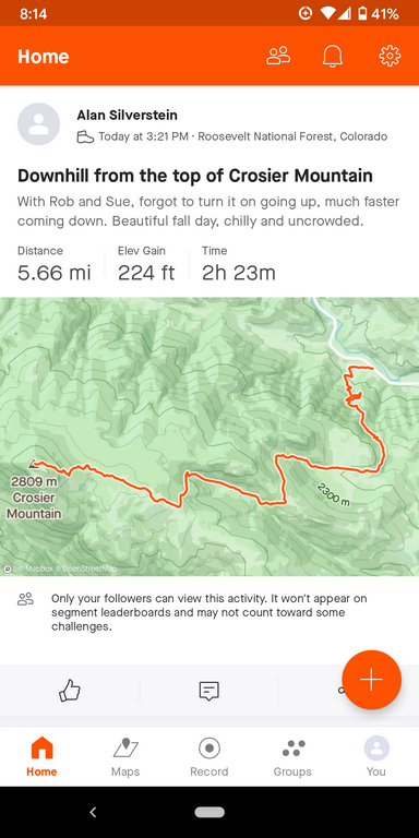
This screenshot from the Strava app gives some idea of the route, although the 5.66 mi seems way too high, it should only be 5.1. Zooming in on the app, I saw lots of unreal jitters that might be GPS errors on the north slopes under the trees.
A_DownhillStrava.png (233 Kb) (under photos/21/1030_CrosierMtn/)
By Alan Silverstein, ajs@frii.com (page updated Tue Mar 10 18:16:39 MDT 2026)