 CAPTION CAPTION
|  PREVIOUS PREVIOUS |
 INDEX
INDEX
| NEXT (or just click anywhere on image) (or just click anywhere on image) |
| CAPTION
| PREVIOUS |
INDEX
| NEXT (or just click anywhere on image) |
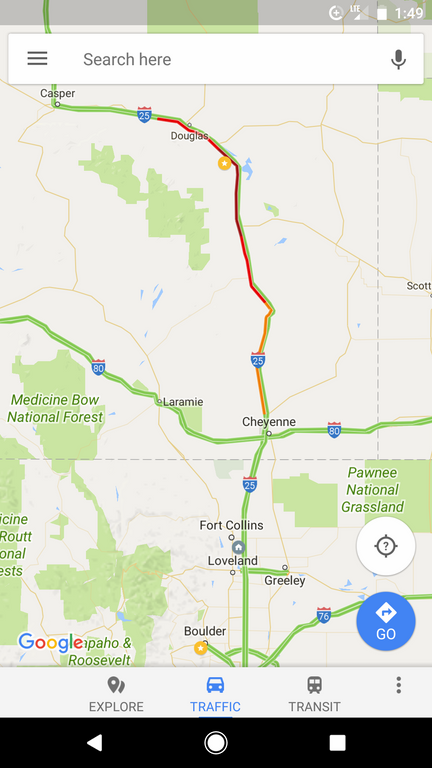
Back at the JK Bar Bible Ranch to unwind and have lunch before leaving, I started watching Google Maps traffic indications -- in horror. The good news was, Verizon cell coverage was solid throughout the day. The bad news was, traffic was seriously backed up both on I-25 and on the "private" frontage road (Wyo 319) running 15 miles (without interchanges) between Orin and Glendo. You can't see that at this zoom level.
Our location was the gold circle near the top, and home was the grey circle southeast of the center of Fort Collins near the bottom.
N_RoadsScreenshot_1349.png (219 Kb) (under photos/17/0703-0825_WyomingVanEclipse/0821A_EclipseDay/)
By Alan Silverstein, ajs@frii.com (page updated Tue Mar 10 18:16:39 MDT 2026)