Neat Hikes at Lake Powell, Utah
By
Alan Silverstein,
ajs@frii.com.
Last update: April 3, 2026
Note: I sold my share of the houseboat in November, 2010, so this
webpage is nearly frozen as of that time. Except for rare occasions
when I get back to Glen Canyon!
CONTENTS
Introduction
Recommended Books
Some Terms Used
Our Invented Names For Some Unnamed Places
Hikes I Have Done
Upstream of Bullfrog
Downstream of Bullfrog
Escalante River
Downstream of
Escalante River
San Juan River
Downstream of
San Juan River
Hikes I Would Like To Do
Rock Spans Worth Listing
Tidbits About Gregory Natural Bridge
INTRODUCTION
This is a personal collection based on explorations from Bullfrog
Marina, which is at about mile marker 95, north to the bridges and
south as far as the bay below Friendship Cove, for one or two
weeks a year starting in August 1989.
I welcome feedback, corrections, suggestions, and additions.
Sorry no more pictures here. But you can look under my
Proposal for New Formal Names in Glen Canyon
page for some images (not good quality).
Reader feedback suggested labeling each hike clearly with "main
attractions" and "type of hike".
I've tried to do that better, although still informally.
Assume all hikes are off-trail unless otherwise noted!
Sorry, you can't search, say, for "petroglyphs", except maybe by using
your brower's search feature.
I just don't have the time to turn this into a better-indexed guidebook.
The larger issue of Lake Powell being a paradise versus the lake
"demolishing the canyon" is a fun discussion, but not the subject of
this document. Suffice it to say that the vast majority of the red rock
country in Glen Canyon National Recreation Area is not underwater, and
much of it is quite remote and fascinating to visit.
Note: In warm weather, bring lots of water and wet your shirt before
you start hiking!
RECOMMENDED BOOKS
"Lake Powell Boating Charts", by the Browns, spiral bound, ~$15
at boat stores; very detailed, accurate, and usable. (I unbound it and
put each page into a plastic looseleaf binder page to protect the maps.
Uh oh, apparently the Browns's boating charts are out of print!) Also,
7.5 minute quadrangles available from the USGS (and at the Bullfrog
visitor center too) are very useful. (Dang, now that's ancient history
too, everything's gone digital.)
In my opinion, the popular Stan Jones fold-up map of the entire lake is
barely usable for navigation, and unusable for hiking (sorry, Stan).
There are probably other maps available nowadays too, but I have no
experience with or opinion about them. I see that Lake Powell Magazine
includes decent maps in every issue...
The elevations used in this document are taken from the Browns' boating
charts except where shown differently on a 7.5 minute topo map.
Stan Jones' "Ramblings By Boat and Boot in Lake
Powell Canyon Country", 1998, 276 pages; long, entertaining, and
full of facts and figures. An excellent read for serious lake
explorers.
The
Wayne's Words website is another
valuable Lake Powell reference.
SOME TERMS USED
Giving directions at Lake Powell is quite challenging. I've found it
most useful to refer to canyon names and channel mile markers, water
flow direction (even in dry gulches), and in some cases estimated
distances from well-known landmarks.
| downstream |
the direction water would flow if there was no lake, or if a
dry streambed had water running in it |
| upstream | opposite of downstream |
| river-left | to the left when facing downstream (in
any drainage, not necessarily a main river, could be a
side-canyon) |
| river-right | to the right when facing downstream |
| left finger | to the left when facing upstream |
| left fork | to the left when facing upstream |
| right finger | to the right when facing upstream |
| right fork | to the right when facing upstream |
| main channel |
of the Colorado River, Escalante, or San Juan; or more
generally, the more-major drainage into which any stream or
canyon empties |
| mile marker |
refers to original main channel mile numbers shown on maps or
floating green or red buoys |
| full-pool |
where the water ends when the lake is full, at 3700' elevation;
often but not always a good reference point even when the lake
is way down |
| mi | miles |
| GPS direct |
The direct distance ("as the crow flies") between two points, as
indicated by a hand-held GPS unit, as one way to indicate
distance. GPS waypoints datum (latitude/longitude coordinates)
for locations given here is WGS-84 unless otherwise noted. I
used dd.ddd format because that's simplest to cut/paste, say,
into
Google Maps or a GPS
unit. Conversion to "dd hh mm" format is tedious, but for starters,
this
website can help.
Honorable mention: Lake Powell, Colorado (southeast
shoreline): 40.25444,-105.65907.
|
| 980803 |
these are dates, expressed for brevity in the form: YYMMDD
(year, month, day) |
| exit |
Occasionally used here in the usual sense, but worth mentioning
in the odder sense, "Life is like a maze where we all go around and
around trying not to find an exit". There are many "exits" in Glen
Canyon, so keep your wits about you in steep terrain, and make a
conscious note of dangerous "exits" (as opposed to benign "up and
out" routes, as I often call them). |
Note:
-
I used to have a lot more abbreviations that were all hyperlinks
back to the table above, but I decided they were too terse and too much
clutter, and expanded them so the text is easier to read.
-
It's been suggested that a "real guidebook" would be more generic and
include less personal trivia, such as the date when I visited a place.
Oh well, I guess this isn't a real guidebook! But it's debatable, I've
read a lot of real guidebooks where I wished the author had been less
formal and, in particular, given me some clue of the year, or time of
year, where he/she visited a location. So I hope you don't mind.
OUR INVENTED NAMES FOR SOME UNNAMED PLACES
Many of these names were formally proposed to the USGS (US Geological
Survey) BGN (Board on Geographic Names) via
webpage in January 2004. Seven names
were approved (marked "A" below) and 10 rejected ("R") on May 12, 2005.
Note: Geographic convention is to not use apostrophes in placenames.
|
Alans Alley |
|
Steep crack climb leading to hidden cliff (no exit), 0.4 mi up
river-left from full-pool in unnamed finger river-right off
San Juan downstream of Alcove Canyon, east of
4369' point. "Honorable mention" but not worth reclimbing.
|
|
Alans Petrified Forest |
|
Upstream arm of Rincon, river-left in arm (Rincon
side), in cove near end at full-pool, in Chinle Formation (gray
clay); also much wood in other Chinle across main channel from
Rincon, and on Navajo land south of Piute
Bay. |
|
Bedroom |
|
Sand and debris slopes below cliffs with flat area high above,
Fifty Mile Canyon, Escalante, river-right ~1 mi
upstream in Fifty Mile Canyon, just below the narrows
(exposed below ~3600'). |
|
Bell Tower Window |
A |
Awesome arch high above, in the top of a pinnacle, in
"Twin Edens Canyon", invisible from the
lake except perhaps at full-pool. (37.265361,-110.851222)
|
|
Boulder in the Sky |
R |
Next high point north of
"Camera Butte" on Waterpocket
Fold, 5200'+; scrambling access up gully from south side to
a huge boulder perched on an airy ridge. |
|
Camera Butte |
R |
Highest small mesa, 5102', south end of Waterpocket Fold
above
The Slope, 1400' above lake, top accessible
from north end. |
|
Chinle Cathedral |
R |
Impressive canyon in Chinle formation mudstone a short walk from
full-pool in left fork of
Popcorn Canyon. |
|
Clock Rock |
|
Bizarre pinnacle at downstream end of Cha Bay,
river-left, San Juan; survivor of massive landslide of
narrow ridge. Major unnamed landmark. (The above name is not
what we actually call it, but it's close, we don't want to
offend the squeamish.) |
|
Daves Lost Anchor Canyon |
|
Small canyon with a major fork, river-left off the main channel
~2 miles upstream of the Escalante mouth, named for
the time Dave lost a small boat anchor in the left fork (and we
found no trace of it a few years later when the lake was
down). |
|
Double Echo Canyon |
|
Small dry finger off river-right of
"Not Annies Canyon" on hike up
and out; shady alcove and nice echoes at rear, but nothing
special as Lake Powell goes. |
|
Dougs Cathedral |
|
Huge amphitheater with "altar" stone and awesome echoes, end of
right main fork (third right finger) of Iceberg Canyon,
~0:10 hike/bushwhack in from full-pool; 900' below surrounding
plateau, and only 2.7 mi direct from nearest water in San
Juan! |
|
Dougs Sound Cave |
|
Huge cave river-left in
"Dougs Finger" near end; smaller cave
(still huge) across (river-right) (37.328806,-110.903250). |
|
Dougs Finger |
|
Escalante, two huge caves ~0.5 mi in near end, river-left
3.5 mi up from main channel just downstream of Davis
Gulch, across Escalante; first told to me by Doug
Baskins; with gorgeous hanging gardens at end. |
|
Eureka Canyon |
|
Off main channel, a narrow canyon hidden just downstream around
the corner river-left of the Escalante mouth; the next
major canyon upstream of
"Walking Rock Canyon". |
|
Garys Rock |
|
Island just below water level at 3687', where Gary Karnik lost a
prop and gashed his boat 9810, southwest end of Bullfrog
Bay just NE of the shallow shoal between Halls and
Bullfrog Bays. |
|
Golden Arches |
R |
Double arch (formally known as Hi-Lo Arch in register but
not on maps) just upstream of Cottonwood Canyon mouth,
river-left (same side); hard to see from main channel, short but
tricky slickrock hike from upstream of Register Rocks; no
mooring, ski boat dropoff. |
|
Heart Cave |
|
Heart-shaped double glen above (behind)
"Moriahs Arch". |
|
ICEFRF |
|
Iceberg Canyon first right finger, a convenient shorthand
name for it, based on a GPS waypoint. |
|
ICESRF |
|
Iceberg Canyon second right finger, a convenient
shorthand name for it, based on a GPS waypoint (37.276500
-110.691028). ICESRF has two smaller side-forks,
ICESRL and
ICESRR. |
|
ICESRL |
|
Iceberg Canyon second right finger, left fork, a
convenient shorthand name for it, based on a GPS
waypoint. |
|
ICESRR |
|
Iceberg Canyon second right finger, right fork, a
convenient shorthand name for it, based on a GPS
waypoint. |
| Island Cave |
|
Huge cave on river-right in Willow Creek Canyon
(Escalante) ~0.5 mi upstream from the Bishops
Creek fork, with an unusual hill of detritus inside; at
full-pool the water goes all the way around the island through
the back of the cave. A smaller but still impressive cave is on
river-left a short distance upstream (in sight). |
|
Lost Sail Cove |
|
San Juan, next big canyon upstream Piute Canyon,
south side (river-left), where Bob Jenk lost a sailboard sail
("I thought they floated!") |
|
Middle Rib Canyon |
|
Unnamed canyon between
"Walking Rock Canyon" and
"Twin Edens Canyon", with a center
rib (slickrock slope) that gives access up and out to the
terrain above. |
|
Moriahs Arch |
R |
(37.292417,-110.864806) A wall arch, top level with flats
behind, separated by a narrow crack, similar to the Eye Arch but smaller; below full-pool
(top ~3657'), main channel river-right ~0.5 mi upstream of the
mouth of the Escalante. A short walk (0:06) from a sandy
beach campsite (usually taken) further downstream. |
|
Monotithe |
|
Long north-south slickrock-sided mesa southeast of Bullfrog
Marina, west of Stanton Canyon; name based on view
from due south. Side view visible from high points miles away;
a major landmark. (The above name is not what we actually call
it, but it's close, we don't want to offend the
squeamish.) |
|
Not Annies Canyon |
R |
River-right northwest of mile marker 80; downstream from
Annies Canyon on the same side, but it's "not Annies".
Surprise, it's hikable out of back up Waterpocket Fold,
past
"Double Echo Canyon". |
|
Not Cha Canyon |
R |
Major unnamed cove river-left between Cha and Nasja
Canyons in San Juan. Mike Berry thought it was
Cha once and we hiked up and out to nearby Navajo cliffs,
but it was "not Cha". |
| Popcorn Beach |
|
(37.674722,-110.458778) At back (east) end of
Popcorn Canyon,
slightly up the right fork, from full-pool down, a small area of
popcorn-like concretions in red Chinle mudstone, most containing
white calcite that fluoresces brightly, some hollow. |
|
Popcorn Canyon |
A |
East-west canyon off Good Hope Bay, across from
Ticaboo Canyon, named for
Popcorn Beach. |
|
Sallys Cove |
|
Nice slickrock site across from Lost Eden Canyon, main
channel river-left downstream, just around the corner from
Halls Marina (marina is 37.465722,-110.715583). |
|
Sallys Pocket |
|
Beach and boulders at rockfall ("natural dam" on some maps) a
short way upstream,
second right finger of Iceberg
Canyon; rockfall and beach mostly under water at
full-pool. |
|
Sandy Beach |
|
Main channel, cove river-right of mile marker 59 ~1 mi upstream
of the San Juan mouth, with a long, steep slickrock hike
up to overlook cliffs; starts upstream of beach.
Years ago this big beach was "sandy", hence the name, but it's
gotten pretty overgrown. |
|
The Slope |
A |
Impressive base of Waterpocket Fold across from
Iceberg Canyon, river-right, mile marker 78; mind-blowing
scale and smoothness; 1500' total rise; calcite crystals
abound. |
|
Twin Edens Canyon |
R |
Short cliff-walled canyon near mile marker 66B, main channel
river-left next upstream from Ribbon Canyon, and second
downstream from
"Walking Rock Canyon". |
|
Walking Rock Canyon |
R |
River-left ~1 mi downstream from mile marker 68. Contained an
amazing "walking rock" high on a shelf below a cliff
(37.277111,-110.850278). |
In addition, the BGN accepted these proposed names:
Cha Bay,
Piute Bay,
Flying Eagle Cove,
Twilight Arch.
The BGN rejected
"Peekaboo Arches".
HIKES I HAVE DONE
In each section hikes are listed more or less north-to-south (upstream
to downstream).
Those hikes of special interest to first-time visitors are marked "!",
but that doesn't mean they're easy or convenient; use your judgement.
UPSTREAM OF BULLFROG
Dirty Devil River bridge: 37.915917,-110.388167 (north of Hite)
Narrow Canyon bridge: 37.891000,-110.369972 (northeast of Hite)
Hite Marina: 37.865639,-110.397333 (just south of boat ramp)
- Uranium mine and Chinle formation above main channel, river-right,
~1 mi upstream of Trachyte Canyon; watch for an old road
along shore; some petrified wood and carnotite? (Yellow-saturated
sandstone.) (Scrambling on boulders.)
- Farley Canyon traversal to White Canyon (eh). Follow
a road around from the end of one canyon to the end of the other.
Impressive acreage covered by wind-blown driftwood in White
Canyon.
- Trachyte Canyon: First right finger, back to end of deep V,
across large logjam below full-pool mark, then up through Chinle
formation and huge boulders (easy scrambling and huge boulder caves)
through cliff wall, to wide, flat upper valley floor. Upper valley
very tempting, with cairns, to probable high point 1-2 mi distant
overlooking Hite; but I was short on time to explore further.
- Good Hope Bay: Castle Butte south side north from
bay; high, steep, can't reach 4527' top. (Steep scrambling,
increasingly exposed.)
0809: Found a relatively easy route up the southwest face (look for
ridges and then a brown bouldery slope) to a huge vertical crack
between summit boulders. Counter-clockwise from here a few hundred
feet, down a little and back up, scrambled to the summit ridge
perhaps 50' below the high point! Awesome views.
- Ticaboo Canyon off Good Hope Bay: Relatively easy and
pretty walk up a wide canyon with steep walls, water, and
cottonwoods. Only had time to go 0.5 mi GPS direct, a bit past the
first left fork above full-pool. Also climbed up slickrock to cliff
wall on river-left at about full-pool to look out to south.
Later, climbed steep loose recent rockfall downstream from
steep-walled cove river-left near mouth to bouldery top of pinnacle
standing out from main (impassable) cliff wall and whitish slump
zones; neat summit, through crack and around to top, great view.
0809: Went about 3 miles up the main left fork of Ticaboo in 2.5
hours one way; a long, relatively easy, pleasant outing with
frequent nice views north to the southern Henry Mountain
peaks. Near the end of the hike, caught an easier trail up on
the "bottom" (flats) to the right (river left) for a long ways.
- Good Hope Bay:
"Chinle Cathedral", petrified
wood, slot canyons, and mudstone tunnel, all ~30 min one way from
full-pool, in left fork of
Popcorn Canyon, between 4378' and 4670'
high points; no exit (cliffs) at back? (Both gullies end in
cliffs.) (Easy walking past Cathedral, then rough scrambling on
boulders.)
- Good Hope Bay:
Popcorn Canyon, right fork,
interesting hiking, petrified wood, and springs/pools above
(river-right of) right fork; also hiked up to base of cliffs on
south side of this finger near mouth (latter includes some
scrambling).
- Good Hope Bay: Unexpected and wonderful up-and-out
climb/hike from a steep talus slope on north side of southeast bay
(strictly speaking, unnamed next bay south of what most maps call
"Good Hope"), ~0.5 mi east of main channel. Scramble up from
~37.66062, -110.47995 on slope between cliffs to left fork at top,
then up rectangular gully a bit to narrow slot (defile) leading up
to the right near the top of the gully. Follow through to a second
defile to access upper regions below main plateau. Note/mark your
return point well here! Continue north up through last complex
cliff wall, many choices, to main plateau. Sand-slog ~2 mi north to
high point (4670') and overlook Popcorn Canyon,
"Chinle Cathedral", and surrounding
canyons. Several large cairns found along this route during a fast
3-hour round trip one evening (000926). (Steep scrambling,
route-finding.)
- Near Seven Mile Canyon, cove northeast, main channel
river-left just downstream mile marker 114, to 4294' high point
south-southeast from cove; challenging.
- Warm Springs Canyon: Cool slickrock area, main channel
river-right just upstream of Warm Springs. Various coves and
gullies; the most-upstream one offers relatively easy access to the
steep slickrock walk to the pink Entrada layer, then the very top of
the Ticaboo Mesa above that. From there it was over a mile
but not hard (just hot) to walk down to look into Warm
Springs. Invisible from the lake is a deep, unreachable slot
canyon above the pouroff; had to walk downstream a little to see
over into the canyon. (Absolutely no shade in this area mid-day,
even in September.)
- (!) Tapestry Wall, 4312' high point (37.600972,-110.606417)
above cliff, ~1 hour one way, 650' up slickrock from downstream end
of wall, small cove off main channel river-right; several huge pools
(dry) in gully directly up from starting point. Ruins of survey
tripod on top; excellent views down to lake and north to Henry
Mountains. (Done three times). (Steep slickrock, otherwise
cross-terrain walking.)
0511: It appears impossible to access this hike when the lake is
down more than about 50'! Or at least you must start much further
downstream.
0809: Yup, we found the next main cove downstream, barely moorable
at around 3628', 1.5 mi GPS direct from the top. Cairns led across
the slickrock northerly to a route through the cliffy pink Entrada
layers to the top of the Ticaboo Mesa 0.6 mi south of the
high point. Watch/cairn/GPS well to find the down-point easily on
your return.
- (!) Smith Fork slot canyon: A relatively easy walk 30-40
min when the lake is 3628', from the very end of the water. Along
the way look right for a short, steep-walled, sandy-floored side
canyon ending in a nice grotto and pool. The main slots are perhaps
1/2 mi further upstream, after the trail winds through a bushwhack
(or look for another trail to the right up the hill). The canyon
narrows, and there you are. The slots go on for a long way, varying
between a sandy and bouldery floor.
- (!) Smith Fork mouth exit: At the downstream side of the
mouth of Smith Fork there's a huge sandstone "ramp" (ridge) that
leads up-and-out, but requires boat drop-off and pick-up or else (as
we did) mooring nearby and kayaking over. Exposure is not bad
although there are a couple of mildly steep sections. This ramp
gives access to a "bouncy" stroll downstream along the top of the
cliff, past a giant balanced boulder, to look north down to a huge
cove and back to the starting point. Also just uphill a bit farther
is a promontory of the Ticaboo Mesa, 4042' (a little lower
here than a few miles north at the Tapestry Wall). This is above a
pink layer of Entrada sandstone; easiest to access on the right
(north) end of the layer. (Repeated 1608, just 1 hour round-trip.)
- (!) Forgotten Canyon, Defiance House ruins, just
near/past end at full-pool, river-right; short from full-pool.
(Done four times). (Easy although steep up trail from full-pool.)
- Hansen Creek Canyon, various strolls northeast from north
(river-left) side. (Easy hill walking.)
- Crystal Springs Canyon, up ridge from amphitheater near very
end, river-left; can't get out of canyon (cliffs above). (Steep
slickrock.)
0907: Revisited, can't even find the ridge we climbed!
- (!) Moki Canyon (mouth: 37.483472,-110.641722), sand dunes
and ruins, right finger near end, river-left; ascend dune through
cliffs to "flats" and view of road (Utah 276) above
(37.463444,-110.577750), and the Cal Black airport
(37.44265,-110.56185) in the distance. (Done twice.) (Steep sand,
then a little scrambling and steep shelves.)
Also ruins (three granaries?) ~45 min upstream from full-pool on
river-right. Also ruins and pretty cove and garden a bit up left
finger (North Gulch). (Canyon mouth: 37.483889,-110.641056)
0007: Dave Boyd said: "We also stayed one night in the right
finger... I tried hiking there, which required a boat dropoff.
After a quarter mile or so of tough going through soft sand, aquatic
grasses, scrub oak, and grapevines, I gave up. I'd call that area
'not hikable.'"
1608: Kayaked up to the end at 3617', just west of the main fork,
and hiked 23 minutes quickly up to get in sight of the massive sand
dune. It was mostly easy walking on sand or somewhat slippery mud,
and later some pretty purple Kayenta base rock. It appears that
years of low lake levels flushed most of the silt and vegetation.
- Moki Canyon, slickrock near mouth, up and out to overlook
points, relatively short but steep, starting from mooring point
river-right just a couple of hundred yards upstream of the mouth and
marker.
- (!) Unnamed canyon river-right downstream of Moki at about
mile marker 96: Easy hike 0.98 GPS direct east in about 0:45 from
3601' up to 4031' high point, a flat-topped remnant mesa on a huge
"penninsula" (lake visible on three sides). View southeast straight
up Moki Canyon mouth, southwest to Halls Crossing and
Navajo Mountain, north to Henry Mountains. (Steep and
some scrambling through initial slickrock cliffs, then easier
cross-country walking.)
Just east of this highest point is a prominent "cone-shaped hill"
(4002') with an even more spectacular view (even though it's a bit
lower) of the lake wrapping around nearly 330 degrees of panorama.
It's < 30 min from the lake (at 3647') from mooring in a cove
south of the cone, 0.9 - 1.0 mi direct from the Moki Canyon
marker.
- Bullfrog area:
"Monotithe" ridge southeast of
Bullfrog, ~4100'; fun, scenic; between Bullfrog Bay
and Stanton Canyon; attain summit through cliffs from
northwest side or from north ridge (from Stanton Canyon road,
above caves); thick river cobble caprock. (Done twice).
0109: Moored west of north end of
"Monotithe" in muddy cove; it looked close,
but it wasn't! We just got to the base in 0:15; too steep to climb
northwest side, and too far to the north ridge before sunset.
"Hobie Cat Bay" houseboat launch area: 37.509194,-110.728444.
- Bullfrog area: Nice slickrock walking, say, up for sunset,
~1 mile north of the marina area.
- Bullfrog Bay west side: Various nice slickrock hikes on pink
Entrada sandstone, both north and south sides of Smith Pass
between Bullfrog and Halls Creek Bays. South side might have no
good mooring (I pulled a kayak up on slickrock), but excellent
views, especially near sunset, from northernmost cobble-topped point
south of the pass (37.50821,-110.75518).
"Bullfrog South" campground: 37.572194,-110.756528 (closed
when lake is down).
Bullfrog Marina boat ramp (top): 37.516333,-110.729472.
Halls Crossing boat ramp (at low water): 37.46787,-110.71693.
DOWNSTREAM OF BULLFROG
- (!) Halls Creek Bay Bridge: 37.49322,-110.80833, west side
of the bay; see also
Natural Arches in
GCNRA. A very nice, small, solid, mature bridge you can view
from the bowl below, cross over from either direction, or get behind
(upstream) and below. Too bad about the dozens of graffiti
scratchings under the south buttress going back to 1976.
GPS helped us find this bridge, especially since we moored 1.8 miles
southeast (the bay was crowded) and hiked "across the grain" of the
gullies to reach it. The main drainage below the bridge ends in a
long finger of water at the lake, the closest point, but if you hike
up this gully, there's a dryfall (with a big cottonwood tree below
it); you must exit to the right and get out below that point.
- Halls Bay to top of Waterpocket Fold (at
37.46009,-110.82560 and ~5280'), 3.55 direct miles from the nearest
hikeable starting point (at 3617'). This was a monster, epic hike
in 95 degree heat, nearly 12 hours and about 10.5 miles round trip,
starting by searching for the Halls Creek Bay south bridge, then
continuing west and up until deep ravines made progress impossible,
then north and northwest up a prominent valley and higher slopes
west to attain the crest. Awesome views easterly, not so much in
any other direction. Upper reaches of slickrock full of hidden
cliffs.
- (!) Halls Bay: Mesa on island (at full-pool), 3825' high
point, between Halls and Bullfrog Bays, southwest end
of Bullfrog Bay just upstream of shortcut/island (at 3687'+),
northwest of
"Garys Rock"; hike west and north from
southeast of high point; fun, short hike up slickrock gully to lots
of river cobble and nice views of area.
- Halls Bay: Island (at full-pool), south end between
Halls and Bullfrog Bays, southwest end of Bullfrog
Bay, southwest end of Bullfrog Bay, southwest of
"Garys Rock"; nice short walk on sand and
gravel around top of large, relatively flat island. (A little steep
at times to the top, but lots of route choices.)
- (!)
"Sallys Cove": 3967' high point above
cliffs east of cove, river-left at mile marker 92A; excellent
surreal night view of marinas by full moon.
- (!) Lost Eden Canyon, short slot canyon in the leftmost
fork, best around 3640' lake elevation; need small boat to start the
brief exploration.
- Miner's steps (37.40821,-110.72935): Downstream of Lake
Canyon, main channel river-right around the corner just before
cliff wall starts, covered at full-pool, easiest to spot even or
downstream of them. They go up over the top, didn't explore very
far. (Can be hard to get off/on boat depending on water level,
otherwise easy walking.)
- Downstream Lake Canyon: 4152' high point east-southeast of
unnamed cove river-left at mile marker 86A around left turn
downstream from Lake Canyon stretch, upstream from Annies
Canyon; short hike up, nice views; many pools of water after
recent rains. (Slickrock walk.)
- Dinosaur tracks across from Annies Canyon:
Little or no hiking involved, depending on water level; underwater
at times. Look for small, like 2" across (therapod?), three-toed
tracks on flat white limestone (sandwiched between red sandstone
layers) on the downstream side edge of a flat area across from the
canyon, the one with a blobby central pillar.
I thought the tracks were only in a few rocks all within maybe 10',
but later we found some larger ones (sauropod?) nearby, and several
hundred feet away too, in the same layer.
- Arches across from Annies Canyon: Two of three small spans
are barely visible from the lake at the best viewing and sun angles.
(Thanks to David Herberg for finding and sharing them.) Can hike
all three in < 2 mi, 2-3 hours, starting from ski boat mooring
around 37.3832,-110.7290 (~0.45 miles SE of the abovementioned
dinosaur tracks). North to south, as nicknamed for discoverers:
"Elisas Arch" (37.38933,-110.73244, big pothole with small rear
crack opening), "Michelles Arch" (37.38552,-110.73082, small
boulder span on cliff edge), "Davids Arch" (37.38589,-110.72453,
overhead opening reminiscent of the Eye Arch).
- Annies Canyon: As described
elsewhere, you can hike up/down the second
left finger of Annies, at least when the lake is 3600' or higher.
Dunno where the main (middle) drainage eventually leads, but "up a
ways" there's a gully up to the left with a trail that goes over a
high point and down into the next drainage. From this "four-way
intersection", probably formed by a fault line crossing the
drainages, you can go down the drainage about 1/2 mile to a wide
slot canyon, narrowing slickrock with pools, and eventually the
upper side of impassable(?) slots.
Up the drainage leads all the (long) way to the crest of the
Waterpocket Fold north of the
"Boulder in the Sky". Straight
across might lead to "Not Annies
Canyon".
A difficult scramble out from the middle finger above the four way
junction are remains of an old jeep road!
(37.37249,-110.77089)
- (!)
Elephant Arch
(37.377528,-110.732889), river-right, main channel downstream
Annies Canyon a short distance; doable from a bit downstream
around corner up flooded gully, with skiboat dropoff, at least at
3687'+; very brief hike up slickrock gully (~0:15). Can get both
above and below arch, latter a bit exposed to reach (friction around
corner), but a gorgeous view from there. Looks like elephant's head
from downstream looking upstream. Look for cairn ("pimple") on
elephant's head. (Steep slickrock at points, some up/down,
routefinding, mild exposure if you go below the arch.)
021128: Can also reach it, a much longer hike, from further
downstream, crossing the top of a flooded gully.
- "Alice J Cove": Up narrow gully to upper "flats" from left
rear of small finger with nice
"Alice J Arch" (covered at
full-pool, named by Stan Jones for his wife, who "discovered" it),
main channel river-left at mile marker 83 (between Annies and
Slick Rock Canyons). About 0:30 brisk climb and bushwhack
(miserable in some ways, only for masochists) out of the gully (from
full-pool), and later went another 40 minutes northeast to an
isolated 4461' high point with an excellent view and a 1959 USGS
survey marker west of the summit. (Steep scrambling, some exposure,
in the gully; route-finding up above on the return.)
090714: Scrambled up again, this time west to overlook the lake and
the arch -- a very pretty view.
170929: Another visit, surprised how long and tough it was, but then
I'm getting older (grin).
- Across from "Alice J" to overlook Annies Canyon:
"Alice J Arch" apparently sits in a cove formed by a fault that
continues across the lake, visible as a deep V on river right. From
the back of this cove at 3629', was possible to scramble up to
slickrock, exit higher at exactly one steep passage (a bit of
pucker factor on descent), and reach the main-channel/Annies saddle
in under half an hour. However, had to continue another 15 minutes
north, down and back up, to a narrow slickrock fin with an overlook
to the main junction in Annies. Might be possible to continue
down/up to Annies itself, not sure.
- (!) Slick Rock Canyon, unnamed Anasazi ruins, roof still
included, just southwest of 4310' point; not the fenced ruins, but
further upstream high above river-right just at end at full-pool;
0:15 one way from full-pool; last 20' to ruins requires steep
slickrock scrambling (done many times).
021128: These ruins are now fenced off, and a new interpretive sign
names this the Mistake Alcove for no given reason. (But web
searching implies the name was given by a researcher around the
1960s.)
170925: Nothing has changed. Difficult hike/bushwhack from 3629'
on the south side of the canyon, but found a much better trail on
the north side going out.
- (!) Slick Rock Canyon, ~2 mi (1 hr+) east from full-pool up
main canyon past two south side branches to lovely pool and ~150'
waterfall at end, via decent trail on north side; some scrambling
and bushwhacking near end. Intense fire 980623 burned from
full-pool through most of canyon, leaving stark beauty in 9807 --
black skeletons of cottonwoods, huge holes from burned out
cottonwood stumps, "ghost tree" ash piles, etc.
- Peninsula across from Slick Rock Canyon is an interesting
place to tour around for a while if you happen to be moored there,
and the water is low enough to connect the "islands". Nice views
from both ends of the peninsula (towards Slick Rock, and high below
cliffs away from it). Also a record density of prop and keg strike
marks on the high domes at the west end, "fossil propasaurus"
evidence.
-
"Not Annies Canyon" up-and-out at
rear onto Waterpocket Fold; "thread the needle" through
cliffs starting river-right in cove near rear;
pass
"Double Echo Canyon" enroute. (Done
twice). (Easy hiking with a short bit of scrambling.)
- Unnamed canyon upstream from The Slope, same side: A small
finger with high walls, upstream of the canyon upstream of the 4172'
high point (below). Impassible dryfall a short distance from the
lake (at 3640'), which is reached by the lake at full pool, but an
interesting stroll if moored in this canyon.
- (!) The Slope bump/knob ("Gertrude"): 4172'
high point on remnant Navajo sandstone tower at base of
Waterpocket Fold across from New Spall, somewhat
upstream of Iceberg Canyon. Challenging scramble from rear
(away from lake) -- steep, loose, exposed. Easier route up the east
side from the south; 30 minutes from lake at 3636'. Look for a
narrow gully, last west before cliffs, up from the south "across"
the face of the knob (about five zigzags) to get access to higher
terrain (below a series of shallow caves). Superb views from the
several summits.
- (!)
Waterpocket Fold (the
"The Slope Hike"); long, 1400' gain (or more;
start from coves in bottom of
The Slope; across from Iceberg Canyon,
or from back of finger just upstream of 4172' point at base of
The Slope;
access to
"Camera Butte", 5102' (topo map, not on
boating chart) from north side (easy)
and
"Boulder in the Sky", 5200'+
(37.345500,-110.791639), from south side (tough); slept on top of
"Camera Butte" once. Also worth going
south to overlook enormous cliff (37.334833,-110.796028) and great
view of Rincon. (Done many times.) (Basically steep uphill
walking with some route-finding, many routes. Can walk around the
west side of "Camera Butte" too.)
0108: Started from northeast of 4172' high point, just at the
"edge" of the The Slope; one hour across red gullies
including a natural bridge to a big broken-rock gully halfway up the
The Slope at north end, and up through this and over and back
down somewhat and then up again, through Navajo sandstone terrain,
and visited 5300' (?) high point (37.356722,-110.794778) 0.8 mi GPS
direct north of
"Boulder in the Sky" for the second
time. Incredible view from Bullfrog Bay to Rincon and
beyond to San Juan and Navajo Mountain; down in 1:30
around
"Boulder in the Sky".
(More scrambling and slickrock route-finding on this trip.)
070811: A quick (1:35), casual jaunt up to the
"Boulder in the Sky" got interesting
when we decided to try connecting to
"Not Annies Canyon" on the descent --
without a map! Half an hour off the Boulder and around to the west
and north, we were on the crest of the Waterpocket Fold
again. We followed the "obvious" main drainage down east as it
curved gently north. Unfortunately, this route led through a lot
more lovely scenery than expected to a narrowing canyon, deep pools,
and then an impassible slot, which is the leftmost finger of
Annies Canyon! We had to backtrack about half a mile to a
"four-way intersection", where we found a well-beaten trail up
(north), over, and down into another valley, eventually leading to
the second-left finger of Annies, about 1:25 more hiking back
from the slots. Later viewing the map, I see you could probably save
a couple of miles and reach
"Not Annies" more directly if you
just know where to turn.
- (!) Iceberg Canyon:
"Dougs Cathedral", 0:10
hike/bushwhack at 3687'+; at end of right fork (beyond several right
fingers), southeast of 4621' point; relatively flat, brushy hike in
to an incredible amphitheater, ~900' below surrounding plateau.
(Done many times.) Can also view it from high above either flank by
climbing up steep walls (37.284194,-110.733333 1127 meters for
Heavens Above).
031128: Took over an hour one way from end of lake near fork, at
lake level 3601', about 1.0 mi GPS direct.
040518: Lake at 3585', 1.1 mi GPS direct.
- Iceberg Canyon left fork (at the back, not the first two left
fingers): Notably tough bushwhack to a nice but unspectacular end
(by GCNRA standards). (Did not explore left fork of the left
finger.) Nice shade on south side at about high water mark, then
the fun starts: Knee-deep gullies, frequent puddles (in a wet
year), and pushing through rushes/willows well over your head like a
tunnel. At the end, a small pretty pool, steep slick walls, high
pour-off above, but nothing like
Dougs Cathedral up the right fork, or
the incredible amphitheater and sheer 700' drop at the end of the
second right finger main fork. There are places just as lovely and
much easier to reach than the end of the left fork. Also there was
a lot of poison ivy in the homestretch.
- (!) ICESRF:
Iceberg second right finger, 0.77 miles
GPS direct, ~0:45 one way from brushy end at full-pool up and down
on decent braided trails to huge sandy flat, gardens, and pool;
probably the biggest amphitheater at the lake, bigger than even
"Dougs Cathedral", with a comparable
600-700' drop from the rim. You can also
overlook this spot. Awesome cave on
river-left along the way, not very big by Powell standards, but the
greatest depth-to-height ratio I've seen at the lake. (Obstacle to
getting here: Below full-pool, natural dam forms a lake up the
finger, you'd have to drag a kayak over or something. Do it at
full-pool, or else much lower, when it's a much longer hike.)
- Iceberg Canyon mouth: Nice, relatively short hike on the
south end of the geologic continuation of the
The Slope, river-left in Iceberg near
the mouth, in sight of the marker. Where the slope meets the lake
below cliffs, walk up downstream (relative to Iceberg) to
overlook the main channel and continue around for a view of
Aleson Arch across Flying Eagle
Cove. (Easy uphill walking, many routes.)
- Aleson Arch (previously called
"Flying Eagle Arch", also called "Kissing Elephants", but the arch
was formally named in October 1988 for the river guide, Harry
Aleson, who carried the discoverer down the river), southeast of
4541' high point, direct or loop from Rincon upstream arm or
from Flying Eagle Cove; at least 1 hour each way. Visible
from lake if you know where to look, on Navajo bump downstream of
Iceberg Canyon and Flying Eagle Cove, upstream of
Rincon upstream arm; study map. Access from Flying Eagle
Cove up to right of arch through cliffs (neat boulder caves
here) and then left on top. (Done several times, met David Muench
and his daughter here once!)
Note, getting directly behind the arch requires scrambling ~10' up a
wall boulder, and frictioning ~25' down the back side.
If time permits, also hike 1/3 mile further NNW up from the arch to
a fine overlook point on the southeast "corner" of the Rincon
(37.31487,-110.77942).
Can also hike from sand dune in Rincon upstream arm back
through Kayenta/Wingate cliffs and around. Excellent views but
non-trivial hiking. (Steep, exposed exit from Flying Eagle
Cove unless you take the "ramp" left to below the cliff, then
right, or tricky route-finding up apparently impassible but actually
easy cliffs from Rincon side, see below.)
- Rincon: Up steep terrain out of Rincon, east side
(river-right) of upstream arm, from top of huge sand dune (yes you
can get through the Kayenta/Wingate cliffs from there) to overlook
Iceberg Canyon
first right finger (37.312639,-110.757611) and
reach 4288' point (tricky route, challenging, but < 2 hours one
way). This is also one route (a longer way) to
Aleson Arch. (Done at least twice).
(High water mark in the upstream arm is 37.303333,-110.779694.)
- Rincon: Around the Rincon, either direction, along
the floor of the old oxbow; long and sandy. River used to flow
around it, but now the high point is at the back due to erosion.
(Easy, mostly flat walking except for sandy sections.)
- Rincon: Up jeep road out of the Rincon bowl (nice
views); pick up the road at rear of upstream arm and follow up and
out southeast side near rear of oxbow; can get to
Aleson Arch or Iceberg Canyon this
way, but it's quite long. (Easy hiking up the road until you depart
it (37.283694,-110.770444), then up and down slickrock and sand
desert with route-finding difficult at times.)
990927: We did the
"Iceberg Canyon Grand Tour", at
least the first half; ~15 miles, 14 hours, overlooking the canyon at
four points (with some steep slickrock ups and downs in between
them):
-
ICESRF, the single most spectacular viewpoint
at the lake, where you can peer over an overhang (at the pouroff)
straight down ~600'; rocks take 7.5 seconds to fall from the
pouroff, and can be watched the whole way. About 3 hours one way
from the trailhead in the Rincon, up the road. GPS and/or map
highly recommended, it's not obvious where to head after you turn
left off the road near a local high point.
-
ICESRL (37.285250,-110.740139), not as
impressive an overlook; the pouroff itself is inaccessible in a
narrow slot, and the canyon below appears too choked to hike.
-
"Dougs Cathedral"; you can't see the
cathedral itself from the pouroff, but must continue east around the
rim to either a precarious, close viewpoint, or 10-15 minutes
further to a straight-up-the-valley viewpoint from across the
canyon; a total of ~2 hours one way beyond
ICESRF, and requires at least a 14 mile total
round trip hike. This point is tough to reach from anywhere; see
also about hiking from
the San Juan area.
-
ICESRR (37.291722,-110.752361), ~1.5 hours
back around northwest from
ICESRF; many very deep potholes in the
drainage before the pouroff, and a nice pool right near the edge.
Gorgeous view down, but curiously the main pouroff is not at the
very back of the canyon, illustrating that these canyons are formed
more by seepage erosion than waterfalls.
We did not continue from
ICESRR to
ICEFRF that day.
020916: Completed the Iceberg Canyon Grand Tour Part 2 in
10:45, up the Rincon road, to
ICESRF, then to
ICESRR, then north over the 4687' high point
and down to
ICEFRF; then to the cliff looking north to
Aleson Arch, up south and west over the
slickrock to overlook the Rincon again, and north and east to
Aleson Arch; finally down to Flying
Eagle Cove for ski boat pickup. (Difficult downclimb in
dryfalls at low water; the rest was mostly not too difficult, just
long.)
- Rincon: Up the Rincon center island, 4880'+; wild
climb, near technical at top, 3 hours for 1000'.
(37.306111,-110.794472.) Ascend gully through cliffs on northeast
side of island; watch for cairns through top of Kayenta/Wingate
layer; then around either direction to high saddle in Navajo
sandstone south of highest point (between two highest knobs); up and
down ("thread the needle") north to the summit. There's just one
way to get there, with ~6 short semi-technical sections... (Done
twice, both times in summer!)
- Rincon: Around the summit "plateau" of the Rincon,
in either direction, rather than to the top. Surprisingly rough and
complex terrain on the east side, hard to follow the very edge
unless you have all day; easier on the west side, so going clockwise
(east side first) is probably best. The far south point is 1.25 mi
GPS (37.28883,-110.79697) from the NE side after you get onto the
flats. Excellent views in all directions as you go around.
- Rincon: Up steep terrain out of Rincon, west side,
via huge sand dune (top ~37.30783, -110.80854), 1:10 to high point.
Rugged climb, but cairns from top of north-most dune to upper shelf;
easier but still rugged 0:15 further south from other dune top.
Thence north to gully at northeast end of cliff, up to pillars and
incredible view (~37.31404, -110.81111). No exit to higher terrain
found in this area, just two dead ends, but gully bottom is
boulder-choked and interesting.
- Near Rincon: Petrified wood in Chinle Formation, various
points river-right north and northwest of Rincon below
cliffs, at or high above waterline,
also at
"Alans Petrified Forest".
Interesting hiking up toward cliffs below
The Slope; weird badlands terrain, tunnels,
undercuts. Caution, poor traction on mudstone!
- (!)
Bowns Canyon: Well-constructed trail(!) starts at
full-pool, river-left, cove at bend in Bowns in sight of fork
with Long Canyon; leads in just 0:20 past unusual
archaeological ruins warning marker (but no sites spotted) to very
pretty flats (37.355889,-110.863000) and amphitheaters on purple top
of Kayenta below Navajo cliffs. Can hike back left to overlook
cliff or climb to "balcony" below higher cliffs for sunset view;
hike further left around corner to springs and view far up
Bowns; or hike right and climb up, out of amphitheater to
neat walk along base of Navajo cliffs to far end; drop down and
continue around corner for view up Long Canyon; could
continue on shelf between rock layers, but not clear how far. At
water line, can get out of Bowns, but both fingers of Long
Canyon end at dry falls not far from full-pool.
991001: Hiked ~2 mi up Bowns past major right fork; very
pretty with unusual perennial creek, springs, side grottos, etc.
and reasonably easy hiking. Climbed high to the top of a steep
talus field on river-right ~0.5 mi upstream the major right fork
before returning. Several possible exit points.
000619: "Bowns to Explorer Canyon Grand Tour": Hiked ~3 mi
up Bowns past previous limit; much drier than last fall, but
still some welcome pools; no easy exit found until a large
amphitheater, river-right ~1 mi beyond previous, with old stock gate
at the top (37.379972,-110.889278). Easy exit! And easy ~1.2 mi
further up across crest and then down to overlook
Explorer Canyon (from
37.380778,-110.910944) and
Zane Grey Arch, total 4.5 hours one way
from start, 8.0 hours round trip.
020720: Hiked ~1 mi up Long Canyon
(one fast hour from trailhead in Bowns) following a pretty
good track (possibly ancient) around above the cliffs, to above
amphitheater at end of Long above full-pool. Gorgeous view
and the canyons kept going.
Later that day, walked up Long Canyon from full-pool (3638')
10-15 minutes on sand to pretty amphitheater, pool, and huge "altar
stone" at end (left fork). Surrounding cliffs appear ultimately
impassable although seductive at complicated points.
031130: Walked up to end again, this time 0:50 from 3601'.
060721: Fast 1:45 one-way from Bowns mooring around the
corner and further up Long Canyon, past right fork, following
deer trails on steep hillsides, to an arch-like depression on the
wall on river-right. Canyon continues up out of sight; could
descend to the floor here for more direct, longer hike in cooler
weather. One hour back to the overlook at the Long/Bowns
junction.
- Downstream Rincon: Up-and-out through cliffs to high points
on huge peninsula, rarely visited, northwest of Rincon from
deepest of ~8 coves, just upstream of mile marker 72 (downstream of
mile marker 72A), river-left; topo map shows creek into this cove
(canyon). Area possibly inaccessible any other way due to cliffs;
~1 hour one way northeast to overlook cliffs above 3 mi stretch of
river west of Rincon. Difficult traversal east from there
but possible, by going lower (southeast), to higher points (reached
4620'); complex terrain, hard to interpret; cliffs block access to
river east of starting point.
(Complicated slickrock, steep at times.)
- (!) Upstream Escalante:
"Daves Lost Anchor
Canyon", main channel river-left ~2 mi, hidden side canyon;
left fork, relatively short but hard bouldery/bushwhacky climb from
end up to beautiful springs and small creek.
- Upstream Escalante: Main channel river-left ~1 mi, small
cove (at 3607'), hike/scramble up and out above full-pool mark,
toward cliffs, and toward a small "Eden" without a pool. To the
right just before this spring, uphill to a narrow cleft partially
hidden by bushes is an almost-cave eroded from a deep crack between
boulders. Also above this point is an almost-too-steep scramble up
slickrock and then zig-zag on neat ledges to eye level with a very
high cove with what appears to be broken down ruins but probably
isn't. No "exit" up and out seen here, although possibly continuing
down and upstream you might eventually get fully out.
(Steep, bushy, scrambling, but great view down-canyon.)
- (!)
"Moriahs Arch" is a short walk from a
nearby nice mooring site, if not underwater. Attempted to find a
way up-and-out through the slickrock behind the arch, upstream of
the
Heart Cave, but discovered it to be a
bit too steep after an initial 10' climb through a broken cliff
wall. Note: This campsite has an excellent view of Navajo
Mountain downstream, and if it's quiet enough you can hear 7-9
echoes from this point returning from up to 7-8 sec away. Also
going directly uphill to the top of the talus field against the
cliffs affords a very nice sunrise view.
0207: Driving the houseboat (the Wildwind II) toward the arch to
show it to my crew, I nearly caused a disaster due to the
combination of powerful, swirling tailwinds ("Moriah"/"Mariah") and
a pair of ski boats in tow, one on each side of the stern.
021128: Coincidentally Moriah Eberhard, age 16, ascended the crack
up-and-out from a boat dropoff, first person we know of to
accomplish this. (Been back and done it several times since.)
030527: Moored briefly directly below the arch at 3607'; climbed
through and around it again. Interesting spot although exposed to
the main channel.
030727: Moored for one night below the arch.
040519: "Lassoed" the arch with anchor line so crew could scramble
up and through the back crack! (And did it again in August.)
ESCALANTE RIVER
Escalante River mouth: 37.290889,-110.873722
- Crushed ruin near waterfall: Small perennial spring and waterfall
(marked on map) upstream of Cow Canyon, river-right, is
interesting to explore on foot from boat mooring spots nearby. Just
upstream of the waterfall there's a steep, precarious way to climb
up ledges, around slickrock to left, and across rubble to the high
point below cliffs about halfway out of the canyon, to a flattened
ruin: Two logs and a 1" thick layer of leaf and twig debris under
1.5' of rock that apparently spalled off the wall -- hopefully after
the dwelling was abandoned.
(Short but steep.)
- (!) Cow Canyon to Escalante, or vice versa, a
surprisingly big, narrow isthmus between the main channel and a bend
in Cow Canyon upstream of the mouth of Cow Canyon,
with trails on both sides. A bit steep but relatively short with
ski boat drop-off and pickup.
- Between Cow/Fence and Explorer canyons, river-right,
a non-descript place to moor near a huge cleft (saddle) in the
cliffs nearby (northeast of 4281' high point). Hiked uphill through
this cleft, down a little, and then up a huge, steep, overgrown sand
dune, ending about 500' above the lake, nearly up-and-out but
blocked by the upper cliff, in a crescent "bowl" formed by an old
abandoned meander. Then down east across a short rock saddle to the
bouldery top of the oxbow's "island", an airy place with a nice
view.
- (!)
Explorer Canyon: Relatively
short hike, though bushwhacky and sandy, on decent trail, to pretty
pool at end (best in morning before sun hits), ~1 hour; look for
small
Zane Grey Arch tucked high on left
side (river-right, take uppermost trail) ~2/3 of the way in (0.54 mi
GPS direct from full-pool). A few petroglyphs beyond (upstream) of
arch.
-
Moki steps visible from lake (not a hike), covered by full pool, at
37.359944,-110.940833, east of Three Roof Ruin.
-
Willow Creek Canyon: A very slow, wet slog from 3602', a
long way to the full-pool mark and beyond to the junction with
Forty Mile Creek; 2 hours back down from this point. Lots of
vegetation, some bushwhacking, required at points to walk through
water; but pretty, one odd small waterfall, lots of neat overhangs
and gardens.
Tried to continue to
Broken Bow Arch, but encountered
a pool at least waist deep in a narrow section 2 min beyond the
fork; went 20 min up Forty Mile instead; some pretty undercuts, but
again slow going.
090924: Moored in Willow at 3636' elevation; kayaked 20
minutes to end of lake just a bit east of the "north fork" junction;
then hiked/waded in water shoes about one hour to the Forty
Mile junction, and about 40 min beyond that, through the
waist-deep pool, to the spectacular Broken Bow Arch.
Actually passed the pedestal of the arch, low in the creekbed,
before being sure we were there. Easy up to sit below the span,
also view it from various angles on both sides.
090924+: On the way back, detoured over an hour up Forty
Mile through pretty scenery all the way to wading the "lower"
flooded narrows, again waist-deep and very pretty.
- Fifty Mile Canyon: Up-and-out, river-left
across from the
"Bedroom", up peninsula east of 4001' point.
Also walked the upper part of the narrows just upstream from the
Bedroom at lake level 3603', a pleasant, wet stroll to a cove
on river-right near full-pool.
090922: Kayaked at lake level 3636' (gliding below some overgrowth)
through marvelous short slot canyon to end of lake, and continued on
foot a short distance up more slot canyon. Not sure if it narrows
again further upstream.
- (!) Up-and-out east from peninsula east of Fifty Mile Canyon
(river-left), to Pollywog Bench and
overlook
"Dougs Sound Cave" (400' drop); look
for hikable slickrock ~1 mi upstream of
of
"Dougs Finger", same side (might not be
doable when lake is lower, exposing cliffs); one very steep section
just before bench, then cross bench to intersect
"Finger"; ~1 hour one way.
- Davis Gulch: Up past
LaGorce Arch
(37.311361,-110.938667, actually a bit SSE of this point) to end of
water at full-pool (37.301278,-110.948917) and thence to
Bement Arch (37.284139,-110.965111,
formerly called "Nemo (no-name) Arch"); ~1.6 mi direct from
full-pool but a tough bushwhack, up and down on sand, braided
trails; took 1:25 one way. I suspect that at one time a natural dam
blocked the gulch and filled it 50-100' deep with sand, which now
forms flat mesas cut by deep, wet ravines. Huge arch high up
river-left wall of Davis, a cross between Rainbow
Bridge (for size and grace) and LaGorce Arch (for style).
(Davis Gulch was named for John Davis, pioneer Mormon in
Escalante, Utah. It crosses the Mormon Trail = Hole in the Rock
Road at 37.252528,-110.974889.)
040521, lake at 3585', hiked about 10 minutes (2 turns) to
LaGorce Arch, about 1:30 total to the corral and exit just
beyond full-pool, and another 1:15 along or above the canyon rim
river-left to a magnificent overlook point down on the arch and up
the canyon west to the Kaiparowits Plateau and Fifty Mile
Point. From there, just 8 minutes around and down to stand
above the span on its downstream side. Returned in under 2:30, nice
barefoot walk in the cool creek and sand.
- Clear Creek Canyon: At the end, Cathedral in the
Desert (37.287323,-110.915818) is underwater at full-pool, never
mind what some maps say. From 3638' walked up to narrow polished
serpentine slots ("pollywog pools"), stemmed up them, then walked on
sand, up and over a big hill, to eventually reach a very pretty
dead-end amphitheater and pool above full-pool, ~0:20 one way.
2003, three visits, definitely identified the Cathedral:
With the lake at 3607-3611' the water ended in a small pool just
beyond the slot waterfall into the floor of the Cathedral.
Snorkeled down 37' using a weighted line to reach the silty bottom.
Depth was 49' in the middle of the area, indicating 12' of silt had
poured over the waterfall and settled below. At 3611', can walk a
ways up the canyon to a previously underwater fall that might or
might not be passable depending on silt buildup.
0311, at 3601', jumped off the roof of a houseboat to the
boulder to the right of the waterfall, moored the boat, and walked
up again to the higher fall.
040519, at 3585', found rope up the waterfall about 20', climbed
out! Depth about 25' in the center of the room.
DOWNSTREAM OF ESCALANTE RIVER
- Near Escalante mouth: Shallow cave high above lake below
3922' point main channel river-left just downstream of
Escalante mouth; fun slickrock to "balcony" perch. (Done
thrice.) (A bit steep and exposed up to the cave.)
- (!)
"Eureka Canyon", a hidden finger just
downstream and around the corner river-left off the main channel
from the Escalante mouth. Less than 30 min of relatively
easy walking from the mouth (at the full-pool point) on the
river-right (north) shore, along purple Kayenta slickrock and a
sandy trail below Navajo cliffs, leads to a great, gorgeous
amphitheater, usually shady, especially in the morning; two pools
and a huge old cottonwood tree. Surprisingly far up and around,
about 10 min, to the interesting clefts high above; no sign of
Anasazi ruins except possibly a thatched roof crushed under fresh
spall on the left end. (Done twice.)
- "Eureka Canyon" possible exit: At the
mouth (high water mark), found a small gully just left (north) of
the main canyon, with a possibly ancient short footpath in it. Just
above this, steep scrambling required in a few spots, but you can
get up the ridgeline to the right and follow the obvious route to
much higher ground, including a view of the Escalante mouth,
"Moriahs Arch", across into the amphitheater,
and down the canyon itself. Couldn't find a "good" way up the last
100' or so to get to the rim though, just too steep for me up the
main center slope or the far right. Look back as you climb so you
are sure how to return. (Done twice.)
-
"Walking Rock Canyon", dead-end
box canyon (U-shaped finger) in Navajo sandstone, ~1 mi long,
downstream across from Escalante (river-left), just upstream of high
pillar with rounded cap; 30 min one way up to small "Walking Rock"
just south of 4415' point. (Done four times; rock discovered 9205,
reported still standing by Herberg 0007, no longer standing (sigh)
0311. I found the rock itself but the legs were gone.) (Easy walk
up canyon floor, then steep debris pile to steep short friction up
slickrock to where the rock used to be.)
-
"Middle Rib Canyon" between
"Walking Rock Canyon" and
"Twin Edens Canyon" features a steep but
doable up-and-out on the center sandstone rib, rare for this area;
it was probably an Anasazi highway, possibly the only exit on
river-left between mile 72 and Cottonwood Canyon (but see also
"Eureka Canyon"). The exit point at the
top of the rib and hill is at 37.272667,-110.847861.
Also a forming buttress arch cave on the north wall and some Anasazi
flakes and metates in the cave to the left of that one. Lovely
valley with big cottonwood trees up the right side of the valley.
(Relatively short, easy walk up from the lake, depending on level.)
-
Bell Tower Window
(37.265361,-110.851222), up and out from the
"Middle Rib Canyon" rib described above,
then across (south and southwest) to overlook
"Twin Edens Canyon" and southwest along the
rim to the Window itself, in a prominent rounded knob of darker
rock, about 1:15 from the canyon floor. Spectacular viewpoint
overlooking the canyon; can scramble to top of north pillar; stood
on the span itself once, but would not recommend it. Also airy to
get below the span, didn't go all the way.
071005, visited again, leisurely 2:05 one-way from 3602'. Back via
meander to
"Walking Rock Canyon" overlook, then
only 10 minutes back to the return point down "Middle Rib".
- (!)
SW Rincon overlook, similar to previous but longer; about
0:50 fast from the lake at 3602' to the top of the rib and slope,
then continue NE ~2.0 mi across relatively flat and fast terrain to
the "Rincon" survey point, 4845', 37.288056,-110.817667, the large,
dome-shaped highest point of a huge, lonesome Navajo sandstone hill
with an incredible view. This is the highest point on the west side
of the Rincon. Reached in 1:25 from the exit point; found
one tinaja in the drainage leading to
"Twin Edens Canyon". Steep scramble to the
summit from the NW side, but easier off (and on) from the NE
subpeaks. On top is a 1953 brass marker, two 1963 markers, and the
remnant corner posts of a survey tripod pillar. (The wreckage
itself was downhill east of the summit.)
From here continue down/up east to subpeaks, then down and north to
a lovely hill overlooking the downstream arm of the Rincon.
Thence west ~1 mi of easy walking takes you to overlook
"Daves Lost Anchor Canyon", where the
terrain is much rougher; and another ~1 mi SSW takes you past the
head of
"Walking Rock Canyon" and back to
the
"Middle Rib Canyon" exit/return point. The
solo round-trip took me ~8.5 hours on a pleasant September day,
including 1:15 on the high point.
0908: Went up Middle Rib again, to Bell Tower Window,
and then all the way to the 4845' high point; 9:20 round trip
on a hot day, with four others on the full loop.
- (!)
"Twin Edens Canyon",
~0:40 stroll from low water on river-right above Kayenta sandstone
at base of Navajo, past view of
Bell Tower Window, to a remarkably deep
pool, nearly subterranean, with long waterfalls down slickrock from
both forks, each of which ends in a lush garden and spring (although
no plunge pools). The right fork's Eden includes an upside down U
shaped cave above with a tree growing in it. (Done twice, second
time also to top of debris pile in left fork, near what looks like
but is not a ruin high above the pool below.)
(Tough scramble through Kayenta cliffs to the flat trail above.)
- (!)
Ribbon Canyon grand tour: Mild bushwhack to the full-pool
mark, with lots of small pools to dodge (in a wet year); spectacular
orange cliff reflections near sunset. Lovely purple Kayenta
streambed, mostly easy walking. Then up the hill (river-left, south
side) to a nice, unexpected deer trail at the first (minor) fork, to
avoid a huge pool and overgrowth below, east to the second (main)
fork.
Up the left (north) fork to the end, about a mile, much
bushwhacking, lots of pretty overhangs. Pretty back there in the
shade, but no special scenery compared to other GCNRA canyons. No
"exit" either, at least 50' of cliff at all points, despite some
hopeful sections on the topo map.
East up the main fork, also about a mile, much easier travel
although still a few spots of whacking. End is lovely, a huge
purple stone amphitheater, kind of like stadium seating in the
round, with an orange floor, cottonwood trees, backlit; a dripping
spring in the shade. Fast hike (1:35) possible from here back to
lake at 3603'.
- (!) Jackass Bench, name mentioned in one guidebook but never
seen on a map, main channel river-right about half a mile upstream
of Hole in the Rock, a huge, obvious slickrock slope ringed
by small cliffs just below full-pool. At lake level 3585', about 7
minutes walk upstream from a cove on the downstream side there was a
cairn and an easy scramble through to a long, somewhat steep and
relentless but awesome, nearly 1000' climb to a 4520'+ hilltop; did
in 0:50. The highest point for about 5 miles around, with an
incredible view -- across to Navajo Mountain, downstream to
the mouth of the San Juan, west to the Kaiparowits
Plateau, north to the basin of the Escalante River, and
even visible were the
Boulder in the Sky and the top of
the Rincon.
0408: Repeated the hike, continued down to Hole in the Rock
for ski boat pickup, total about 4:10 one way.
0607: Repeated the hike in the other direction, up Hole in the
Rock in about 50 minutes, across to the 4520'+ hilltop, and down
to the lake, in under 4 hours.
- (!) Hole in the Rock (well-known), main channel river-right;
can be done in 0:17 from full-pool in cool weather, but 0:45 is more
typical (an hour by headlamp for sunrise); fun scramble up old
Mormon route. (Done five times?) (Steep scrambling in spots, and
very hot on a summer afternoon.)
- (!)
"Golden Arches" (really Hi-Lo
Arch, not on map but says that in the register) near
Cottonwood Canyon mouth; great slickrock hike to double arch!
20 min one way from full-pool, but requires ski boat drop-off in
cove off main channel, river-left, upstream of Register
Rocks, upstream of Cottonwood mouth, just southeast of
3922' point (not accessible at lower lake level due to circular
cliff); then route-finding up and down southeast across steep
slickrock gullies to arch; can get under and over both arches; nice
views. (Done twice.) (T-storm 990803 caused awesome waterfall
through arch, seen from lake while crew huddled behind it out of the
rain.)
- Cottonwood Canyon (mouth: 37.233056,-110.874750): Overlook
point above cliff above Cottonwood Canyon; 30 min one way,
slickrock, very steep and exposed; start past (downstream) cliff,
river-right, just before canyon makes sharp left to mouth, well
downstream of left finger. (Cottonwood Canyon was previously
known as Cedar Creek Canyon and Cottonwood Valley.)
- (!) Cottonwood Canyon: Moki steps and pretty pool, at rear
of first left finger (only major branch); steps up wall, right
corner, at left subfinger (airy, but easier than most); pool at
right subfinger (done twice, second time went up moki steps, not
much to see above there).
- Near Llewellyn Gulch mouth: River-left from cove at base of
Navajo cliffs ~0.4 mi upstream from mouth, easy scramble to
relatively flat area perhaps 3/4 mi across, no exit found up through
higher cliffs, but apparent Anasazi hunter camp (lots of various
agate shards in a small area plus some old stoneworks) at base of
Navajo cliffs (37.23295,-110.88460); nice overlook of Cottonwood
Canyon mouth and up to Hole in the Rock; could get
somewhat higher but cliffed out.
- Across from Llewellyn Gulch mouth, downstream a little and
across the lake: Unnamed box canyon at least 1 mi long, fairly
pretty with cottonwood trees, but hidden from the lake (the mouth is
on flats above full pool, maybe 10 min walk from that point). Easy
hike to near the end, then a steep scramble up loose bouldery debris
from a relatively recent spall. No plunge pool at the back wall,
too porous, but attractive hanging garden and "tapestry".
Out from the mouth of this canyon and a little upstream is an
isolated 3940' pillar with a rough white limestone top, a little bit
of a scramble to reach from the east (maybe two easier ways on the
west), with a great view including downstream to Navajo
Mountain.
- (!) Near San Juan mouth:
"Sandy Beach" hike, main channel
river-right at mile marker 59; sandstone friction to high overlook
(the "Balcony" with no "railing", 37.20250,-110.90237) above cliff.
Start from sandy back of cove, right side; hike up trail onto
slickrock at right; follow way up around cliffs, below and to right
of big alcove, zig-zagging on slickrock however you are comfortable,
to access top terrain. It levels off into an area with about ten
"pollywog pools" in a row. Continue up the gully, left of biggest
dryfall. At the first reasonable place, cut back sharply left to
leave the main gully. Then drift right a little, don't stick tight
left, to find the cliff overlook. The Balcony is about 30x50' and
overlooks a 700' drop. Very steep slickrock at points, but a
tremendous view. (Done at least thrice.)
Also worth a visit: A high point with a couple of cairns and a
panoramic vista just a few minutes uphill and north of the Balcony.
- (!)
Jacks Arch, back of finger off San
Juan river-right just upstream of the mouth; short walk on
trails (at right of arch) from end at full-pool; can get both below
and above this arch (latter around to left side). (Done many
times.)
Can also hike/climb way back above the arch to the backs of two
pretty glens, one above the arch, the other (spectacularly
decorated) to the left, upstream relative to the main channel.
Narrow path through rocks leads up from arch, or use large debris
pile more to the left all the way up from lake level.
(Steep slickrock but not awful.)
0607: 20+ minute walk from water at 3609', left fork off San
Juan, to the arch and then the coves above. Descended debris
pile to sand dune and then west down to the main channel (closer)
for ski boat pickup. At low water level, this point is a bit closer
and easier to get to the arch.
- Near Jacks Arch, last cove river-left downstream before
San Juan, ~0.5 mi from the arch, hard to describe. Found
moki steps in excellent condition (ancient or recent?) leading up
through a short cliff to a large upper slickrock area below highest
cliffs. Rope helpful for comfort on descent; unsure if there's any
other way down from this area. Hiked downstream to a huge "balanced
rock" and "arch" on the point between the main channel and the
San Juan, then out (south) on faint trails to a high
slickrock bump with an excellent view up both rivers. No ruins or
markings seen.
SAN JUAN RIVER
San Juan River mouth: 37.179833,-110.895361
- San Juan Chinle Formation, ~3 mi downstream Zahn Bay
(37.208361,-110.590389), river-right, large area of whitish/gray
mudstone; interesting canyon, much petrified wood, hiked ~1/2 mi
into it. (Easy walking.)
- Alcove Canyon, ~1.5 mi north to end, no exit; flat but
bushwhack, some glens. (Mouth: 37.276528,-110.691028.)
- Downstream Alcove Canyon: Unnamed finger river-right off
San Juan downstream of Alcove Canyon, east of 4369'
point; can hike way back on river-left, but no exit found;
one tough scramble
("Alans Alley") leads to cliff;
crack river-left closer to main channel gives
technical exit with exposure (used rope, 9810). From water to jeep
road and local high point on Wilson Mesa ~2:50 total; then ~2
mi further north to overlook
"Dougs Cathedral" in Iceberg
Canyon in 1:20. This is definitely the hard but entertaining
way to overlook the
"Cathedral"! Approx 46 mi by rivers,
2.4 (difficult) mi one way direct. See also the
Iceberg Canyon Grand Tour.
Nearest water on San Juan to Iceberg: 37.265361,-110.851222.
- Piute Bay, north side, up cliff from cove at south end of
"cape" toward highest point; tough climb; semi-technical crack
through Kayenta/Wingate. Complex highlands beyond cliffs; no easy
way to very top of Navajo bumps; ~1 hour to highest point on cliff.
Saw and left a 4-finger, 6-point antler near top of route; explored
northwest into major gully with impassable cliffs at head in Navajo.
- Piute Bay, north side, around cove to high point on small
peninsula to view bay and cliffs; 0:45 round trip.
- Piute Bay, north side, ~0.5 mi west of previous site, up
talus to cliff base, nice view, but no exit. (Steep and loose.)
- Piute Bay, Neskahi Wash; walk up from west of mouth,
lots of petrified wood, around dark cone-shaped bump, and drop
through cliffs into gully above full-pool; continue walk up wash
past small dry fall with burro trail on river-left, then up to
second larger dry fall (climbed it, but trail goes river-left again)
and further to turnaround point (Neskahi Wash continues
further for miles), 1.0 mi GPS direct from water at 3667'; easy
walk, lots of fossil wood, some shade.
0808: "Killer hike" similar to previous, continuing up
through cliffs to a point 5560' (GPS) above the lake and about 2.4
mi from the dark cone-shaped hill. Turned left at the fork above
the bigger dryfall, which was a mistake, the gullies were complex
and boulder-choked at the bottoms. Slogged up and down on burro
trails to the base of the cliffs; past small green oasis on the
hillside; up the steep talus "cone" and around, to the right, into a
massive slab boulderfield; found a couple of cairns and a tricky way
through to the upper flats, and then a few tens of feet more onto
the rim. Took 4:30 from near the Neskahi mouth at 3631'.
"Hidden" arch noticed on the far right on the way up the talus
slope. Down faster, 2:40, to end of water in Neskahi near
cone-shaped hill, by staying on high ground as long as possible
before dropping into the wash. Best way up is reverse, stay in
right fork from dryfall for 1-2 mi before cutting uphill and out
left.
- Piute Bay, three unnamed gullies/washes
(one called
"Lost Sail Cove") southwest of
Neskahi Wash, south to petrified wood; Navajos disallow
collecting. (Done four times).
0108: Continued up through petrified forest to flatter sandstone
area, then more Chinle with huge blackened fossil logs, to more
sandstone below cliffs; left to obvious talus slope, steep but
burros get around on it, to just left (east) of pinnacles; narrow
"sky sidewalk" here with cairn; east to high point; then south 0.5
mi GPS direct further to 5286' high point on cliff overlooking
Neskahi Wash, incredible view; then down more directly around
terrain to finger canyon south of pinnacles, dropping west, bushy
but direct, to flats above Chinle again; 7.0 hrs round trip
(leisurely), 1600' gain.
0607: From river-left side of "Lost Sail Cove", scrambled up
to base of cliffs on SW side of on prominent ridge/plateau forming
the west side of Piute Canyon. No non-technical route found
through the best-looking gullies, but lots of burro trails below the
cliffs. Continued south and up to saddle just north of obvious
pinnacle on the ridgeline, with nice views down both west and east,
then down to the start of the walkable ridge, and all the way south
down to the water, veering left off and around the ridgeline down
low as it became cliffy in Chinle mudstone. Hiking down this long
ridge is a marvelous experience.
0808: Similar to 0108, but across terrain south from houseboat
moored out from canyon mouth, 1:30 to shade in cliffs just below
pinnacles. Once on top, continued south much farther than before,
to overlook point above large dryfall between levels in ""Lost
Sail Canyon" (on the east side of it). Had to go down several
hundred feet to find a smaller cliff, upstream to get into the upper
gully, 10 min back to the big dryfall; no way down to walk out the
canyon. Back up directly northeast, through difficult overgrown
cliffs, north back to rim high point, and down again similar to
0108. Was out 9:55 round trip!
- Piute Canyon, up the canyon itself, about 1.5 hours one way
from lake level 3577' to just above the full-pool mark and then up a
ridge at about 3900', 1.6 mi GPS direct from the lake; excellent
view. (Easy canyon walking.)
- (!) Piute Canyon, river-right off canyon near mouth, high
butte with long north ridge all the way out and down to the lake.
No good way sighted up butte, but very interesting hike down the
sharp ridge from lowest sandstone pinnacles, with sheer dropoffs to
east side, and petrified wood here and there; < 1 hr one way from
water. (Steep and loose at points.)
- Piute Canyon, river-left, cove near main channel with small
spring ("waterfall"), ~1/2 hr up steep, loose donkey trails or rocks
to impassible Kayenta/Wingate cliffs and shady spots, with nice
view.
- (!)
"Peekaboo Arches" ("rim arches",
unnamed on map but named in register), four holes (technically three
openings), ~4450', 750' drop to full-pool! ~1.5 hours one way,
scrambling, slickrock, from cove in northeast end of oxbow in San
Juan east of Wilson Creek, just northwest of 4286' point
(about 37.19131,-110.73111, but location and mooring depends very
much on water level); get to flats above Kayenta/Wingate cliffs,
then northeast along and in drainage up to tree-dotted gully visible
from lake; follow cairns northeast from top up and across Navajo
"dunes", then a bit SW from the high point. Probably single best
arch hike at Powell! Unmarked 9609; showing much trail
"development" by 9807. (Done six times.)
0607: Miscellaneous notes about this arch based on GPS use at the
arch (center of rear bridge) and on the water below:
Location: 37.191306,-110.731111.
Elevation: 4472' (GPS indicated well with low DOP); probably
really 4450' or so, given GPS usually reads a little high in this
part of the world versus USGS maps. Lake elevation 3605' indicated
on GPS next day (really 3609', surprised it read low not high), and
depthfinder on boat said 80' below the span (but main channel of old
riverbed is more like 140' away from the cliff), so 4472 - 3605 + 80
= 947' from top of rear span to bottom of cliff below, plus or minus
perhaps 50' for various errors.
Dimensions: Top hole is ellipsoidal. Rope across the long
dimension, knotted and checked to be close to the edges when
stretched across, and later measured, says 32.5' plus or minus 1-2'
(not as big as I would have guessed). Rope from center of rear span
just touching floor = 25' plus or minus 1-2'. That means the nearly
spherical inner chamber is probably only 50' across, and the front
hole, nearly circular, is right around 33' across too (it looks
similar to the long axis of the front hole).
Horizontal minimum distance indicated while boat drove below
the arch was 250', so the setback from the bottom of the cliff to
the front of the outer arch might be 200', plus or minus a lot --
GPS variations at different elevations on different days.
Front span: Once again I didn't have the, uhm, desire, to
cross the front arch. It's really exposed and only about
1.5' wide at the narrowest, though perhaps 3-5' thick (plenty
strong).
0908: For the first time, ascended the alternate way, east of
slickrock ridge below the boulder gully. Found a well-cairned trail
that was a highway in spots and non-existent in others, but still
just 1.5 hours one way.
Note: This is such a remote location that I don't know of any good
overland route. You might be able to 4WD the Rincon road to
about here: 37.24489,-110.75406, and then hike SSE ~4 miles to the
arch and ~4 miles back, but don't know if there are terrain
obstacles, especially at the end.
- San Juan oxbow: Up gully north ~0:15 to dry fall from cove
just northwest of north end of island in San Juan oxbow;
pretty little canyon. (Steep scrambling, dry falls.)
- Unnamed finger east of Wilson Creek, from cove river-left
~0.5 mi from mouth, with obvious purple dry fall just above
full-pool, and many dead trees (muddy and tough anchoring); pass
first dry fall on either side (easier on left) to second dry fall,
semi-technical scramble but found 1/2" nylon rope in 0108; then
friction, boulder, and bushwhack up and out the rest of the deep
slot; then a short distance across and up to 4322' high point west
of oxbow and overlooking it, with small arch on summit; 0:35 to top.
Great view, interesting outing with lots of variety. Short
side-trip on return to overlook upper end of unnamed finger.
- (!) Wilson Creek "water slide" (37.190083,-110.791194),
honorable mention though it's not a hike (well at least not at
reasonable lake levels!); perennial stream with nice slickrock slide
into the lake, best at 3690' or so; also jumping-off ledges; usually
a rope here (hard climb) to use the slide.
0108: Lake at 3667', ~3' of scummy water below enormously high
waterfall, no way to climb up. (Starting a hike from here requires
high lake level.)
030528: At 3607' the "water slide" was a bit of a hike,
~0:20 one way, first on sand and silt, then on rock after the lake's
been down long enough to flush the drainage. It's quite beautiful
in its natural state.
100811: At 3637' the "water slide" was just five minutes (including
wading waist-deep through a pool) around from the end of the lake, and
still gorgeous.
- Wilson Creek river-left near the end, small cove
(37.18336,-110.78173), up-and-out to flats above, and then over
three miles northwest on relatively easy terrain, following cairned
burro/deer trails, all the way up to Aladdins Lamp Pass! The
route follows river-left, although you can detour a little in less
than a mile to look down about 200' to the "water slide" (see
above). It's helpful to have a map and/or GPS to follow the proper
drainages as they fork. The trails do meander a little in/out
(down/up) some side drainages. Nearing the pass the creek becomes
impassibly narrow, exit to the left and then head overland (bumpy
uphill) to the saddle. I made it in 2:50 one way.
The pass (37.21519,-110.82346) is 4400'+, a small saddle where you
can look down both Wilson Creek and Cottonwood Canyon all the
way to Hole in the Rock and the Register Rocks.
(Better views from a few hundred yards to the north on the
Emigrant Trail gravel road.) You could continue about three
miles down into Cottonwood, but good luck arranging ski boat pickup!
Instead, I had time to detour south about 0.5 mi, including crossing
part of what I think is the "Aladdins Lamp" rock formation (a big
hill), to top out on a 4820' point (37.20823,-110.82223) with a
great view; some detours needed due to dropoffs going down directly
from there back to Wilson Creek. Overall I was out on foot about 9
hours.
- Wilson Creek mouth area, northeast of peninsula and east of
short canyon upstream of Wilson; found easy scramble up one
rock-filled gully and around west and northwest to come down another
gully river-left in Wilson Creek just upstream of mouth, then
back via burro trails just above water, 3.0 hours round trip.
- (!) Wilson Creek mouth area, river-right from downstream of
peninsula, up obvious slopes ~0:35 with a bit of scrambling to
overlook cliffs on northeast side of Cha Bay. Relatively
easy access to a very impressive view.
0108: Second time, ~0:40 to cliff, then ~1 mi west along it up to
talus slope, then up to 4722' point on Wilson Mesa and big
cairn, a nice walk along the cliff.
- (!) Cha Bay, south side, up old Navajo (?) trail just west
(downstream) of Trail Canyon (look with binocs for trail wall
segments); lowest part of trail swept away by slide; primitive trail
reaches it from further downstream. Once on flats above, proceed
west (downstream) up 2 more high points to 4714' point above cliff
(37.163444,-110.799528). Excellent views all directions including
Navajo Mountain; ~1.5 hours one way.
000623: Continued 0:10 down west to overlook Cha Canyon
mouth, then south along river-right rim of Cha, remarkably
easy walking, toward Navajo Mountain, past big cairns, to
another constructed trail (!) down into Cha left fork ~1 mi
up from petroglyphs. (Trail meets canyon floor at
37.134722,-110.812167.) Under 3 hours from high point to
petroglyphs, including tricky downclimb of a gray dryfall in the
Chinle mudstone. Saw ATV tracks and some trash on the plateau
(sigh).
030527: Hiked it in the other direction, from Cha to
Trail, in 7:00 at a slow pace (and hot weather). The Navajo
trail near Trail Canyon was rapidly eroding and becoming
little better than the raw hillside.
070808: Hiked up steep hill to high point below the cliff, below
the 4714' point. Rough and grubby, but also a good view, and under
only an hour from the river-right shoreline of Cha Canyon
downstream of its mouth.
071003: Up from the Trail Canyon mouth to the Navajo trail,
to the 4714' point again, in about 1:35. Then south to, and along,
the road and up a hill (5058'?) 2.84 miles GPS south of that point,
with nice view of Navajo and Navajo Begay (the littler
peak to its east). Onward west to overlook the south end of the
left (east) fork of Cha Canyon, north along the rim about 0.8
miles, drop down to the other trail and the canyon floor, out to
lake for ski boat pickup, 8:35 end to end. Very scenic and pleasant
on a clear, cool fall day.
- Cha Bay, north side, route through Kayenta/Wingate cliffs to
Wilson Mesa, 4722' high point on Navajo bump with huge (6'
high)
cairn visible from lake if you look for it;
great views, not very long, rather steep and loose; scrambling, some
exposure; sharp gray limestone caprock at cairn.
0108: Visited second time from west at Wilson Creek mouth
area; see above.
(!) 050901: Cha Bay north shore grand tour: Mini-slope
from mouth of Wilson Creek to the cliff overlooking Cha Bay (< 45
minutes), continue west over a mile to high point with 6' cairn;
continue west down to flats and along the rim another 1.5 miles or
so to the westernmost point and down via the "crux move" below.
- Cha Bay, north side from west side of cape; it's possible to
scramble east then north on steep talus through cliffs to the 4370'
high point. (But this is a tough, loose, steep scramble with
route-finding difficulty.)
030526: Did this from just east of the cape, all the way to the top
crux move in 0:40 one way. There's only one way through the
top of the cliff, right at the point; an airy step across a 30' deep
hole to the last 8' up behind a boulder. Excellent view, of course.
Also, saw a single piece of fossil wood just above full-pool here,
the only piece I'd ever found on the north side of Cha Bay. (Steep,
loose talus here too, but not as bad as further east.)
- (!) Cha Canyon petroglyphs (37.142139,-110.813583); moderate
(at least near full-pool); start from end of water, follow creekbed;
petroglyphs scattered on boulders between streams and east of left
fork, beyond main fork, ~30 min one way; one large, pretty Navajo
(?) horse petroglyph along the stream, river-right facing
downstream. (Done several times.)
070809: Went beyond the petroglyphs less than a mile up the right
(west) fork to another gray Chinle mudstone waterfall, not dry, a
trickle running over it. Didn't see a good way to get above it,
maybe higher up the hill.
- Cha Bay:
Up to base of
"Clock Rock" from northeast side;
impressive chasm; difficult scramble on huge, loose boulders; short
distance up from end at full-pool. (Done twice.) (Very steep and
loose.)
-
"Not Cha Canyon": Up and out at
rear, river-right, through cliffs, southeast to base of cliffs.
- Bald Rock Canyon: Short hike/scramble through modest cliff
on mild trail to top of dryfall ~200' above full-pool; thence very
flat, pleasant walk up streambed mostly on purple top of Kayenta
sandstone, below Navajo hills and cliffs, with some small dryfalls
and sandy stretches. Went ~2 mi to 4040', 1.5 mi GPS direct, to
larger dryfall and pretty pool below a pillar. Canyon just keeps on
going "forever" toward Navajo Mountain
(37.033333,-110.870167).
050831: From top of the dryfall, then ~200' higher west to the
divide between Bald Rock and Nasja, merely 0.3 mi
direct from the water, but a nice view.
- (!) Bald Rock to Nasja: 0908, revisited 050831 destination
(see above) and then kept going towards Nasja. Not far (down and
up) to a great view far down and over to the dryfall (see below); no
direct access. Detouring uphill and upstream, found a "corridor
canyon" perpendicular to Nasja, well-tracked by burros, giving easy
access to the floor. Thence downstream, somewhat slow with boulders
and sand, to an incredible overlook at the huge dryfall. Descended
directly to the lake for ski boat pickup by following the narrow
"catwalk" ledge on river right to a talus slope with one short,
vertical scramble through the cliff band. Total round trip < 3
hours!
- Nasja waterfall: "Honorable mention", 030731: Lake at
3607', heavy rain on east side of Navajo Mountain produced a
spectacular 120' tall, 200' wide flash flood waterfall over the
impassable U-shaped cliff at the "end" of Nasja.
- San Juan "shortcut": Across isthmus (boat drop-off/pick-up)
several miles up San Juan at gooseneck between 4204' and
3922' points; much longer hike than you'd think due to cliffs on
both sides. Must exit water just southwest of 4204' point and hike
to water about due west of 3958' point. Unsure if it's doable at
all at lower lake levels.
DOWNSTREAM OF SAN JUAN RIVER
- Reflection Canyon:
Mooring on river-right near the two islands a few turns up the
canyon gave access to a short hike up to the base of the cliffs
above, with a nice view. Continuing downstream along narrow ledges
(mild exposure at the worst points) took me to a big, deep cave,
also with a great view, and no evidence of past visitation, aside
from the possibility of Anasazi thatched roofs crushed under
rockfalls.
- Music Temple Canyon (37.170889,-110.922722),
Butterfly Arch; hour or less one
way (at full-pool) from obvious starting point below and slightly
downstream of arch; steep slickrock. Requires ski boat dropoff, and
maybe full-pool too.
- Music Temple Canyon, up and out river-right near end at
full-pool, look for obvious slope, to overlook San Juan
mouth (awesome view); dangerously steep section on descent.
Hidden Passage Canyon mouth (across from Music Temple):
37.17496,-110.92673.
- Oak Bay, 4138' point northeast of "mouth" of bay, more or
less across from the biggest island, just south of a somewhat hidden
cove (nice at 3607' but tough anchoring). Reaching this point
requires comfort on barely-doable steep slickrock; took me 1:15 up
with exploring, but only 0:28 down knowing the route.
- Twilight Canyon: Up and out to
Eye Arch; single route, river-left,
near full-pool only (OK at 3687'+), just upstream of
Twilight Arch (underwater at
full-pool, base ~3662'), east and slightly south of 4138' point west
of canyon, north of more obvious but impossible "gap" between
Twilight and main channel. Ski boat dropoff required. Route
has section of steep slickrock followed by narrow slot requiring
long, hard stem to ascend/descend. Short walk from there northeast
to arch; under 1 hr total from water. Arch is enormous, much bigger
and higher (~400') than it appears from water. Also nice views west
into Twilight at several points.
- (!) Oak Bay, main island in bay, from southwest side; steep
slickrock and cobbles, ~0:10 to top, great views; nice place to
watch sunset on Navajo Mountain.
Warning, some maps seem to have Oak Canyon and Secret
Canyon reversed. I finally figured out that the narrow slot
labeled Secret on some maps is formally Oak (on official USGS maps),
while the canyon at the back of the bay is unnamed!
- (!) Oak Bay, 4103' butte west of bay, from northeast side;
short, steep slickrock and cobbles, great views.
- (!)
Oak Canyon (mouth:
37.123167,-110.957556): Up main fork or left finger when no risk of
flash floods. Incredibly long and narrow slot canyon for ski
boating (when lake is full enough). Able to (carefully) bring ski
boat to moor on sand in main fork at 3691'. Later started near fork
at 3638' and hiked in one hour past wading pools on mostly rounded
cobbles well grouted by sand, past best slots below full-pool and a
two-way fork to an open area (37.100722,-110.954472) with 3-way fork
~300' above lake level (and the canyon kept going). Numerous
possible up-and-outs noted.
- (!)
Rainbow Bridge National Monument
(short), well known. (Done many times).
030530: At 3607' it was ~1 mi and took 0:25 to reach the bridge
from the courtesy dock. I highly recommend going very early in the
day, not only to avoid boat wakes in Bridge Canyon and people
at the bridge, but also because early morning light is very nice on
the bridge. Within a couple of hours after sunrise, the shadow of
the bridge is really cool too.
- (!)
Rainbow Bridge overlook: Just downstream from the dock at
3640' elevation, or above the dock at 3575', there's a nearly
vertical arch on the river-left wall. We were able to friction up a
steep sandstone rib to get to flats just below the arch, but not
around the downstream side of it, nor up all the way to the opening.
Furthermore, continuing up the steep, overgrown, bouldery gully to
the left of the arch, to the top of a ridgeline (and beyond),
yielded an incredible view of Navajo Mountain, Bridge Canyon,
and Rainbow Bridge. This was a tough scramble, but it took only 20
minutes back down to the water. There was no evidence at all that
anyone had ever been there.
100810: Second visit, earlier in the morning with puffy little
clouds, great lighting. Pleased that almost all evidence of our
previous passage had weathered way, except starting to form a
footprint trail in steep/deep sand near the overlook point, oh well.
(Actually both trips we went up the gully to the little arch, and
only down the lower rib to the left of it, it's a little slippery
near the bottom for climbing.)
190206: Third visit, could not safely quite reach the higher level
for viewing by any of about 6 routes attempted. Too steep, or due
to being cold and wet, too slippery on the previous friction route.
- Forbidding Canyon: At 3602', a messy, log-strewn ski boat
drop-off, then a pretty, but wet walk over an hour nearly to the
full pool mark; stopped by time and a deep narrow pool, 0.53 miles
GPS distant. Wider than Willow Creek, but similar.
- Carrot Top Arch
(37.08915,-111.04101), high above main channel river-left, hikeable
from slickrock center finger of Little Arch Canyon, 1:00,
fairly straightforward (but steep near the end). Nice large span,
great view, no evidence whatsoever of prior visits in 0307 except
for Stan Jones inscription, August 9, 1973, on wall left of arch,
apparently when he named it for a red-headed friend (his wife?)
- Balanced Rock Canyon, short hike east up slickrock and
through Carmel rubble to the base of the Entrada sandstone fin
between Balanced Rock and Klondike. Skirted north
along the east side of the fin and down to the back of Klondike
Cove at cliffs. Nice views down and across to
Carrot Top Arch.
- Rock Creek Canyon, first right fork (a major side-canyon), at
the back, up sandy beach (at 3607') to narrow slot; then up ~300'
nearly to top of Entrada sandstone; serious stemming, scrambling,
and climbing over chockstones, to an open area with no good exit
higher (but some evidence others had done it and slid down the rock
leaving tread marks); saw a simpler slope downstream river-right
from the back of the canyon.
- (!) Rock Creek Canyon, first major
cove on left (river-right) well into Rock Creek Bay after
passing mouth of Middle and Dry forks, a bit upstream of a major
cave underwater at full-pool; can get onto expansive pink Entrada
slickrock slope from top of rubble pile, then hike up and across 1
mi south in about 1 hour to top of unnamed arch
(37.126111,-111.177056) at top of cliff about 100' above full-pool
(clearly visible from lake, like Eye Arch). Can descend to
top of span itself, but recommend light rope (just a static line =
hand line) with belayer above for getting back up.
Also, just around the corner south from the same cove, steep talus
piles give access across cliff bands to high ledges; scramble up
with mild exposure to uppermost ledge, go left a ways, then up a
small crack to the top of the plateau; easy to walk back north to
promontory overlooking lake.
- Main channel river-right downstream of Friendship Cove,
promontory west-northwest of channel marker M, ~500' up steep talus
and slickrock through Entrada sandstone to high point at base of
impassable cliffs; great view; 0:45 up, 0:35 down. (Very steep at
points.)
Glen Canyon Dam is 36.94215,-111.48634 (actually a bit
downstream, the coordinate is as close as we could boat).
HIKES I WOULD LIKE TO DO
ROCK SPANS WORTH LISTING
The list below of 29 bridges and arches is ordered
upstream-to-downstream. "Diff" is the approximate difficulty, and "OW"
is the approximate one-way hiking time in minutes, at least from
full-pool. Stan Jones'
book says there are a total of 86 significant
rock spans around Lake Powell.
See also (if you can still find it, link broken) The Stan Jones Gallery
and the rest of the Natural Arch and Bridge Society
website for
pictures of many of these and many other spans. Note: Vreeland numbers
mentioned below are explained
here.
| Name |
Diff |
OW |
Comments |
| "Halls Creek Bay Middle Bridge" |
low |
40 |
(37.493222,-110.808333) Spans a drainage in the huge slope of the
Waterpocket Fold west of Halls Creek Bay. Nice little bridge you
can get far below (gully floor), just below (from upstream, and
cross the top to view from both sides.
|
| "Halls Creek Bay South Bridge" |
? |
? |
(37.468333,-110.781666)
1608: Tried to find it, but nothing found at the given coordinates!
Google Earth shows a possible bridge (that we missed) a bit north
and east at 37.47103,-110.77831.
|
| "Devils Potty" |
low |
0 |
(37.42665,-110.70643, about 3609', Vreeland 23a) River-right very
near mile 89 marker; short easy walk from slightly upstream at
3585'. Houseboat fit underneath to look up through the opening. At
3609.1', underside of arch was "one cubit" above the water. |
| "Alice J Arch" |
low |
0 |
(37.370028,-110.715861, actually a bit southwest of this point, top
of hole about 3690') At or below full-pool; excellent to swim
through; passed small sailboat through it once. Cannot get above.
Named by Stan Jones for his wife, who "discovered" it as the lake
was rising. |
| Elephant Arch |
low/medium |
10 |
(37.377528,-110.732889, about 3900')
Small and easy to miss; can get below and above; remarkably high
above the lake when you're there. |
| Aleson Arch |
medium |
60+ |
(about 4700')
Long hike and scramble; huge; great views; can get under, but very
exposed above. Really a bridge? Previously informally called
Flying Eagle Arch. Formally renamed to Aleson Arch in
October 1988 for river guide who carried the discoverer through the
area.
|
| "MM72 Arch" |
low |
0 |
(37.327694,-110.859833, about 3624')
River-left just downstream (toward 71) of mile 72 marker (not
72A/B), up a small cove. Can get above it from slightly upstream,
scramble through cliff. GPS indicates arch elevation right about
3638' (based on difference from known lake level). |
| "Moriahs Arch" |
boat/low |
0 |
(37.292417,-110.864806, about 3657', Vreeland 7-21a)
Flat span at edge of cliff, underwater at full-pool. Relatively
easy to boulder up and then climb out slot from below, if you're not
too big! |
| Stevens Arch |
? |
? |
Not yet visited; saw from air. Way up Escalante just beyond
full-pool, high on wall; 225' span, 160' high, second largest at
Powell, seventh in US. Formerly called "Sky Arch" by Harry Aleson;
renamed "Stevens Canyon Arch" in Sep 1955 issue of National
Geographic. |
| Jacob Hamblin Arch |
? |
? |
Not yet visited. About 6.5 miles up Coyote Gulch,
Escalante. Formerly called "Lobo Arch"; renamed in Sep 1955
issue of National Geographic. |
| Coyote Natural Bridge |
? |
? |
Not yet visited. About 6 miles up Coyote Gulch,
Escalante. |
| Cliff Arch |
? |
? |
Not yet visited. Large jughandle/buttress type arch about 3 miles
up Coyote Gulch, Escalante. Formerly called
"Jughandle Arch"; renamed in Sep 1955 issue of National
Geographic. |
| Zane Grey Arch |
low |
30 |
(37.380750,-110.915972)
In Explorer Canyon, Escalante; relatively small; can
get under and above, but exposed to cross. Easy to miss hidden in
canyon wall; really a bridge? Named by Edson Alvey, descendent of
Mormon pioneer family. |
| Gregory Natural Bridge |
boat |
0 |
(37.329750,-110.938778, underside about 3551', top of lintel about 3661')
Underwater in Fifty Mile Creek (previously called Soda Gulch),
Escalante. Named for geologist Herbert Gregory.
040520, lake at 3585', snorkeled down to see the edge of the roof on
the downstream side and briefly got a hand on it! Read about it
here, along with epilogues and pointers to
pictures.
040810, lake at 3577.5', snorkeled down again, measured underside of
roof (at the outer corner) at 3550.5' plus or minus a foot, but the
underside of the span is a bit lower.
090922, lake at 3636', was able to climb ~20' up a crack on the
upstream side of the lintel to stand atop it; amazingly narrow. |
| Broken Bow Arch |
? |
? |
(37.327103,-111.001793) In Willow Creek Canyon,
Escalante. Gorgeous span; wet hike/wade; distance depends on
lake level; ~1h40m from 3636'. |
| Bement Arch |
medium |
85+ |
(37.284139,-110.965111)
Tough bushwhack and scramble to reach via Davis Gulch floor.
Huge, beautiful, hidden. Can get under but not above from below,
but can get to the top from above. Formerly called "Nemo (no-name)
Arch"; renamed for "discoverer" Harlon Bement in Sep 1955 issue of
National Geographic. |
| LaGorce Arch |
low |
0 |
(37.311361,-110.938694)
Just above full-pool in Davis Gulch; huge, but small compared
to size of wall. Can get below but not above; fun to jump from
upstream side to meet a ski boat. Awesome "sound chamber".
Formerly called "Moqui Window" or "Moqui Eye"; renamed for National
Geographic editor in Sep 1955 issue; back side dry at 3607'. |
| Bell Tower Window |
high |
110 |
(37.265278,-110.850556)
Awesome arch high above, in the top of a pinnacle, in
"Twin Edens Canyon", invisible from the
lake except perhaps at full-pool. |
| "Golden Arches" |
medium |
20 |
(37.245556,-110.868611)
Also called "Hi-Lo Arch", and by Stan Jones, "Triple Arch"
(apparently due to the cave at the back); short hike but some steep
slickrock and somewhat hidden. Can get below and above both
arches.
Also apparently known as "PT Bridge" due to photographer P.T. (Pat)
Reilly, who was a river runner and photographer of at least Glen
Canyon and Grand Canyon in the 1950s.
|
| Jacks Arch |
low |
5 |
Near water; pretty view. Can get below, and above too with a little
slickrock friction; easy to walk across, about 50' tall. |
| "Peekaboo Arches" |
high |
60+ |
(37.19130,-110.73110, about 4440', Vreeland 7-11, called "Rim
Arches" by Stan Jones)
Awesome four-hole chamber above a cliff looking out over Piute
Bay. Difficult hike due to scrambling up gully. Can get below
with small down-scramble, above rear arches easily, front span very
exposed. |
| Butterfly Arch |
high |
20 |
Steep slickrock climb to small arch, at least from near full-pool.
Can get below, also above, but crossing is exposed. |
| Eye Arch |
high |
60 |
(37.147917,-110.957667, about 400' above the lake) Huge; easy to
miss or underestimate from lake. Hard to reach; can get above, in
fact, walk across without realizing it. Doesn't really have an
"under". |
| Twilight Arch |
low |
0 |
(37.139722,-110.960278, about 3680' (approx), Vreeland 7-112)
Often underwater; small triangular arch with two boulders at base,
in huge wall; can get under. Passed ski boat through it on several
occasions. No way to get above. |
| "Lehi Bridges" |
low |
0 |
(37.134222,-110.920500, just above water, boat below, at 3606',
Vreeland 7-20a) In Lehi Canyon just above, in sight of, mouth
on Anasazi Canyon; often underwater; lovely nearby pair of
bridges across a narrow slot canyon; no way to get above. |
| Rainbow Bridge |
low |
5 |
World's largest(?) natural stone span, 290' high, 275' wide; easy
walk from courtesy dock; can get above, but very exposed, and no
longer allowed by Park Service. Regarding walking under the span:
The Park Service allows but discourages this, because supposedly
it's a native American spiritual site (but there's a lot of
controversy out there about how real this is). There's no other way
for people who hike or especially backpack up/down the canyon
to/from the lake, or who want to visit the bronze plaques on the
upstream side, since there's no trail around it. (Correction, in
Feb 2019 we found a trail now runs around it!) You'll have to use
your own judgement on this matter.
|
| Carrot Top Arch |
medium |
60 |
An interesting hike, relatively short, easy to get below, and
possibly above too with a long round-trip. Final approach to
arch (37.089139,-111.041000) either directly up the steep face
below, with some exposure, or up white talus slope to the left and
then traverse right on a ledge. Found August 9, 1973 inscription by
Stan Jones on the wall left of the arch. |
| "Rock Creek Arch" |
boat |
0 |
(37.136583,-111.170722, actually a bit south of this point, arch top
about 3615', underside about 20' down, with 30-40' diameter pool
behind, at least 80' deep)
Rock Creek, river-left near mouth of first major right fork,
discovered underwater 030731. |
| "Rock Creek Arch 2" |
medium |
60 |
(37.126111,-111.177056, actually a bit south of this
point, about 3800')
Rock Creek, river-right near mouth of bay, up high on wall
(like the Eye Arch). |
TIDBITS ABOUT GREGORY NATURAL BRIDGE
Short story on my visit to Gregory Natural
Bridge on Thursday, May 20, 2004, followed by epilogue and pointers
to pictures:
I saw the Gregory Natural Bridge! Which was underwater at Lake Powell
since April 28, 1969.
We tied up our houseboat in Fifty Mile Canyon (off the
Escalante River) for a few hours near the bridge. I'd been
hunting it for several years as the lake level dropped. It didn't help
that it was not on the USGS topo map, that until recently it was not in
the USGS online GNIS database, and that one of the pictures in Stan
Jones' "Boat and Boot" book is of the wrong span and the other is
mirror-reversed!
Using a print of Stan Jones' old slide of the bridge (obtained from the
Natural Arch and Bridge Society)
while we motored in I was able to line up three or so key identifying
features of the span (rock) above the bridge, and mark on my print the
present water line at 3585'. There were a lot of changes to the details
while it was under water. The pillar shown on top of the span no longer
existed, the rock surface was fuzzed out by dried algae scum, etc.
The depth gauge on the houseboat read 82'-90' in the area just outside
the downstream side of the bridge.
We moored a couple of hundred feet upstream on a sand bar that blocked
the canyon beyond the bridge. I suspect this sandbar sat atop natural
terrain that was abandoned when the bridge formed in prehistory. There
was still a huge pool beyond the bar, around the corner on the upstream
side of the bridge, presumably linked to the lake by the bridge's hole
itself!
After studying the rockface and the photo, I put on a wetsuit and took a
kayak over from the houseboat to the downstream side of the bridge. I
made about five "deep dives" with a mask and snorkel. I expected the
top of the bridge to be about 28' down at 3557', based on the NABS
website (but it actually said 3552'!), and that's a hard depth to reach.
My personal record was 37' with a weighted line for a fast descent.
However, on the last four dives I saw the top corner of the roof, and on
the last two dives I actually got my hand on the corner for a moment.
The rock above the opening sloped outward a lot. I had to follow it
down and in, and then bump against it a few times coming back up. It
was dim, dark, and cold down there! Very little light came through the
span, and I couldn't get deep enough to see through it. Maybe later
I'll use a weighted line to descend farther and faster. Also if I have
time I'd like to drag the kayak around and explore the upstream side.
Epilogues:
040810: I did both. I measured the top edge (corner) of the underside
roof of the arch to be just about 3550.5'. The lake was at 3577.5'
mid-day (plus or minus a few inches). I tied a line to my kayak, held
it against the corner, brought the mark to the surface, tied a knot at
that point, checked it on the next dive, and later measured the length
on shore as 27'0". (But see also below.)
050614:
Bill Watson
wrote to say:
I just wanted to let you know that I recently obtained
photos from September
2, 1968 (a co-worker was there and has photos and documentation of
dates!) and I'd agree on a "3551" elevation of the roof. The water
level during their trip was 3548.6', and they are seen swimming under
the opening, but it was clearly too small for even their small boats to
make it under. We'd gauge the gap at 2 to 3'...
In the
photo forwarded by
Bill, you can see the corner I believe I touched and later measured, in
the top center of the image to the right of the top of the windshield on
the lefthand ski boat. My best guess is that my measurement was a bit
long due to the angle of the measurement line, and that the corner I
touched was at 3548.6 + ~4 = 3552.5', more or less. That would put it
about 25'0" below the surface when I dove to it, not 27'0". If so, the
pitch of the wall above the corner would be about 68 degrees (22 degrees
off vertical), and the horizontal offset was about 10', which is
believable.
Bill also said the top of the lintel is at about 3661', which would make
the span just about 110' thick.
Other photos:
From various sources including Bill, I obtained the following photos
(sorry no thumbnails), in order by date:
-
By Josef Muench around 1960.
Bill wrote:
This is the best overview shot I have found to date. The view is of
the upstream side of the bridge, looking downstream. In some aerial
photos that aren't as well defined, some people see the cave in the
upper right side of the photo and think that is the "bridge". My best
estimates at present are a river level of 3466', the top of the opening
at 3551', and the top of the lintel at 3661'. This would imply the
opening is 85' tall with a 110' lintel.
-
By Don Thompson around 1960.
Bill wrote:
It is the upstream side of the bridge. This shot helped me establish
the riverbed elevation, as the person provides some scale. I estimate
that the person is standing at an elevation of 3490' as I have
"inundated" photos at 3487' that show this platform slightly above the
water level. This would put the river level at 3466' or so.
-
By Tad Nichols in 1964.
Bill wrote:
...in the last week of May or the first week of June, 1964. This is
the downstream side, looking upstream, and is another good overview
shot. The encroaching lake will be under the bridge by the end of
June...
-
Lake rising.
August, 1967; unknown source (I lost track), maybe Stan Jones via NABS
website?
-
Boat under bridge.
Same photo as in the narrative above.
-
By Stan Jones.
Sometime in 1969, similar to the August 1967 photo above.
-
By Tad Nichols.
Bill wrote:
...in May of 1976. This photo shows the downstream side of the
bridge and the lintel barely submerged. Given a date of "May", I've
reviewed historical data to see that lake level varied from 3664.1' to
3667.5' during the month, so I've considered this a 3666' lake level
shot simply based on the statistics of the level over those 31 days.
I'm thinking the deepest submersion is around 5', so this would put the
lintel around 3661'.
Bill also wrote:
As for submersion dates, the lake did not get to the bridge floor
until late June 1964. It was nearly totally submerged by June of '66,
but lake levels rose and fell numerous times, putting the bridge in
various states of submersion from June '64 to the last week of April
1969, when it finally was completely submerged for the first time. It
took until June 1974 to submerge the lintel, which has reappeared since
then, presently for its sixth time.
...What is interesting is that access to upper Fifty Mile canyon by boat
is blocked between water levels of approximately 3546' and 3601'! Above
that, you can boat around the bridge in the original river channel by
making over [the sand bar]...
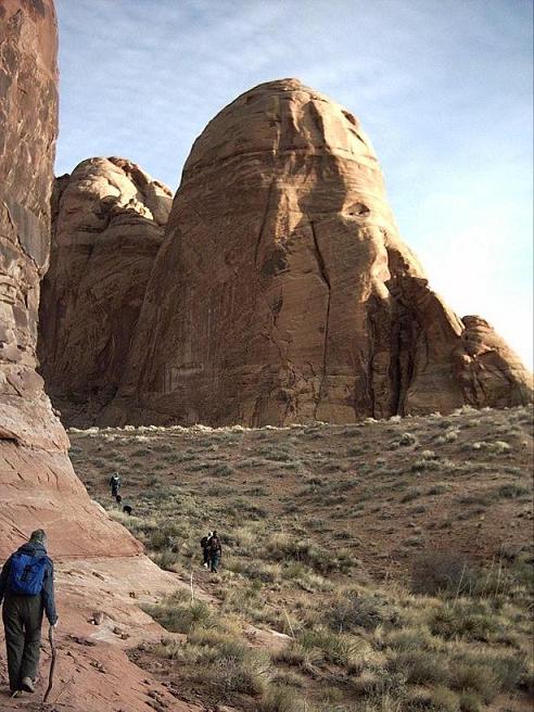
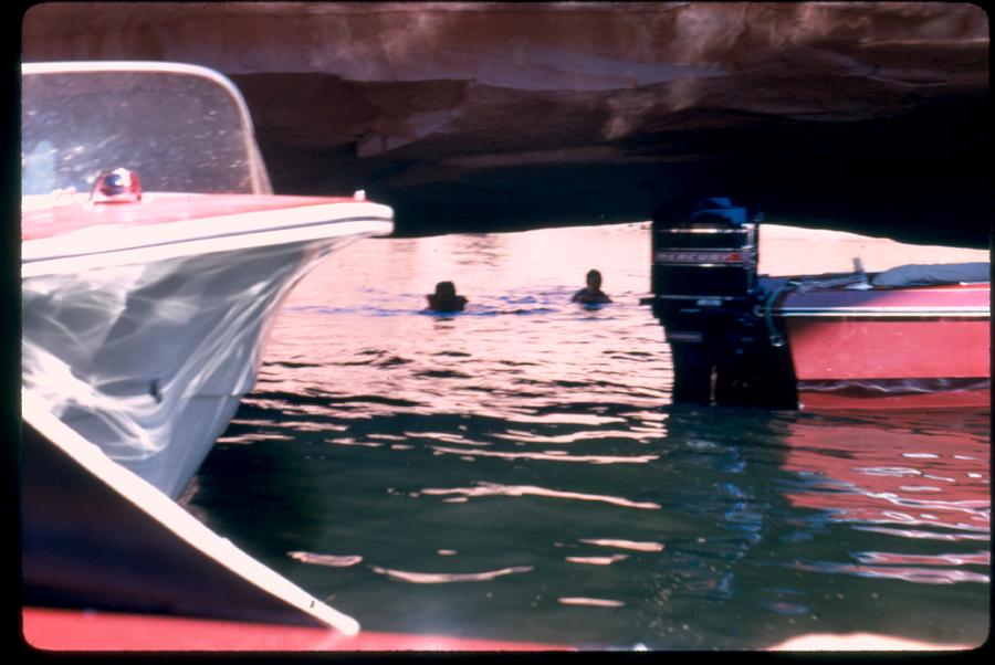
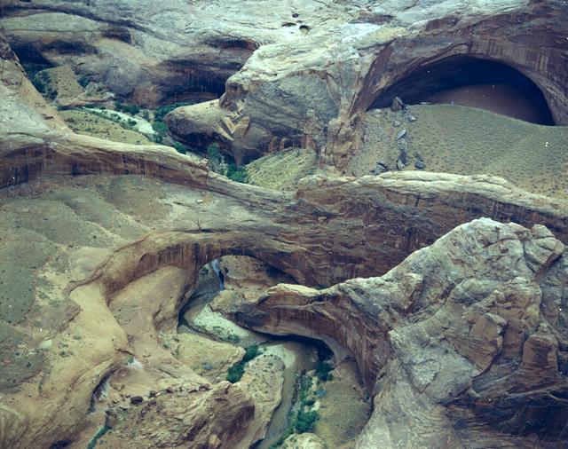
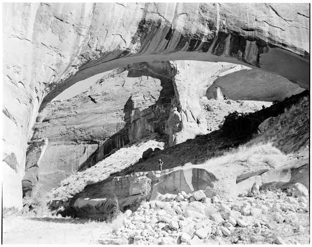
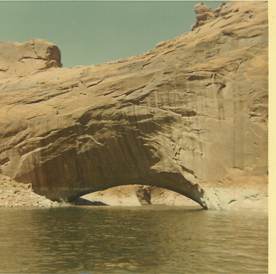
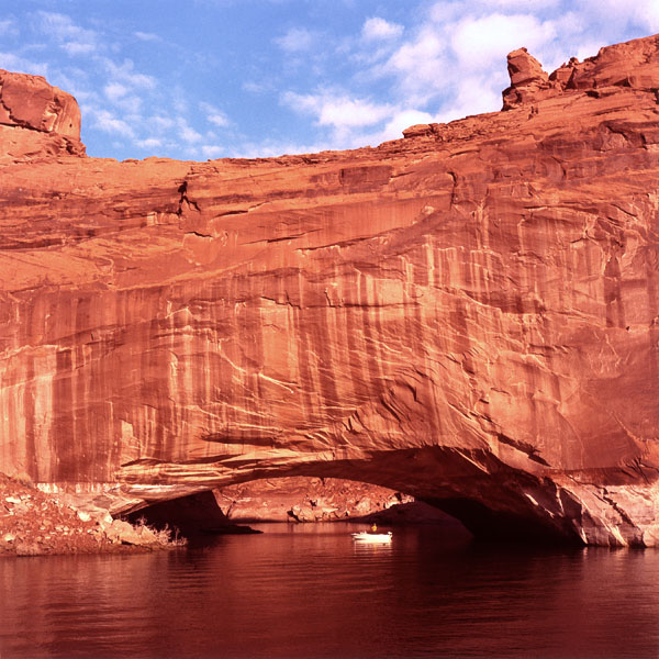