One of many
trip reports under the
SilGro home page for Alan Silverstein and Cathie
Grow.
Email me at
ajs@frii.com.
Last update: February 19, 2025
(Previous trip report: 2009_1205_DunkingCamera.htm)
Contents:
It was the best of trips, it was (nearly) the worst of trips... Seven of us had a great time during seven nights houseboating on Lake Powell, Utah. But let me confess up front that I also incurred more damages in one trip than I had during the past 30 or so! There were a series of "firsts" for me after 21 years of houseboating: First time losing something off the roof, first time breaking glass, and first time bending a prop against rocks.
Fortunately no one broke a foot bone (unlike the last two trips last year) or had any other significant injuries. But I counted eleven (11!) mini-disasters, when 0-1-2 in a whole week is more typical. Most of these issues were due to me mishandling strong afternoon winds, even though the nighttimes were mostly just blessedly breezy (not howling windy).
I was pretty rattled by this accident and resolved to be very careful for the rest of the trip, but then...
Two major problems in one trip? I decided it was time to really be careful. But then...
Yikes, this was starting to feel like my 1989 "Houseboat from Hell" trip! (My first time on the lake, before I was an owner.) With resignation and determination I tried to have only a little more, safe, fun on the way to the marina, but...
Total repair costs back at home: ~$206.
OK now that my list of sins is out of the way, let me tell you about the highlights of our vacation!
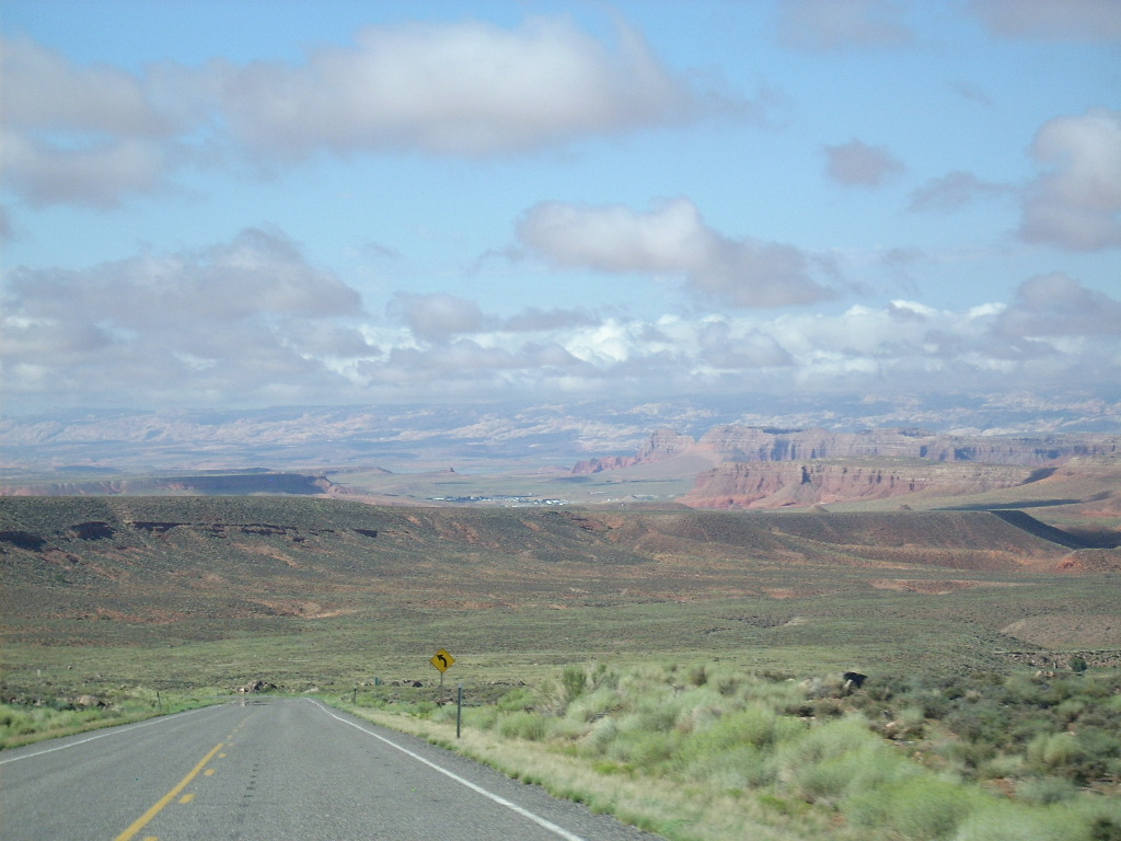
The drive out to Utah with my wife Cathie Grow in my car and two kayaks on the roof rack was uneventful. We met up with John, Robert, Shannon, Katelyn (10), and Stephen (9) Yockey in Green River in the evening. They traveled together in one truck hauling John's ski boat. We all walked to the West Winds and back for a nice dinner (complete with a glorious rainbow on the way over, but no cameras handy). John roomed with us at Motel 6.
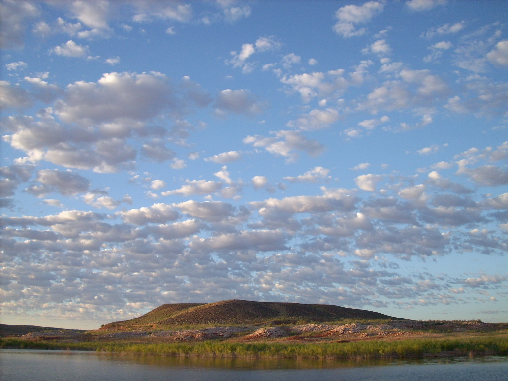
Sunday morning's drive to Bullfrog Marina was unusually spectacular with fall-like puffy low clouds all around. We'd caught the tail end of a several-week monsoon pattern. Gravel side roads were muddy, the desert was in bloom, and the day was blessedly cooler than hotter.
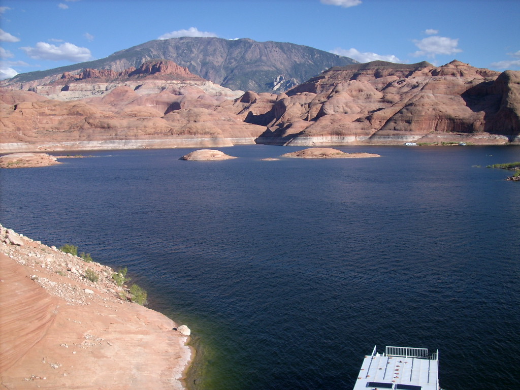
We picked up houseboat Wildwind at Hobie Cat Bay as usual, but earlier than usual at 10:30 am. Much later, all loading and preparations complete, we departed at 2:35 pm and decided to head south (downstream) as we most often do. The lake was unusually busy with boat traffic.
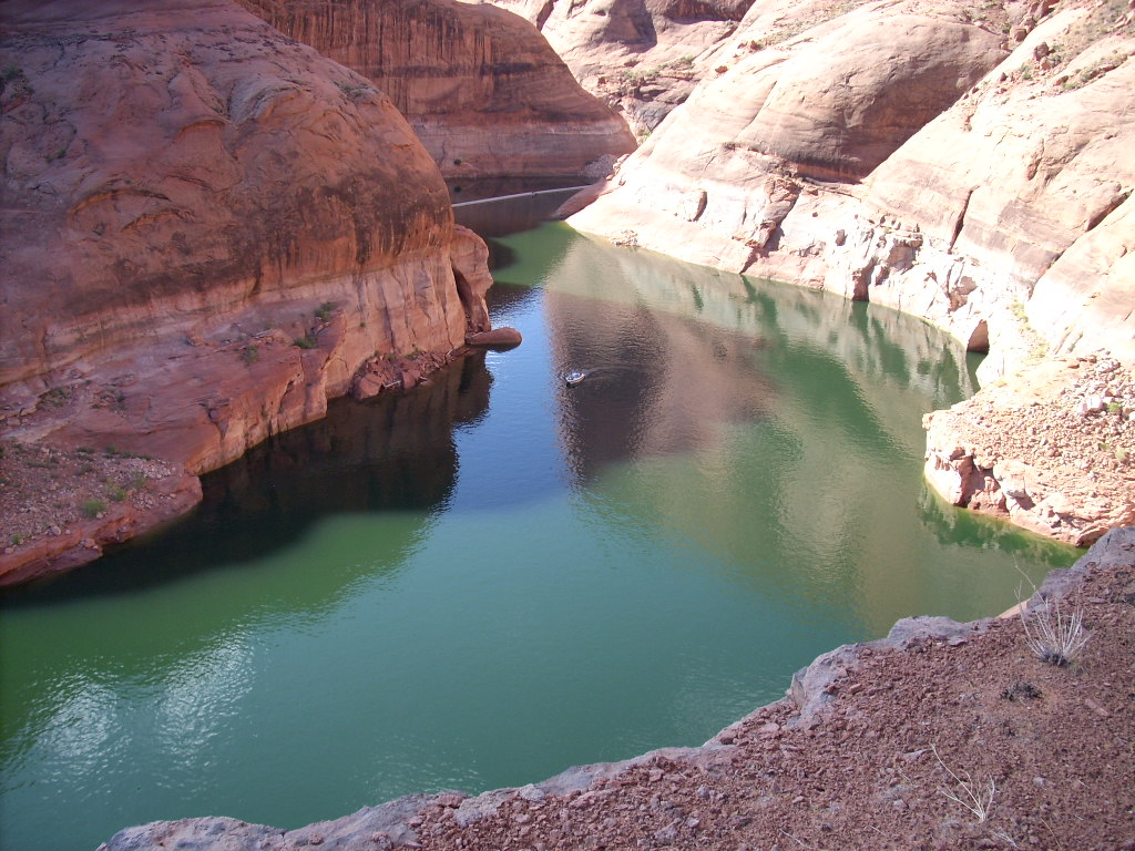
We tied up a while at the dinosaur tracks across from Annies Canyon to enjoy them. Then I started looking for a good mooring site for the night. I'd never been able to do that on the peninsula (sometimes islands) across from Slick Rock Canyon, but this afternoon it materialized. Never mind that first we had to give up one spot too close to another boat just arriving. Fortunately we found a pretty good location on the downstream side, which also worked for an evening campfire.
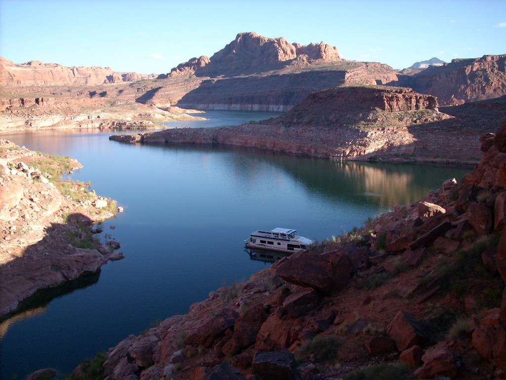
It was great to be back on the Lake with a small crew of happy, enthusiastic people!
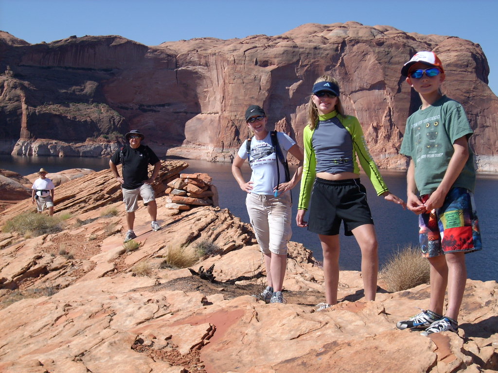
I took off to explore the peninsula on foot, south end to north end, and everyone else tagged along much of the way. It was a beautiful Lake Powell morning, unseasonably cool, pleasant for walking around. I even got my fellow hikers to clamber up and walk across the "catwalk" ridge going north.
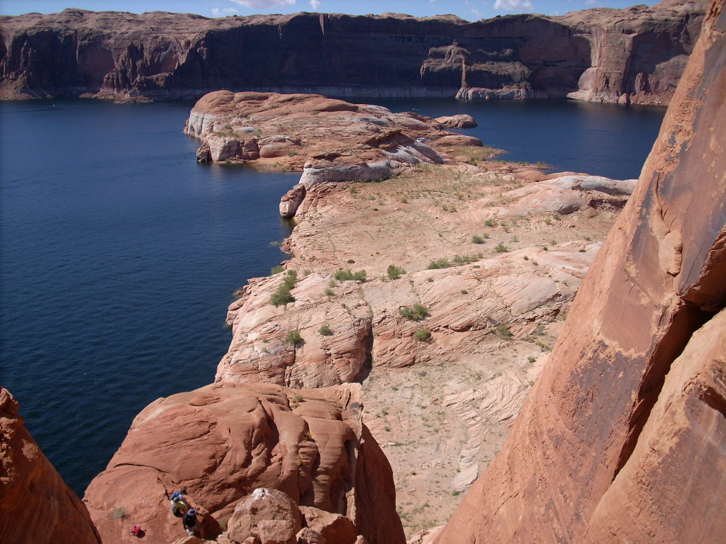
I went as far up the north cliffs as I comfortably could, for a great view out over the peninsula towards Slick Rock Canyon, while the others rested above a lower lakeside cliff below, still probably 150' above the water.
Later we decided to drive the houseboat all the way down to Oak Bay to be near Rainbow Bridge the next morning. I'm sure that as usual we stopped for "evapo breaks" as required along the way, to swim out in the open channel. We made one real stop, at "Moriahs Arch", which in hindsight was ill-advised. This is where the first two mini-disasters (described earlier) took place. Unlike last year, the slightly lower water level meant we ended up pinned (badly) on a huge boulder below the arch, instead of further in, just over the rock and tucked completely underneath the span.
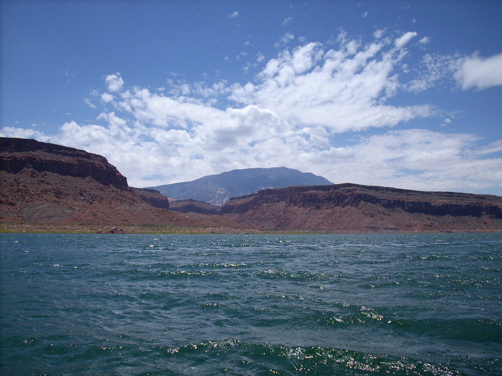
Anyway we arrived at Oak Bay with plenty of time to look around. As usual despite being far from any shore-access marinas, it was crowded with houseboats. I guess other people loved the big bay and the nice view of nearby Navajo Mountain as much as we did.
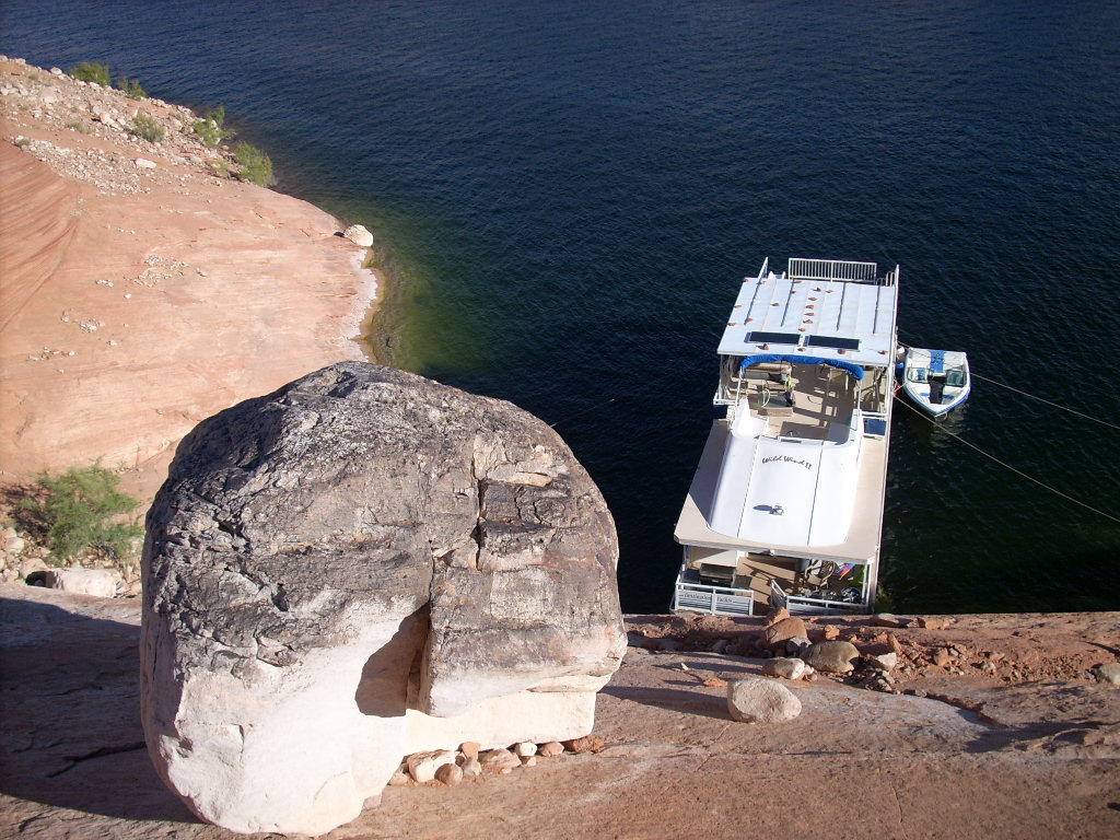
Well we got lucky and found a decent mooring site on the southwest side of the huge island in the bay, the same place I'd stayed once about 11 years earlier. There was just one cove, and just one way to park the houseboat there. Too bad about the enormous boulders way up the hill above... Only one of them was really a risk, and not much of that; it had been there for many years, including underwater.
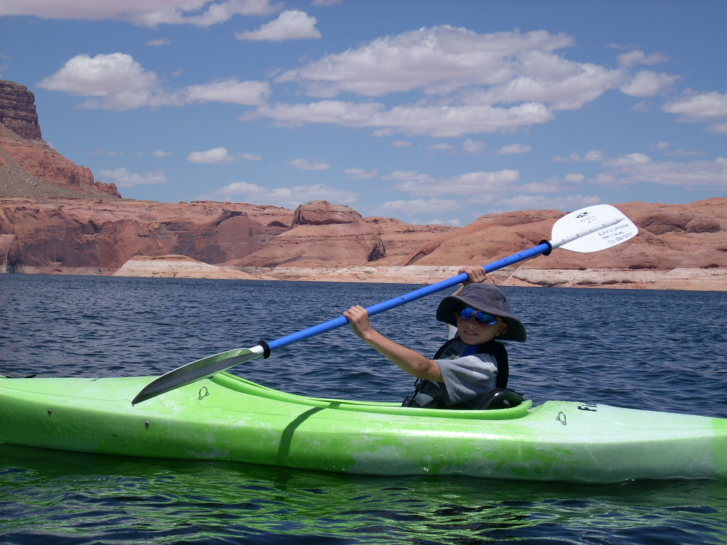
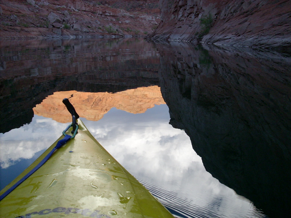
After we settled in I enjoyed a bouldery stroll to the top of the island's hill. Great views all around. Back at the lake there was still time before sunset and dinner for a kayak ride, so no one else wanting to join me, I took off alone. -- Well actually Stephen, who I started to think of as "Energy", would have come along too, but it probably would have been too far/fast for him. But he surprised me the next day with his paddling stamina.
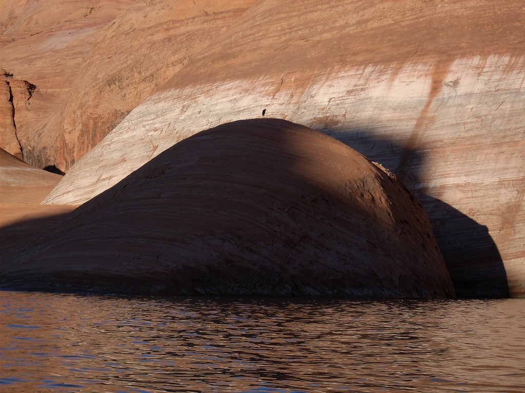
In about 1:10 round-trip I went south towards Navajo Mountain to the very back of Secret Canyon and returned. Unlike past years there was little beach in the canyon. The water was low and the shoreline was largely overgrown with tamarisks, so not many boats in there. But I enjoyed nice late-day light and shadows on the slickrock.
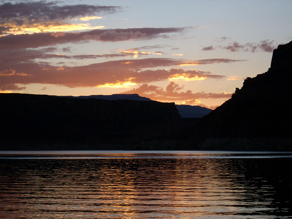
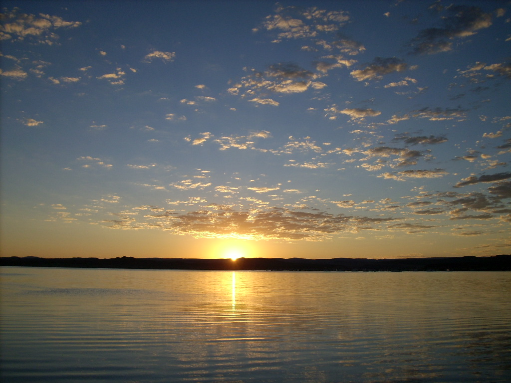
People were still out enjoying watersports when I returned. I think we ate dinner together on the roof every evening, but often, as tonight, at twilight or later, meaning after 8 pm. It was a beautiful evening with a pretty sunset followed by a gorgeous, starry, calm night.
We all got up early, just after sunrise at 6:30 am... Yes even the kids, with some dragging. All of us but Cathie went in John's ski boat "around the corner" a few miles, up Forbidding Canyon and then Bridge Canyon. The others dropped John and me on shore at 7:50 just a bit downstream from the courtesy dock, below the "little" wall arch on river-left that's often overlooked.
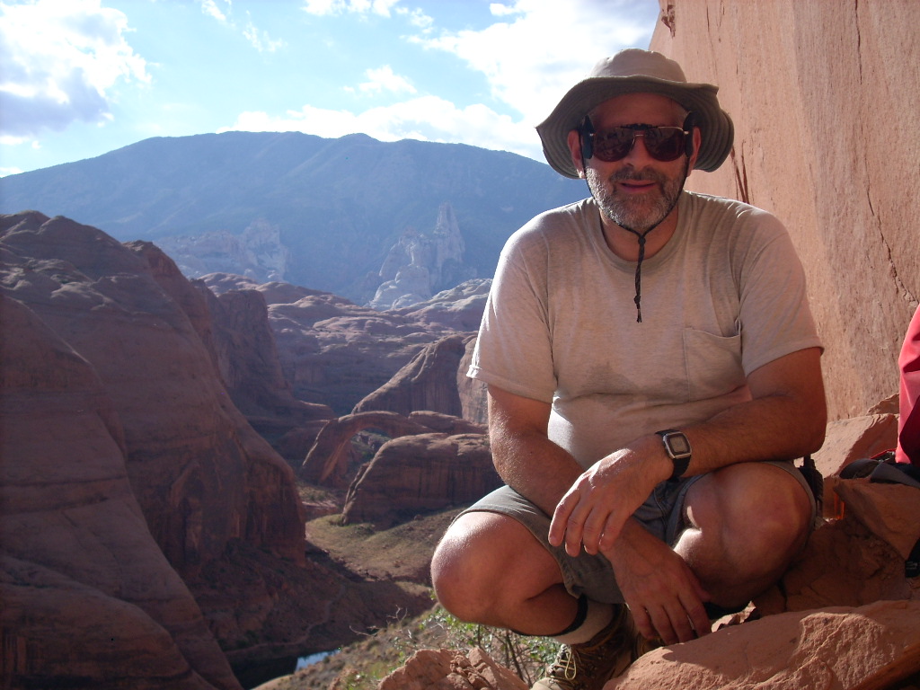
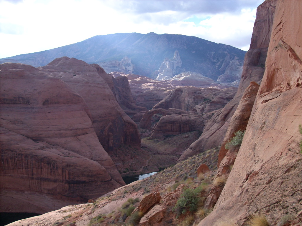
We clambered up some steep slickrock and then boulders/dirt for my second visit to a glorious overlook point on Rainbow Bridge. Meanwhile the rest did the tamer walk up the trail to the Bridge, reaching it about 8:30.
We had the place all to ourselves for about an hour. The partly-cloudy morning light was spectacular. Just like last year the hikers below were ready to go before John and I returned to the lake. We were still exploring around the arch as they boated out. I went as high as I could, which wasn't very close to the opening, and scraped up both knees in the process, my worst injury of the week.
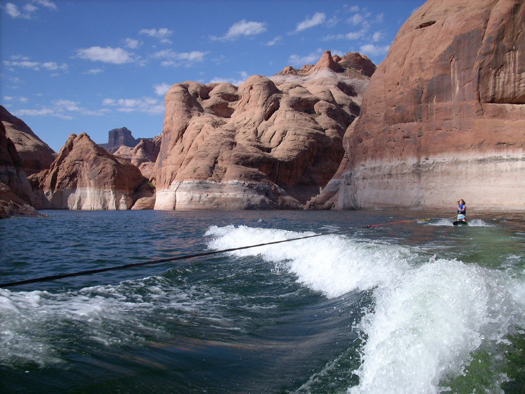
We hopped back on the ski boat at 9:05 am, and towed both kids on a kneeboard out of Forbidding Canyon.
On the way back to Wildwind, after checking in with Cathie by radio, we took a detour to play around both sides of the Twilight Arch, six tight turns up Twilight Canyon.
Later that day after doing some snorkeling, I went out around 1 pm in the kayaks with Stephen for what turned out to be a long tour. We circled the big island (on which we were moored) clockwise, into a strong wind and big waves. On the far side in the lee, Stephen declined going ashore to hike up the hill, but then he paddled the rest of the way around.
Still not tuckered out, Stephen agreed to head south to one of the smaller islands in Oak Bay. We pulled ashore on one of them and sat on top for a while to rest and admire the view. We were out for about an hour total.
Now it was time to depart back upstream. I had a "brilliant" idea (I've really gotta watch those): Let's cast off the Wildwind and have Cathie drive it a little, then float around and wait for us at the mouth of Anasazi Canyon! Meanwhile most of the crew would ski boat all the way back to the double-bridges at the mouth of Lehi Canyon, which we knew must be underwater. Well they were -- but we still ended up playing around there so long that Cathie got worried! No radio connection possible of course.
At the mouth of Lehi we were able to step out above the drowned bridges and waterfall for a brief look. Then bemoaning my failure to bring a mask and snorkel, I decided to try diving down to see the bridges anyway. And I found both of them! I touched their saddles, around 15-20' down, clearly visible in the cloudy green water.
From the ski boat John handed me an anchor on a line. I set the anchor lying down first on one saddle, then on the other, so I, Rob, and Katelyn could use it as a weighted line for rapidly descending. Katelyn also managed to view one of the bridges. However I could not get a good picture of them using Rob's underwater camera.
Eventually emerging from Anasazi Canyon, where was the houseboat? Still downstream around the corner a mile. We motored past the Eye Arch, now with the sun shining through it, rejoined Wildwind, and started the drive back upstream.
Everyone agreed to going up the San Juan River, for three nights as it turned out. We hoped to stay (for my first time) in "Not Cha Canyon". But alas, this short finger with just one parking space was already occupied, for the next three days in fact, by another houseboat.
Disappointed, we continued into Cha Bay. We explored the northwest shore, then the entire southwest shore past Cha Canyon, but I was surprised not to see anything I liked. Poor anchoring, overgrown shorelines, no shelter. It was getting late when, after a few more false starts, we settled into a spot on river-right of Cha Canyon, far out near the "corner", on the south center of the bay.
This location had a great view with no other boats nearby. But it was somewhat exposed to the westerly side-wind, which fortunately did not blow strongly all night. Once again we saw a number of memorable early Perseid meteors before bedtime.
Typically people are tired by mid-week and Wednesday morning is a lazy one. It certainly was the case this time. I jumped in John's ski boat with the Yockeys to watch and video some early morning watersports. Later while they hiked up Cha Canyon to see the petroglyphs, I went out alone in a kayak for a 1.5-hour loop of the middle bay, to and along the north shore, despite some strong winds and middling waves. We happened to arrive back at the houseboat nearly simultaneously.
Next John, Stephen, and I went out in John's boat scouting for a better place to spend the next night or two. But first I dragged them over with a trash bag to clean up a fireworks mess I'd seen on shore nearby while kayaking. Anyway after that we were gone a long time looking, and finding surprisingly little. All the "good" spots were occupied! Eventually we settled on a little cove up Wilson Creek that we'd seen early in the outing.
We cast off the houseboat in the afternoon for the short drive east and north. Some seemingly small thunderstorms were in the area. Turning westerly with our destination in sight I told the crew, "if this storm gets windy we won't moor right away, I'll drive into it slowly and wait for it to pass." Then suddenly all hell broke loose as we were hit head-on by the microburst I wrote about earlier. I barely managed to keep the houseboat under control; we got close to hitting the shoreline. Rob was quick and brave enough to jump on more bed parts to keep them from going overboard too.
The storm passed quickly. After retrieving all but the table that had blown off the roof, we got tied up in what turned out to be a pretty decent spot, so nice we spent two nights there. Everyone stood down from "red alert" with great relief, and we stood the wet mattresses on edge on the roof to start draining and drying them. Unfortunately we had nice evening shade we didn't want this time. We used the mattresses upside down that night (vinyl sides up), and they finished drying the next day.
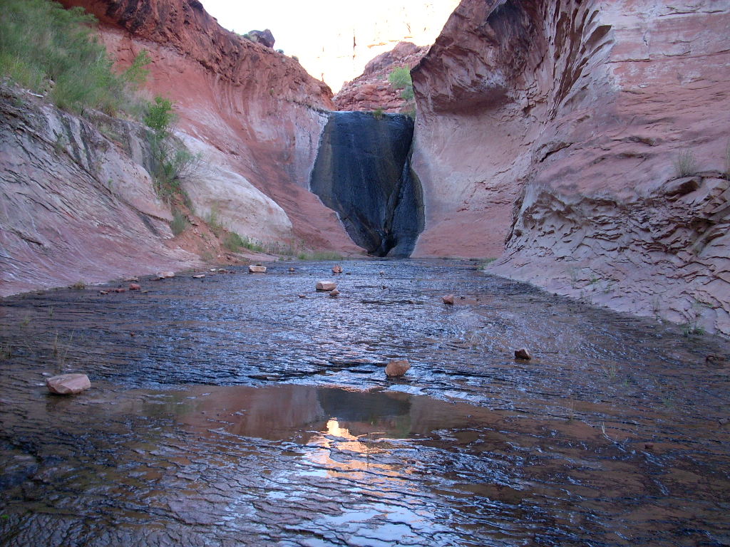
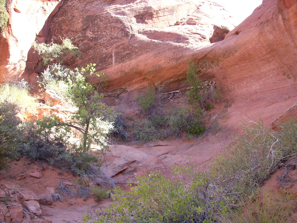
Before sunset Cathie and I kayaked about 20 minutes up Wilson Creek to the end. Then I walked and waded (waist deep with crawdads) about five minutes farther around the corner to see the "Wilson Creek Waterslide" for the first time in years. Of course it had been a perennial creek waterfall, not a waterslide, for a decade since the lake was up (cresting just above the 30-40', moss-covered face). It was a beautiful sight.
The crew built a campfire on shore, and we enjoyed some nice (if few) Perseid meteors, still half a day ahead of the predicted peak.
It was another mellow morning, but eventually I got myself moving for a solo walkabout that turned into an epic outing. I left at 10:15 am joking that it was already too hot and late for my hike, and returned nearly nine hours later at 7:11 pm! The day peaked out at 95 degrees, I drank over a gallon of fluid, and I wore myself out to the point that climbing uphill was painful -- but it was otherwise uneventful and memorable (grin).
I intended to get through the steep, bouldery, near-lake shoreline, then scramble up a higher, narrow Navajo sandstone gully that I'd descended many years earlier at the end of a loop. However upon topping out perhaps 100' above the houseboat, I saw a vast, relatively flat plain (top of Kayenta sandstone) in front of me. There was no reason to curve more to the right just to get into local slickrock complexities. I told Cathie by radio that instead of my original plan, I was going to walk about a mile away to overlook the "Waterslide" directly, not perhaps on my way back instead.
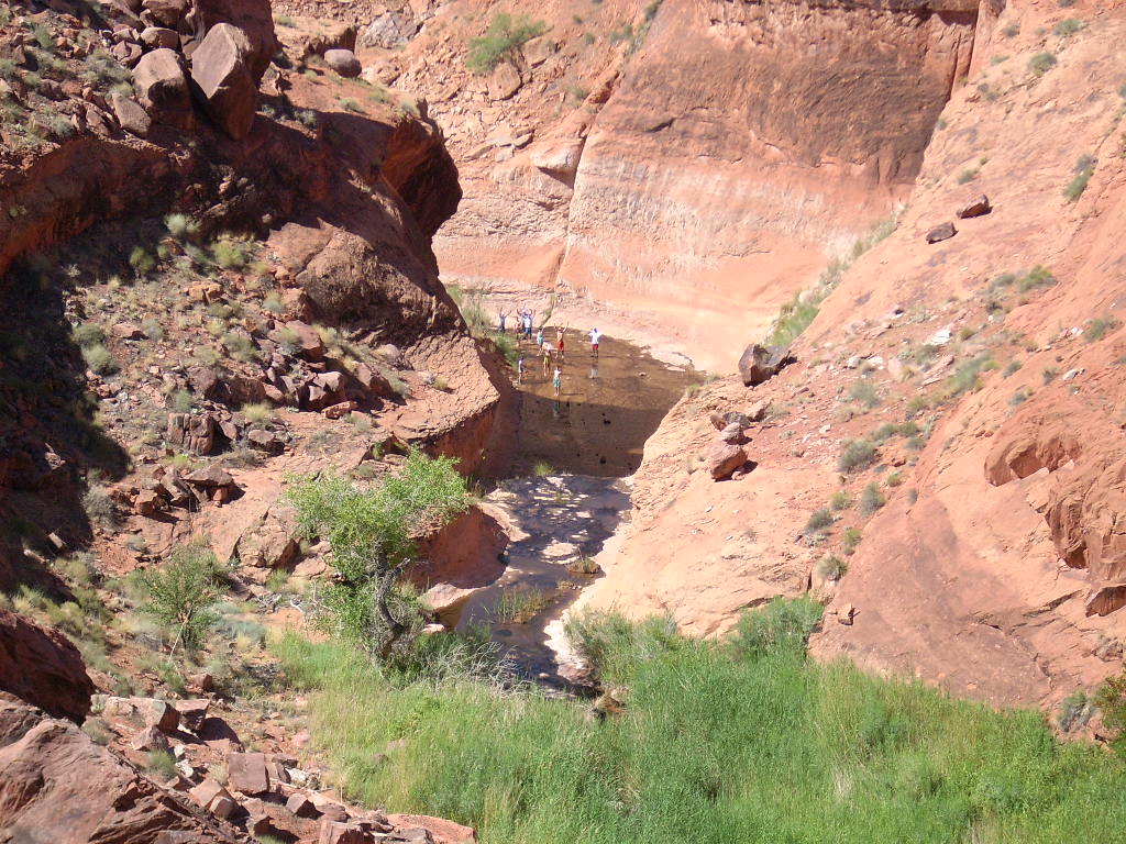
I found pretty good burro trails leading me up the right side (river-left) of Wilson Creek. I had to detour down and left a little to peer over the rim to the "Waterslide" about 150' below. And look, there was a crowd of people visiting beyond it! I yelled to them, they yelled and waved back, then departed.
Now I'd long wanted to hike past Aladdins Lamp Pass (4400'+) between Cottonwood Canyon and Wilson Creek. Similar to how the backs of Iceberg Canyon and the Great Bend were near each other on the peninsula (further up the Colorado and San Juan Rivers), the drainages of Cottonwood and Wilson cut across and met at the Pass. While only about six miles afoot, it was so far around by water that I figured it would never happen... It was too hard to arrange a boat pickup at the far end.
I knew that Aladdins Lamp Pass was still over two miles away, and that I'd have to return the way I came, but what the heck! I had all day, feeling good, lots of food and water, and there were plenty of small potholes with shirt-wetting water left over from yesterday's small storm. So I called down to the houseboat with my new plan.
Then I meandered northwesterly on the animal trails. They followed the canyon rim with some small detours down/up into some side gullies... Not really too bad. I had a (correct as it turned out) sense of where the pass must be. Using approximate coordinates gleaned from the topo map, my GPS also gave me some idea of the distance, along with my current elevation, plus the map and GPS guided me the right way at some forks. Eventually the creek bottom pinched out at a crack. I had to climb up and out to rolling desert above to finish the stroll.
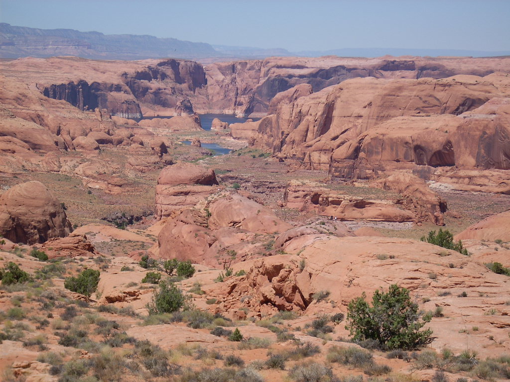
I reached the unmarked, unremarkable saddle of the pass at 1:05 pm, 2:50 from the boat, 95 degrees already, mostly clear and just a little breezy. It was incredible looking down toward the San Juan River behind me (although I couldn't see the water) and more steeply into Cottonwood Canyon below me, all the way down to Hole in the Rock! I scanned around for any rock formation resembling Aladdins Lamp. The best I could find was a huge pair of hills to the southwest that appeared right in profile.
After a rest/snack break in the small shade of a nearby juniper bush, I proceeded uphill northerly to look down from a higher point. Man was I surprised to see and hear a couple of hikers coming up from Cottonwood Canyon! They turned out to be two of over 20 boy scouts working on improving the marker posts on the Emigrant Trail! The wheel-tracked, slightly trashy, dirt and gravel road wasn't far off either. I wandered down and up it a ways.
I called the houseboat by radio from a sunny high point. They all agreed to remain at the same spot another night, so there was no reason I had to rush down. I sheltered for lunch in the solar lee of an enormous solitary juniper tree. I figured to head back home next, but then, still having time and energy, instead I circled back over Aladdins Lamp Pass at 2:40 pm, then kept going over half a mile southwest and south.
I followed close to the ridgeline to below the north hill of the Lamp (I think). Then I climbed to the top of what I believe was Aladdins Lamp itself (4760'+). I did OK, but was already huffing some from the heat and exertion. I admired the incredible view of the surrounding terrain, familiar to me at least, including the south cliffs of Cha Bay and the mouth of the San Juan River.
After a short break I continued a ways easterly to the real goal, my high point of the day, a bare slickrock hilltop at 4820'+. I continued to enjoy the shifting scenery, and a hot but strong westerly wind. I couldn't see the water in Cha Bay, but it was great finally being on the slickrock highlands I'd studied on the map well up from the bay's north cliffs. It would have been nice to detour even further in that direction, but I knew I was already pushing it.
I talked with the Wildwind again to update my location, and finally started down at 3:45 pm. It took me nearly 3.5 hours to get back! First I had to find a suitable route zig-zagging through very steep terrain into lower drainages. Then nearing the floor of Wilson Creek's main fork, I hit a dryfall and had to go up (groan), around, and hunt for a better way down, which took a while.
I finally rested in some shade on the gully floor at 5 pm. There I made the decision to iodize a liter of pond water at the next opportunity, rather than to ration the remainder of the "3 liters and a soda pop" I'd started with.
This water addition I accomplished a ways downstream at some sheltered pools deep in the gully. Somehow I got a tadpole in the first liter, had to pour it out and try again. Half an hour later I had ready to drink a liter of somewhat cool, but green, fresh water that tasted like pond scum, metal (the iodine), and a little gatorade powder I added... Yum!
I knew I still had a long walk ahead of me, but it was mostly downhill and I was still happy to be there. I plodded out, enjoying late-day colors and shadows, taking pictures and updating the houseboat by radio on occasion. To my relief I made it home before sunset. Even more importantly, after drinking a lot of water and taking a swim/bath, I felt pretty good that evening and the next day!
This was a lazy day of mostly houseboat driving. We left Wilson Creek at about 11 am and tied up in Iceberg Canyon (river-right cove downstream of the first right finger) at about 7:30 pm, less than an hour before sunset.
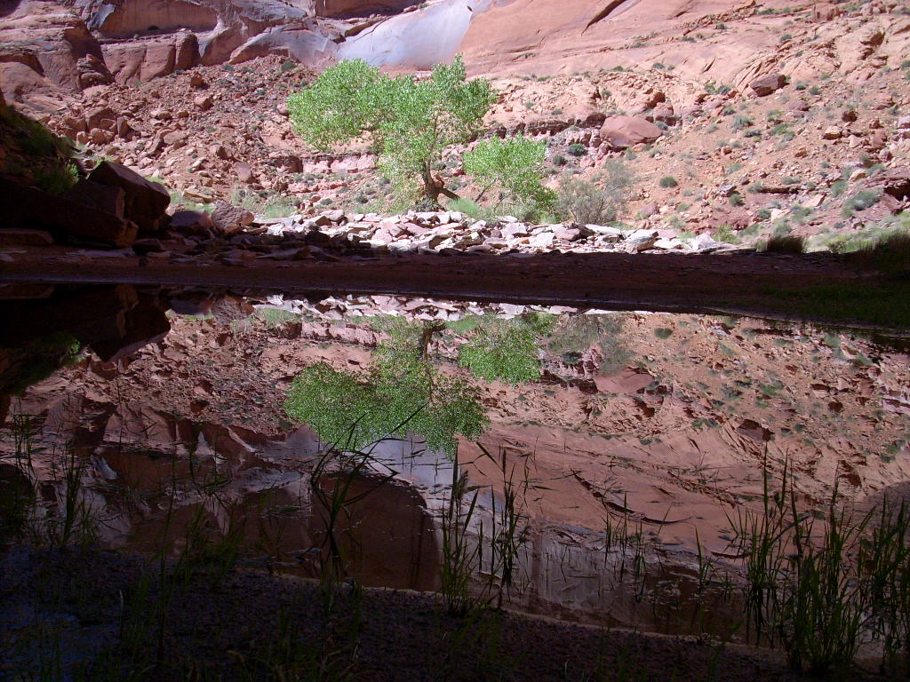
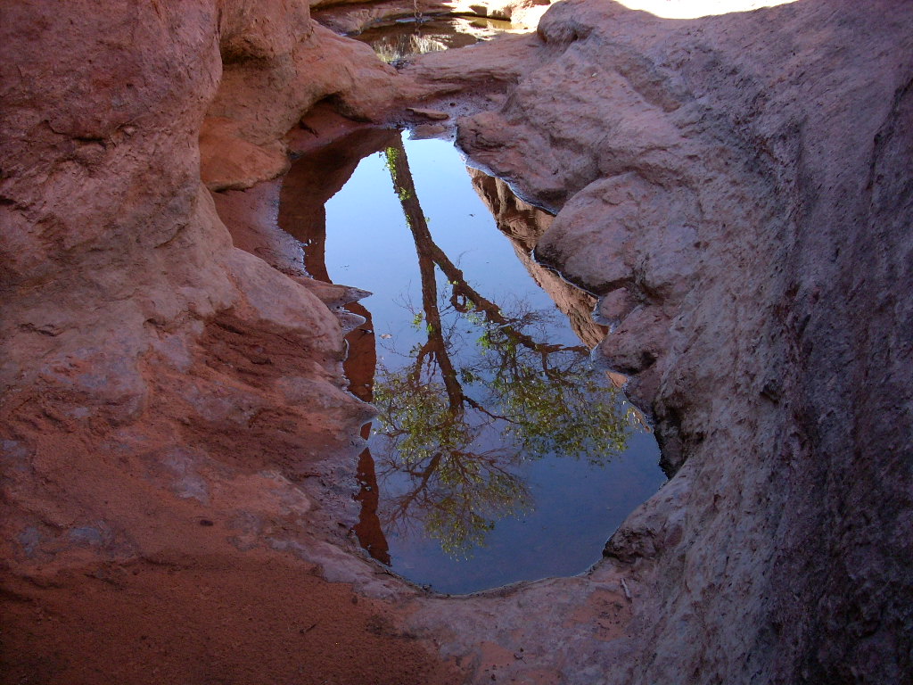
Along the way we moored for a time in "Eureka Canyon" near the mouth of the Escalante River. While the Yockeys toured up the latter, I kayaked 10 minutes to the end of the water in "Eureka" and walked about 10 more minutes into the lovely reflecting pool (smaller this year though) and cottonwood tree at the end of the canyon.
While untying in "Eureka" we had strong winds and an unfortunate encounter between rocks and dock lights, already mentioned earlier. My pilot friend says that when two things go wrong it's time to land the airplane. Our count was already higher than that, but what could we do? I resolved to be even more careful, for all the good it did (not) do.
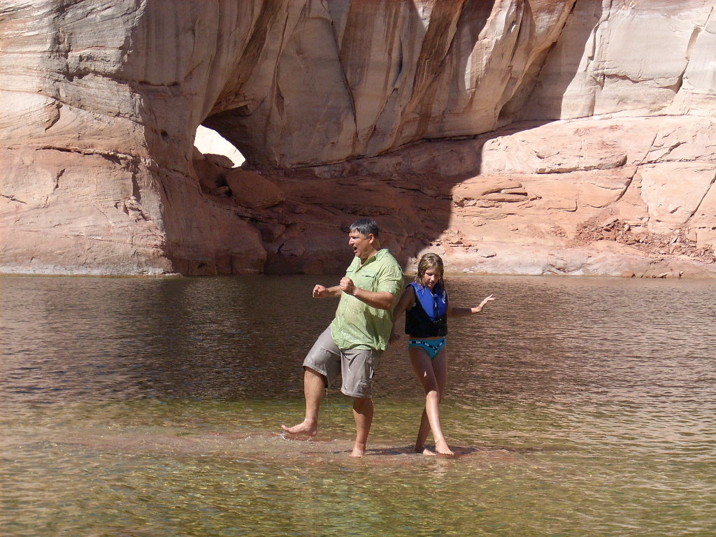
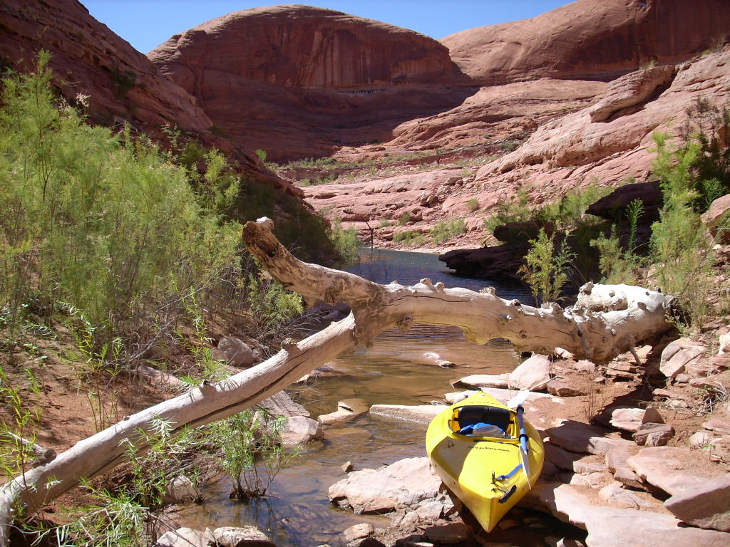
Anyway later safely moored up in Iceberg Canyon, there was time to swim over to the "triangle cave" nearby. It was at a perfect water level to explore... A small entrance leading to a huge, high, dark, eerie cavity, complete with an enormous floating log that must have drifted inside when the lake was lower, and gotten trapped.
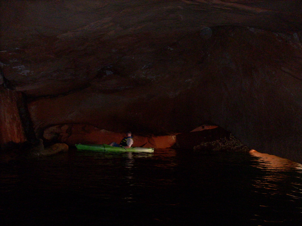
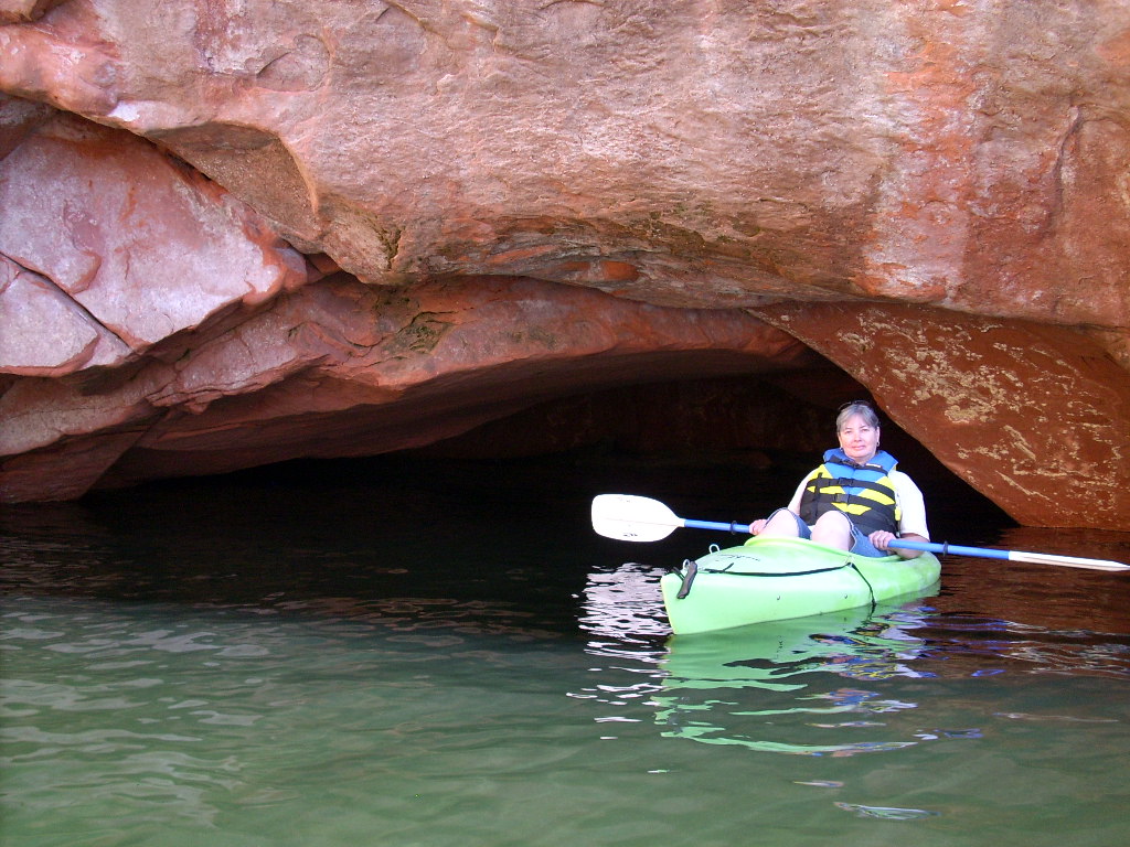
Before leaving Iceberg, Cathie and I kayaked back into the nearby triangle cave. It was an even better way to see it than by swimming. Really a fantastic, eerie, humid, warm place with weird acoustics.
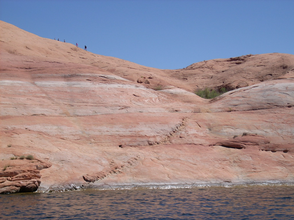
We all departed in the houseboat before 11 am headed for the marina. Along the way we nosed up to the rocks and dropped off some folks to hike up the hundred-year-old miner's steps near Lake Canyon. Later we later retrieved them without incident, which was becoming more and more rare (groan).
Well I wanted to make a quick dive down to the "Devils Potty Arch" while we passed by that point. And I did, but not without some issues and consternation, as already mentioned earlier. The arch was nominally (according my records) 19' deep, but it felt closer to just 12'. Anyway after this episode I started a numbered list of, "things that have gone wrong so far," hoping that would be the end of it... Nope!
It was fast, fun, and easy driving the Wildwind into Lost Eden Canyon, first to launch the ski boat with the rest of the crew to see the small slot canyon (formerly underwater), then to drive the houseboat down to the big cave in the main fork to wait for them. Oops, the cave was really crowded with a lot of little (and bigger) boats! I had to work to maintain position in the breeze (side-effect of an apparently stronger wind), scraped the bimini as previously mentioned, and exited the cave to wait outside, where it happened to be a lot gustier.
Still I didn't foresee the difficulties I'd encounter steering the houseboat back out. It was windy and wavy enough that the little-boat folks decided to not come aboard until I exited Lost Eden... Which I ended up doing very embarrassed, mostly on one motor with unknown damage to the other engine's prop.
It remained very windy around Halls Crossing Marina. This of course made the dock duty no picnic, especially trying not to use the right engine after confirming the badly bent prop. Somehow we got through it OK with no more bent metal or hurt feelings (I hope), 4:00-6:10 pm (longer than usual). The little boat took some crew to get ice cream. There being none at Halls they went all the way to Bullfrog Marina, but still didn't win!
We managed to find an acceptable place to tie up on the southwest shore of Bullfrog Bay near Halls by 7 pm. I was pretty worn out, but with a little help from my friends we swapped in the new prop before sunset. (Fortunately the old one turned out to be repairable.)
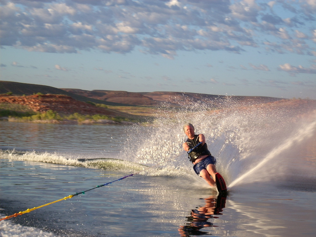
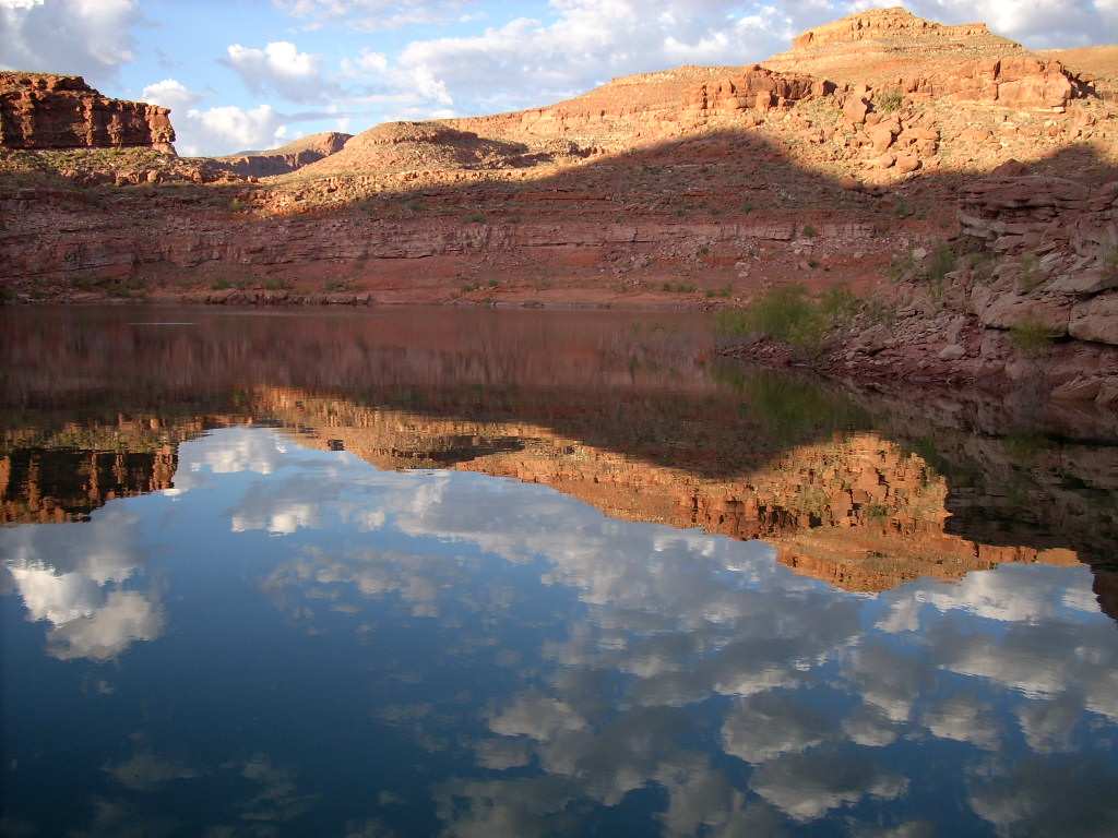
The sunrise was magnificent... Calm, poetic, with many small, low, puffy clouds reflecting off the lake. John went waterskiing one last time and I took pictures. It was beautiful and colorful.
We had the houseboat on the beach at Hobie Cat Bay by 9 am, and handed it off to the next user by 11 am. The Yockeys left the marina about 11:15, meanwhile Cathie and I at five-of-noon, which wasn't too bad! We made it all the way to Fruita for a late lunch, and home at 10:10 pm (partly due to heavy traffic). All that was left was to unload, unpack, regroup, and resume our normal landlubber lives.
This negatively memorable outing turned out to be the last of 45 vacation trips (3-8 nights each) that I ran as a part owner of the Wildwind I or II. The following month I had a great September week reserved, and I couldn't find anyone to go with me, not even my wife, so for the first time in 21 years I had to cancel a trip.
Soon after that I got an "offer I couldn't refuse" to sell the boat to some new owners. Taking all of this as a sign, I signed it away to them with mixed feelings, but ultimately few regrets. My memory banks were full from 307 nights spent out on the lake on one of the two boats. And (as of October 2023) I've been on 6 more trips since then -- 1 short work weekend plus five more trips on the Wildwind II with two other owners, through October 2020 (yeah, during the pandemic!) -- total 343 nights now.
(Next trip report: 2011_0709-10_OldestTreesInColorado.htm)