One of many
trip reports under the
SilGro home page for Alan Silverstein and Cathie
Grow.
Email me at
ajs@frii.com.
Last update: February 18, 2025
(Previous trip report: 1998_1116_LeonidMeteors.htm)
Adapted from email I sent about three nights on Lake Powell over Thanksgiving:
From:  Alan Silverstein <ajs@hpfcajs.fc.hp.com>
Date:  30 Nov 1998
Subject:  Thanksgiving at Lake Powell
Wednesday, Nov 25: Kathy Glatz and I left Denver in my car at 4:50 pm. Doug Baskins, Monica Engle, and her daughter Amy (age 7, and irrepressibly bright and cute) drove out a bit behind us from Fort Collins in Doug's truck with his ski boat and portable generator. We chatted on the ham radio at 1:04 am as they finally passed us near the turnoff toward Hanksville, Utah. Kath and I were bedded down in the desert under a quilt and stars near a dino bone site I'd found. The others launched Doug's boat in the dark and were asleep on the houseboat (at the buoy) by 4 am.
Thursday, Nov 26: The next morning Doug picked us up by ski boat at the boat ramp. We departed in the houseboat at around 12:15. First stop, "Gary's Rock", southwest Bullfrog Bay, to look for Gary's stainless steel prop, knocked off his boat in a collision last Oct 10. Said rock was now nearly a foot out of the water, still with no hazard marker -- it was blown off by the wind the night of Oct 3 while we were moored nearby. Also no sign of Gary's prop as I snorkeled around in the bitter cold water wearing a wetsuit... No trophy for Gary. Meanwhile, Doug bent the stainless prop on his boat by encountering the same rock in reverse gear! Oops.
On to Halls Crossing Marina. Huh? The gas dock closed at noon on Turkey Day! Who'd have thunk? We got on the radio and returned to Bullfrog Marina, where an attendant on call came in from waterskiing(!) to sell us 95 gallons.
Finally at about 3 pm we motored toward Moki Canyon. We anchored at the foot of the huge orange sand dune in the right fork; 3.5 miles by GPS from the mouth of the canyon. Just upstream from us rested the ghost ship "Cruise Inn", a gorgeous houseboat well and thoroughly grounded in sand a foot above and about 100 yards from the water. Rumor is they were blown upstream during a flash flood and then stranded when the water dropped rapidly. It was a weird and sobering sight.
We feasted that evening on Cornish hen and other delectables. The nights were long and cold, but quiet and pretty as always under a waxing moon.
Friday morning, Nov 27: We hiked up Moki Canyon about a mile to see some Anasazi ruins, then up the big sand dune and out of the canyon to the surrounding plateau. At the local high point the GPS said we were 1.7 miles from the Cal Black Airport (which we could barely see). Running down from the very top of the dune took me 59 seconds. (grin)
Later we parked the houseboat around the corner from Forgotten Canyon, and ski boated in to see the Defiance House ruins. Doug was bummed because the ruins had both been made accessible, and "armored" against visitors.
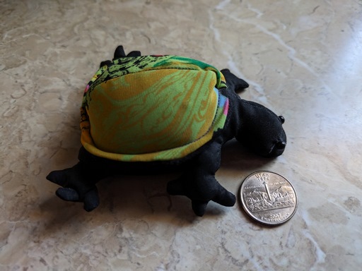
Back at the houseboat, during a game of catch, Amy's sand-pillow turtle
Myrtle took a bounce off a box, over the rail, and dived into the
lake... Where it will dwell forever deep below that lovely spot.
Fortunately we were able to buy her a replacement on Sunday at the
Defiance House Lodge
gift shop! (And I got myself one too.) [Which was still near my PC in
2023!]
We had only about ten hours of daylight each day. Being as the day was short, we just had time to reach the huge southeast bowl of Good Hope Bay, where we moored in a nice open spot northwest of an unnamed canyon.
Saturday morning, Nov 28: We ski boated to various nearby locations to admire the enormous trunks of petrified trees in the Chinle formation. I began to realize something about the big picture... The major rock layers in this area are Navajo sandstone above Wingate sandstone above Chinle mudstone. Wherever uplifts brought the Chinle to river level, you get wide canyons, now bays, rimmed with Chinle mud (and fossils). Where the Chinle is deeper and the sandstone is at river level, the canyon is narrower; the nature of the cliff depends on the type of sandstone.
We moved the houseboat at about noon and returned south. I skimmed along the base of the majestic, 650' high Tapestry Wall, and then we moored downstream of the cliff. From there we were able to do a nice 2:15 round trip hike to the top of the wall. Fortunately the overcast that had built up overnight just made it warmer and prettier, with no significant rain (yet).
I was surprised how many boats were on the lake at this time of year... Not crowded, but not empty either. And we saw hikers on the Tapestry Wall both Friday and Saturday.
We moored at sunset as far south as we could get before dark Saturday night, a mile downstream from Hansen Creek. It was windy and rainy. I slept indoors for just the third night in 126 nights at the lake.
Sunday morning, Nov 29: We got moving right at sunrise. We completed marina chores and were on the buoy in under two hours, and then headed for home by about 11:30. It was remarkably pretty driving in the desert under partial cumulus after the rains the day before. The trip home was pleasant and uneventful except for ice and snowpack from Vail to east of the Eisenhower Tunnel.
(Next trip report: 1998_1224-0103_Pennsylvania.htm)