 CAPTION CAPTION
|  PREVIOUS PREVIOUS |
 INDEX
INDEX
| NEXT (or just click anywhere on image) (or just click anywhere on image) |
| CAPTION
| PREVIOUS |
INDEX
| NEXT (or just click anywhere on image) |
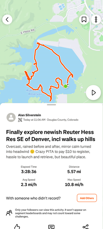
I drove home from Pueblo the next day -- but with a long detour for a pretty, mellow, overcast, sometimes windy boating loop at the relatively new (2012) Rueter-Hess Reservoir southeast of Denver. I'd wanted to kayak there for a few years since they opened up restricted access, but it was never convenient, and the Douglas County website and rules were daunting. I paid my $10 and finally did it anyway, despite the day being cool, overcast, and gloomy.
I actually followed the shoreline closely with just two crossings... Google Maps had this image all wrong! Perhaps reflecting a future fuller lake if they get permission to increase to 75 KAF.
Q1_RueterHessLoopMap.png (161 Kb) (under photos/25/1008-11_VanColorado/)
By Alan Silverstein, ajs@frii.com (page updated Tue Mar 10 18:16:39 MDT 2026)