 CAPTION CAPTION
|  PREVIOUS PREVIOUS |
 INDEX
INDEX
| NEXT (or just click anywhere on image) (or just click anywhere on image) |
| CAPTION
| PREVIOUS |
INDEX
| NEXT (or just click anywhere on image) |
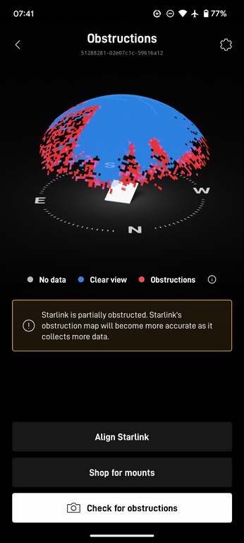
The Starlink cellphone app built this "image" of the sky over several hours as it noticed satellites fading or dropping out -- due to the building (on the right side) or some trees (south and east). But it mostly works well enough for my/our needs since we're not holding meetings or otherwise streaming video. There are brief outages apparently while the phased-array antenna switches to a different (unobstructed) satellite.
D4_StarlinkObstructionMap.png (121 Kb) (under photos/25/0914-16_CathiesCabinSolo/)
By Alan Silverstein, ajs@frii.com (page updated Tue Mar 10 18:16:39 MDT 2026)