 CAPTION CAPTION
|  PREVIOUS PREVIOUS |
 INDEX
INDEX
| NEXT (or just click anywhere on image) (or just click anywhere on image) |
| CAPTION
| PREVIOUS |
INDEX
| NEXT (or just click anywhere on image) |
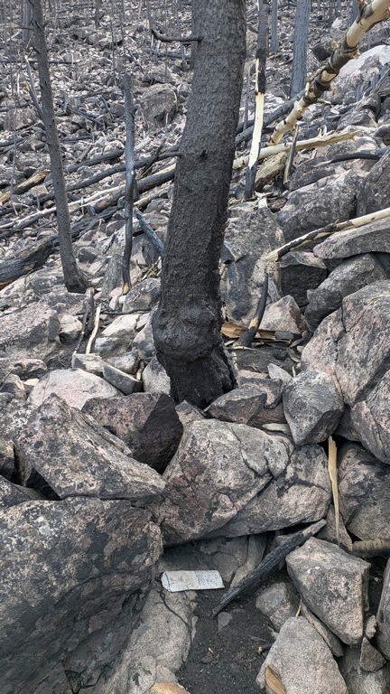
It took me about another half hour to (mistakenly) go too far north then east while avoiding rocky outcrops, before traversing back south on a steep, rough, slippery hillside to the crash coordinates. All while frequently checking my position on a map app, but somehow it was disorienting too.
This cardboard "foggle" (IFR training mask) was the first bit of wreckage I saw confirming I was at the crash site. There were small bits of mostly plastic and metal scattered over a wide area, but they'd removed everything bigger than 6-8" across.
H1_FirstCrashEvidence.jpg (205 Kb) (under photos/25/0503_PalisadeMtnCAP_CrashSite/)
By Alan Silverstein, ajs@frii.com (page updated Tue Mar 10 18:16:39 MDT 2026)