 CAPTION CAPTION
|  PREVIOUS PREVIOUS |
 INDEX
INDEX
| NEXT (or just click anywhere on image) (or just click anywhere on image) |
| CAPTION
| PREVIOUS |
INDEX
| NEXT (or just click anywhere on image) |
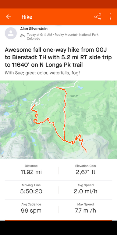
We started on the left (after riding the shuttle bus up from the parking lot) and made the GGJ/Storm loop (already long and tough enough), with a 4 hr round-trip climb up as far more of the North Longs Peak trail as we had time for.
A_StravaMap.png (200 Kb) (under photos/24/1006_NLongsPkTrail/)
By Alan Silverstein, ajs@frii.com (page updated Tue Mar 10 18:16:39 MDT 2026)