 CAPTION CAPTION
|  PREVIOUS PREVIOUS |
 INDEX
INDEX
| NEXT (or just click anywhere on image) (or just click anywhere on image) |
| CAPTION
| PREVIOUS |
INDEX
| NEXT (or just click anywhere on image) |
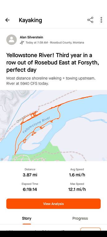
This is a messy map that shows a lot of shoreline stops and strolls. Near the end I had to ferry back (south) to the near shore and paddle/tow the boat back upstream as usual.
A_KayakStravaMap.png (99 Kb) (under photos/24/0917-24_WyomingMontanaVan/0920_ForsythAndMatthews/)
By Alan Silverstein, ajs@frii.com (page updated Tue Mar 10 18:16:39 MDT 2026)