 CAPTION CAPTION
|  PREVIOUS PREVIOUS |
 INDEX
INDEX
| NEXT (or just click anywhere on image) (or just click anywhere on image) |
| CAPTION
| PREVIOUS |
INDEX
| NEXT (or just click anywhere on image) |
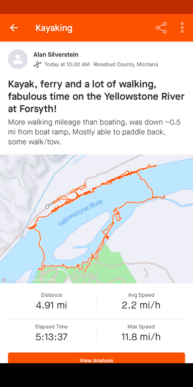
More walking than boating (today), an interesting ground track from rockhounding. I ferried across, floated downstream with stops about 0.5 mi, ferried back, and was able to mostly paddle upstream with a few exceptions to walk/tow the boat back.
A1_BoatingStravaMap.png (129 Kb) (under photos/23/0910-15_Montana/0912_RosebudE_toFarWest/)
By Alan Silverstein, ajs@frii.com (page updated Tue Mar 10 18:16:39 MDT 2026)