 CAPTION CAPTION
|  PREVIOUS PREVIOUS |
 INDEX
INDEX
| NEXT (or just click anywhere on image) (or just click anywhere on image) |
| CAPTION
| PREVIOUS |
INDEX
| NEXT (or just click anywhere on image) |
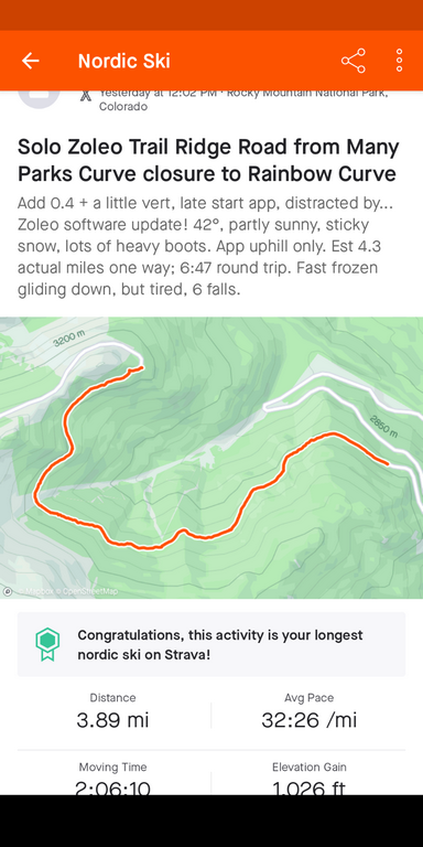
"Zoleo" is the satellite communicator I bought a few months ago for a little false confidence, err, insurance, allowing me to go out in the winter alone. I lacked cell coverage during most of this route. Stopped the Strava app at the top to save cellphone battery, and the real distance was about 4.3 mi each way.
A1_StravaPartialMap.png (209 Kb) (under photos/23/0329_TrailRidgeRoad/)
By Alan Silverstein, ajs@frii.com (page updated Tue Mar 10 18:16:39 MDT 2026)