 CAPTION CAPTION
|  PREVIOUS PREVIOUS |
 INDEX
INDEX
| NEXT (or just click anywhere on image) (or just click anywhere on image) |
| CAPTION
| PREVIOUS |
INDEX
| NEXT (or just click anywhere on image) |
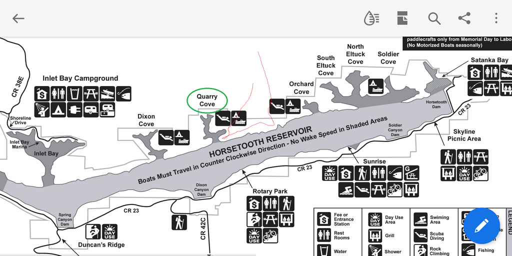
Marked up screenshot from Horsetooth Reservoir brochure map (Larimer County). The red line is our approximate route, and Quarry Cove is circled.
A2_ReservoirMap.png (314 Kb) (under photos/23/0109_LorySP_RobRexy/)
By Alan Silverstein, ajs@frii.com (page updated Tue Mar 10 18:16:39 MDT 2026)