 CAPTION CAPTION
|  PREVIOUS PREVIOUS |
 INDEX
INDEX
| NEXT (or just click anywhere on image) (or just click anywhere on image) |
| CAPTION
| PREVIOUS |
INDEX
| NEXT (or just click anywhere on image) |
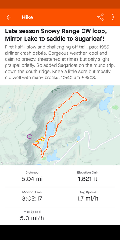
My actual route, which was clockwise. The first jogs left, not far from the trailhead, were up and down the hill at the aircraft crash site. Then just for grins, I continued off-trail north around the west side of Lookout Lake up to the MedBow/Sugarloaf saddle. The weather looked threatening at times but stayed calm, so I went about 300' more on up Sugarloaf Mtn, down the SW ridge, and back along the Lake Marie trail.
I marked the crash location with a small purple oval, and where I found debris (over about a half hour period), between an orange line and circle (latter the engine). I was about 1:15 into the 6:08 round trip at this point, but hadn't gone very far.
C4_ActualRoute.png (179 Kb) (under photos/22/1006-08_MedBowVedauwoo/)
By Alan Silverstein, ajs@frii.com (page updated Tue Mar 10 18:16:39 MDT 2026)