 CAPTION CAPTION
|  PREVIOUS PREVIOUS |
 INDEX
INDEX
| NEXT (or just click anywhere on image) (or just click anywhere on image) |
| CAPTION
| PREVIOUS |
INDEX
| NEXT (or just click anywhere on image) |
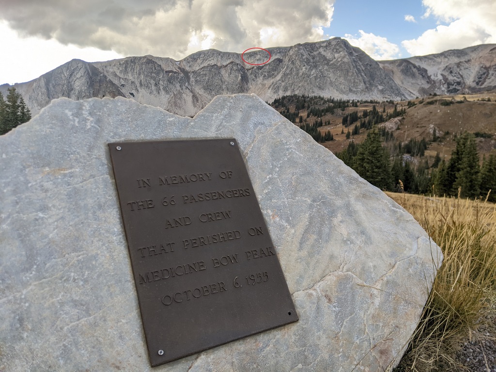
This brief plaque keeps the memory alive. I took this picture in the evening after the hike. After finding the coordinates and doing a lot of studying, I was able to circle the crash location here. The 12013' summit of Medicine Bow Peak is far upper right. Upper left is called "the Diamond", and the higher peak to the right of the crash site, "Old Main".
C1_MarkerAndCrashLocation.jpg (296 Kb) (under photos/22/1006-08_MedBowVedauwoo/)
By Alan Silverstein, ajs@frii.com (page updated Tue Mar 10 18:16:39 MDT 2026)