 CAPTION CAPTION
|  PREVIOUS PREVIOUS |
 INDEX
INDEX
| NEXT (or just click anywhere on image) (or just click anywhere on image) |
| CAPTION
| PREVIOUS |
INDEX
| NEXT (or just click anywhere on image) |
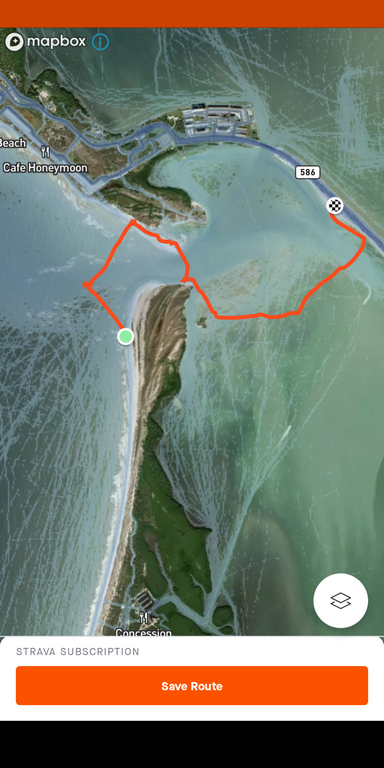
I forgot to turn on the Strava app until returning back from the north coast of Caladesi Island -- which is only reachable by boat or ferry, or by hiking up several miles from Clearwater Beach (it's not quite a separated island) -- which I actually, finally, did 4 days later! What's interesting about this image is all the blue "heat map" traces where other people have run Strava and saved their routes within the last year!
The first little wrinkle on the left of my orange path is a persistent shallow spot outside Hurricane Pass where there are always square waves, and this time, dozens of rays feeding or playing in them, getting flipped around by the surf. Sorry no pictures, it was too rough to dig out the cellphone!
A2_KayakReturn.png (517 Kb) (under photos/21/1208-15_Florida/1210_KayakDunedin/)
By Alan Silverstein, ajs@frii.com (page updated Tue Mar 10 18:16:39 MDT 2026)