 CAPTION CAPTION
|  PREVIOUS PREVIOUS |
 INDEX
INDEX
| NEXT (or just click anywhere on image) (or just click anywhere on image) |
| CAPTION
| PREVIOUS |
INDEX
| NEXT (or just click anywhere on image) |
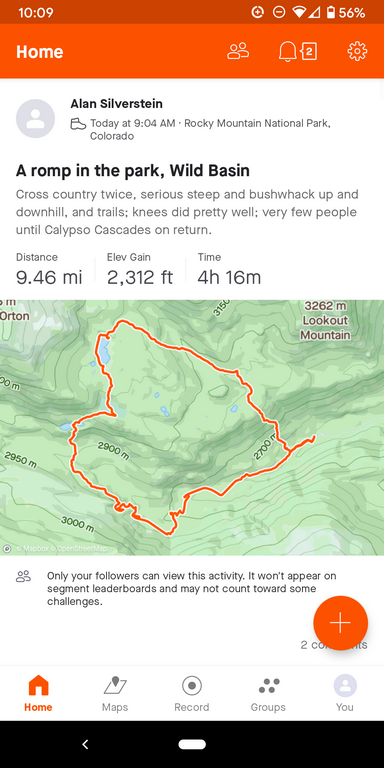
Although I'm an old dog who still carries a paper map much of the time, I've learned new tricks like Google Maps, and thanks to PaulB, recently this Strava app (here's a screenshot). But I still don't believe the distance number it came up with, way too high, I map-measured >= 7.6 mi, so I can believe maybe 8.5? The vertical seems about right, but the 4:16 moving time is way too low, I was out 8:28 in all!
You can't tell from this, but I went counter-clockwise.
A2_PostHikeStrava.png (221 Kb) (under photos/21/1025_SandbeachLake/)
By Alan Silverstein, ajs@frii.com (page updated Tue Mar 10 18:16:39 MDT 2026)