 CAPTION CAPTION
|  PREVIOUS PREVIOUS |
 INDEX
INDEX
| NEXT (or just click anywhere on image) (or just click anywhere on image) |
| CAPTION
| PREVIOUS |
INDEX
| NEXT (or just click anywhere on image) |
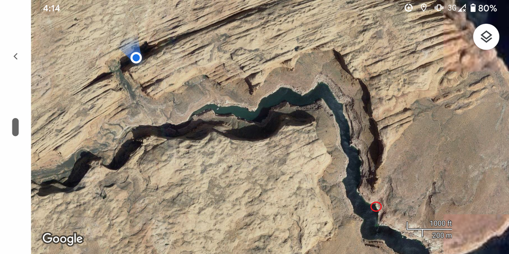
Screenshot showing where I rested and turned around (blue dot) and where the houseboat was moored (red circle) in Llewellyn Gulch, "just" a few rough miles away, including some hairy downclimbing at a couple of points. Coincidentally the water level was about the same as when this satellite image was taken.
J2_GoogleSatView.png (1372 Kb) (under photos/20/1023-1103_LakePowell/1031_KayakAndLlewellyn/)
By Alan Silverstein, ajs@frii.com (page updated Tue Mar 10 18:16:39 MDT 2026)