 CAPTION CAPTION
|  PREVIOUS PREVIOUS |
 INDEX
INDEX
| NEXT (or just click anywhere on image) (or just click anywhere on image) |
| CAPTION
| PREVIOUS |
INDEX
| NEXT (or just click anywhere on image) |
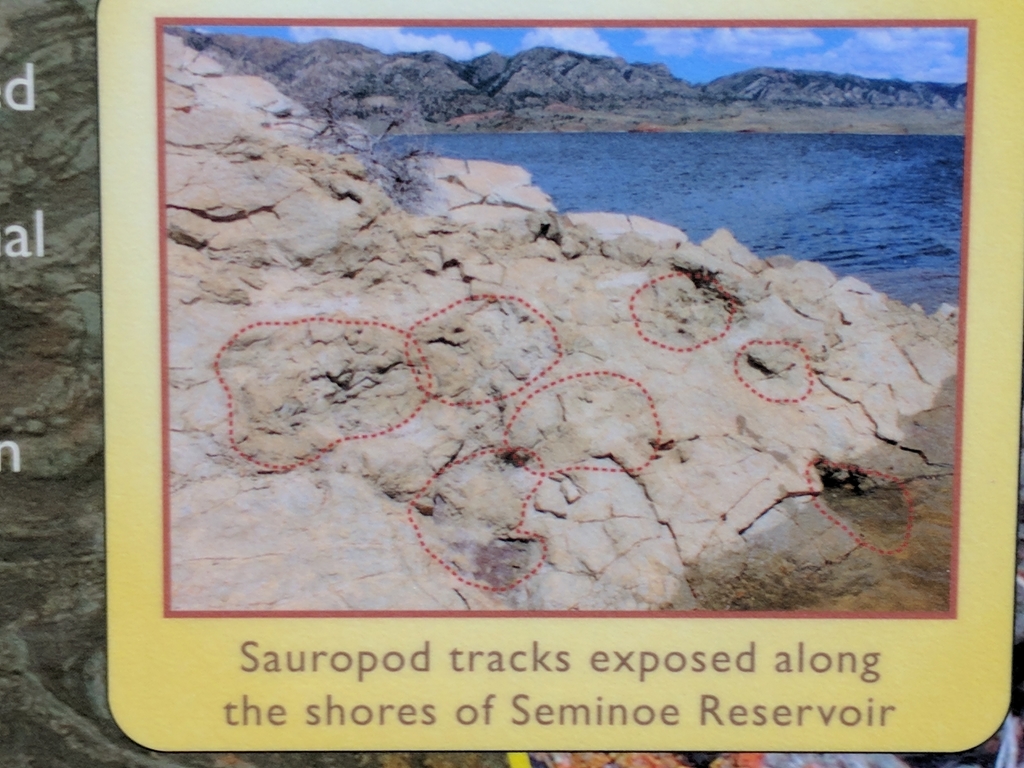
After paddling back and reconfiguring, on the way out of North Red Hills I stopped to get a closer/better picture of part of the interpretive sign. Now I think maybe my spot in the previous images was the rocky ridge just beyond the tracksite shown here, but not sure. Next time there, I'll have to look again.
D_InterpSignCloseup.jpg (549 Kb) (under photos/17/0703-0825_WyomingVanEclipse/0817_SeminoeAndPathfinder/)
By Alan Silverstein, ajs@frii.com (page updated Tue Mar 10 18:16:39 MDT 2026)