 CAPTION CAPTION
|  PREVIOUS PREVIOUS |
 INDEX
INDEX
| NEXT (or just click anywhere on image) (or just click anywhere on image) |
| CAPTION
| PREVIOUS |
INDEX
| NEXT (or just click anywhere on image) |
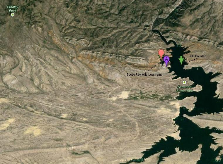
This screenshot from Google maps gives you some idea of the relationship of where I found the boulder versus where I got it to the car, about 1.14 miles away. Best I can tell now, the "good BIF" is exposed around Bradley Peak, and washes down southeast to the lake. But perhaps in geologic times past there were similar layers exposed closer to the lake. Unclear, since presently it's all sedimentary down there now.
00_SeminoeSatMap.JPG (82 Kb) (under photos/13/0702-15_BIF_Boulder/)
By Alan Silverstein, ajs@frii.com (page updated Tue Mar 10 18:16:39 MDT 2026)