 CAPTION CAPTION
|  PREVIOUS PREVIOUS |
 INDEX
INDEX
| NEXT |
| CAPTION
| PREVIOUS |
INDEX
| NEXT |
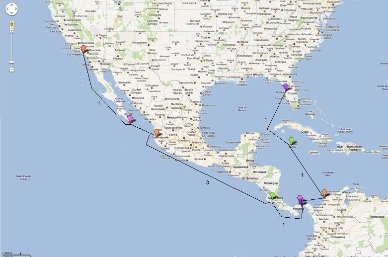
This image I prepared myself by looking on Google Maps for indications at each port or area where the cruise ship might dock or pass through. In some cases I switched to satellite view to look for actual cruise ships at docks. Then I used right-click, "What's Here" to get GPS coordinates.
Entering all coords at once gave me this image except for drawing lines in between the points and indicating the number of sea days on some of the legs. The GPS said this route would cover at least 4940 statute miles. At the end of the cruise, the information channel on the ship said we'd traversed 5408 miles.
CruiseMap.JPG (59 Kb) (under photos/11/1201-17_CarnivalCruise/)
By Alan Silverstein, ajs@frii.com (page updated Tue Mar 10 18:16:39 MDT 2026)