 CAPTION CAPTION
|  PREVIOUS PREVIOUS |
 INDEX
INDEX
| NEXT (or just click anywhere on image) (or just click anywhere on image) |
| CAPTION
| PREVIOUS |
INDEX
| NEXT (or just click anywhere on image) |
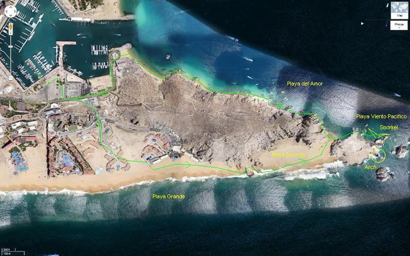
Cabo San Lucas is at the very southern tip of Baha California, west across the Gulf of California from the Mexican mainland including Mazatlan. Curiously though as you can see from this marked-up satellite image, the port area and El Arco are a bit east of the actual south tip. Also the cruise ships were moored to the north, off this image, and we took a tender to the docks where we started and ended our journey.
Following some advice I'd read, we walked south through a resort area to access the huge, wide, golden sandy beach on the Pacific, then east including some rock scrambling toward "Lands End" and El Arco to get back on the bay side, in sight of the cruise port; and finally back west (very rough in spots) to the tender docks and shopping district.
A_OurWalkingRoute.JPG (90 Kb) (under photos/11/1201-17_CarnivalCruise/1215_CaboSanLucas/)
By Alan Silverstein, ajs@frii.com (page updated Tue Mar 10 18:16:39 MDT 2026)